Theeknobs
| Theeknobs | ||
|---|---|---|
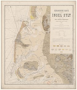
| Thee-Knob on a map from 1876 | ||
| Waters | North Sea | |
| Geographical location | 54 ° 42 '46 " N , 8 ° 15' 24" E | |
|
|
||
| surface | 30 km² | |
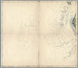
| Thee-Knob on the Amrum map sheet (1893) | ||
The Theeknobs (also Theeknob ) is a sandbank west of the Amrumer Odde , the northern tip of the island of Amrum , and southwest of the Hörnum-Odde , the southern tip of the island of Sylt . The bank, which is around 30 km² in size, is surrounded by the pre- tipping depression in the southeast, the Hörnumloch in the northwest and the Theeknobsrinne in the south. To the south there are other sands such as the Hörnumknobs and the Jungnamesand . The sand, washed over regularly and at very high speeds, acts as a natural breakwater for the island of Amrum.
Individual evidence
- ^ Henning von Nordheim, Dieter Boedecker, Jochen C. Krause: Progress in marine conservation in Europe: Natura 2000 sites in German offshore waters . Springer, Berlin 2006, ISBN 978-3-540-33290-9 , pp. 106 .
- ↑ H.-G. Ramming: Results of a numerical model for determining water levels, speeds and mass transport - North Frisian Wadden Sea . Hamburg 1982.


