Thomasreuth
|
Thomasreuth
Coordinates: 49 ° 44 ′ 48 ″ N , 11 ° 51 ′ 5 ″ E
|
|
|---|---|
| Incorporation : | January 1, 1946 |
| Postal code : | 92676 |
| Area code : | 09645 |
Thomasreuth is a district of the town of Eschenbach in the Upper Palatinate , two kilometers southeast of the city center. The former community of Thomasreuth was partly in the area of today's Grafenwöhr military training area .
history
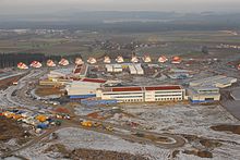
The rural community of Thomasreuth was established in Bavaria in 1818 on the basis of the municipal edict . In 1933 it had 354 inhabitants. Before the expansion of the military training area Grafenwöhr in 1936 a. a. the hamlet of Netzaberg. Netzaberg was replaced from 1936 and the residents were relocated. In 1946 the rest of the Thomasreuth community was incorporated into Eschenbach in the Upper Palatinate. A settlement, the Netzaberg Housing Area , was built in Netzaberg in 2008 for the US citizens and soldiers stationed at the Grafenwöhr military training area .
Individual evidence
- ^ Wilhelm Volkert (ed.): Handbook of Bavarian offices, communities and courts 1799–1980 . CH Beck, Munich 1983, ISBN 3-406-09669-7 , p. 459 .
literature
- Eckehart Griesbach: Grafenwöhr military training area - history of a landscape. 5th edition, 2005.

