| No.
|
designation
|
leaves
|
number
|
| I.
|
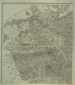
Topographical military atlas of the duchies of Holstein and Lauenburg, the principality of Eutin and the areas of the free cities of Hamburg and Lübeck
|
5, 6, 7, 16, 17, 18, 27, 28, title
|
9
|
| II
|
Topographical-military atlas of the kingdom of Hanover, the Grand Duchy of Oldenburg, the Duchy of Braunschweig, the principalities of Lippe Dettmold and Schauenburg and the area of the free city of Bremen
|
14, 15, 16, 17, 24, 25, 26, 27, 28, 34, 35, 36, 37, 38, 43, 44, 45, 46, 47, 54, 55, 56, 57, 66, 67, 68, title
|
27
|
| III
|
Topographical-military atlas of the Kingdom of Bavaria
|
94, 95, 96, 97, 108, 109, 110, 111, 112, 113, 123, 124, 125, 126, 127, 128, 137, 138, 140, 141, 142, 143, 152, 153, 154, 155, 163, 164, 165, 166, 173, 174, 175, 176, 177, 181, 182, 183, 184, 185, title, Renvoi
|
42
|
| IV
|
Topographical-military atlas of the Kingdom of Württemberg and the Principality of Hohenzollern
|
125, 126, 138, 139, 140, 150, 151, 152, 161, 162, 163, 173, 174, title
|
14th
|
| V
|
Topographical-military atlas of the Grand Duchy of Baden
|
110, 124, 125, 138, 139, 149, 150, 160, 161, 162, 171, 172, 173, title
|
14th
|
| VI
|
Topographical-military atlas of the Kingdom of Saxony
|
69, 70, 71, 82, 83, 84, 85, 97, 98, 99, 113, titles
|
12
|
| VII
|
Topographical-military atlas of the Grand Ducal and Ducal Saxon Lands, the lands of the Princes of Schwarzburg and Reuss
|
67, 68, 80, 81, 82, 95, 96, 97, 108, 111, 112, 123, title
|
13
|
| VIII
|
Topographical-military atlas of the Grand Duchy of Hesse Darmstadt, the Duchy of Nassau, the Principality of Hesse-Homburg and the area of the Free City of Frankfurt
|
66, 77, 78, 79, 92, 93, 94, 108, 109, 110, 123, 124, 125, title
|
14th
|
| IX
|
Topographical-military atlas of the Grand Duchies of Mecklenburg-Schwerin and Strelitz
|
7, 8, 18, 19, 20, 27, 28, 29, 30, 39, 40, title
|
12
|
| X
|
Topographical-military atlas of the Prussian province of Pomerania
|
1, 2, 3, 8, 9, 10, 11, 12, 13, 19, 20, 21, 22, 23, 30, 31, 32, 33, 41, 42, title
|
21st
|
| XI
|
Topographical-military atlas of the Prussian province of Brandenburg
|
28, 29, 30, 31, 32, 33, 38, 39, 40, 41, 42, 48, 49, 50, 51, 58, 59, 60, 61, 70, 71, 72, title
|
23
|
| XII
|
Topographical-military atlas of the Prussian province of Saxony
|
38, 39, 47, 48, 56, 57, 58, 59, 67, 68, 69, 70, 80, 81, 82, 95, 96, title
|
18th
|
| XIII
|
Topographical-military atlas of the province of Silesia
|
61, 62, 71, 72, 73, 74, 75, 84, 85, 86, 87, 88, 89, 100, 101, 102, 103, 104, 117, 118, 119, 120, title
|
23
|
| XIV
|
Topographical-military atlas of the province of Westphalia
|
43, 44, 45, 52, 53, 54, 55, 64, 65, 66, 77, 78, title
|
13
|
| XV
|
Topographical-military atlas of the Jülich-Cleve-Berg province
|
52, 53, 63, 64, 76, 77, title
|
7th
|
| XVI
|
Topographical-military atlas of the Lower Rhine province
|
63, 76, 77, 78, 91, 92, 93, 107, 108, 122, 123, title
|
12
|
| XVII
|
Topographical-military atlas of the Imperial Austrian Kingdom of Bohemia
|
84, 85, 97, 98, 99, 100, 101, 113, 114, 115, 116, 117, 118, 128, 129, 130, 131, 132, 143, 144, 145, 155, 156, 157, title
|
25th
|
| XVIII
|
Topographical-military atlas of the imperial Austrian province of Moravia
|
117, 118, 119, 131, 132, 133, 134, 145, 146, 147, 148, 157, 158, 159, title
|
15th
|
| XIX
|
Topographical-military atlas of the Archduchy of Austria above and below the Ens
|
145, 155, 156, 157, 158, 159, 165, 166, 167, 168, 169, 170, 176, 177, 178, 179, 180, 184, 185, 186, 188, 192, 193, title
|
24
|
| XX
|
Topographical-military atlas by the Duke Steyermark
|
177, 178, 179, 180, 185, 186, 187, 188, 193, 194, 195, 196, 202, 203, 208, 209, title
|
17th
|
| XXI
|
Topographical-military atlas of the kingdom of Illyria
|
192, 193, 194, 195, 200, 201, 202, 206, 207, 208, 209, 210, 211, 212, 213, 214, 215, 216, 217, title
|
20th
|


