Chogha Bonut
Coordinates: 32 ° 13 ′ 20 ″ N , 48 ° 30 ′ 18 ″ E
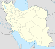
Tschogha Bonut ( Chogha Bonut , Persian چغابنوت, ancient: Čoḡā Bonut ) is an archaeological site on the territory of the ancient Elam in today's province of Chuzestan (then: Chusistan ) in southwestern Iran . The facility is located about 20 km southeast of Dezful and 5 km west of Chogha Mish (Čoḡā Mīš), another historical site.
By virtue of calibrated 14 C dating , it is assumed that Tschogha Bonut dates back to 7200 BC. Was inhabited and thus would be the oldest human settlement in the southwestern lowlands of Chuzestan. This would be an indication that farmers and hunters joined together to form agricultural communities. It is a small hill which, with a diameter of almost 50 m, protrudes about 5 m above its surrounding area.
The site was discovered by chance in 1976. The settlement was encountered while trying to level the area for the purpose of developing more sustainable agriculture. Helene J. Kantor , who was doing archaeological research in Tschogha Misch at that time, was able to obtain immediate permission to explore the complex. Until the beginning of the Islamic Revolution in 1979, research could be carried out undisturbed.
It was not until the Persian archaeologist and Iranist Abbas Alizadeh resumed research in 1996 and published his collected finds in 2003. These are rare finds from the Neolithic Age .
literature
- Helene J. Kantor: Excavations at Chogha Mish and Chogha Bonut. In: Oriental Institute Annual Report 1976-77, pp. 15-24.
- Abbas Alizadeh: Excavations at Chogha Bonut: the earliest village in Susiana, Iran. In: The Oriental Institute News and Notes 153, 1997 full text
- Abbas Alizadeh: Excavations at the Prehistoric Mound of Chogha Bonut, Khuzestan, Iran, Seasons 1976/77, 1977/78, and 1996. Oriental Institute Publications 120. The Oriental Institute, Chicago 2003. ISBN 1-885923-23-6 PDF .
Web links
- Abbas Alizadeh: Čoḡā Bonut . In: Ehsan Yarshater (Ed.): Encyclopædia Iranica (English, including references)
