Tukang Besi
| Tukang Besi | ||
|---|---|---|
| Waters | Banda Lake | |
| archipelago | Sulawesi | |
| Geographical location | 5 ° 20 ′ S , 123 ° 36 ′ E | |
|
|
||
| Number of islands | 5 main islands | |
Tukang Besi is an Indonesian group of islands.
geography
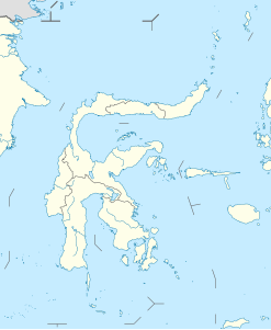
Tukang Besi is located in the Banda Sea , southeast of the island of Sulawesi . The islands belong to the administrative district (Kabupaten) Wakatobi ( Sulawesi Tenggara Province ).
The main islands are Wangi Wangi ( Wanci ), Kambode , Kaledupa , Tomia and Binongko .
population
About 18,000 residents speak Binongko , which is also called Tukang Besi .
Wakatobi National Park
Four of the group's main islands were the basis for the acronym Wakatobi ( Wa ngi-wangi, Ka ledupa, To mia, and Bi nongko). The four main islands form the Wakatobi National Park with many smaller islands such as Tokobao, North Lintea, South Lintea, Kampenaune, Hoga and Tolandono . The park has been listed as a possible UNESCO World Heritage Site since 2005 .
Web links
Individual evidence
- ↑ Lestari Hutan Indonesia ( Memento of the original from April 20, 2010 in the Internet Archive ) Info: The archive link was inserted automatically and has not yet been checked. Please check the original and archive link according to the instructions and then remove this notice. , accessed July 23, 2010.
- ↑ UNESCO World Heritage Tentative List: Wakatobi National Park , Retrieved July 23, 2010

