Tzintzuntzan
| Tzintzuntzan | ||
|---|---|---|
|
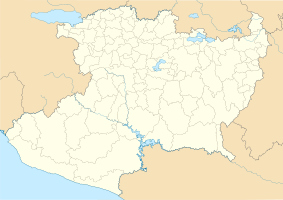
Coordinates: 19 ° 38 ′ N , 101 ° 35 ′ W Tzintzuntzan on the map of Michoacan
|
||
| Basic data | ||
| Country | Mexico | |
| State | Michoacan | |
| Municipio | Tzintzuntzan | |
| Residents | 3534 (2010) | |
| Detailed data | ||
| height | 1634 m | |
| View over Tzintzuntzan from Las Yácatas | ||
Tzintzuntzan is a small town and archaeological site in Mexico and best known as the former capital of the Purépecha . Its name comes from the Tarascan word Ts'intsuntsani from translated, this means place of hummingbirds . Tzintzuntzan has about 3500 inhabitants and is the administrative seat of the Municipio Tzintzuntzan .
geography
location
Tzintzuntzan is located at 2050 meters above sea level, in the Tarascan Plateau , about 15 km north of Pátzcuaro on Lake Pátzcuaro , in the Mexican state of Michoacán .
history
The settlement was founded around 1325 by the Purépecha. After the center of the Púrépecha empire was initially in Pátzcuaro , power shifted to Tzintzuntzan in the middle of the 15th century. The empire continued to grow and withstood the attacks of the neighboring Aztec empire until the arrival of the Spaniards. The ruler of this city surrendered to the Spaniards because he wanted to escape the fate of the Aztecs, whose capital Tenochtitlan was destroyed. In its heyday the place had 40,000 inhabitants.
From the pre- Hispanic times, only the ruins of seven yacatas , typical pyramids with slightly stepped side walls and a floor plan made up of a rectangle and a circle on the long side, have survived. This complex was once the ceremonial center of the ancient Purépecha capital.
Today the place is a small town that lives mainly from tourism and fishing.
gallery
Web links
- Tzintzuntzan , lakepatzcuaro.org


