
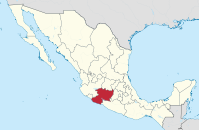
Michoacan
| Michoacan de Ocampo | ||
|---|---|---|
|
 .svg) |
|
| Capital | Morelia | |
| surface | 59,928 km² (rank 16 ) | |
| population | 4,351,037 (Rank 9 ) | |
| Population density | 72.6 inhabitants per km² (2010 census) |
|
| governor |
Silvano Aureoles Conejo ( PRD ) (2015-2021) |
|
| Federal MPs |
Morena = 5 PT = 3 PES = 2 PAN = 1 PRD = 1 (12 federal constituencies) |
|
| Senators |
Morena = 2 PRD = 1 |
|
| ISO 3166-2 | MX-MIC | |
| Postal abbreviation | Me. | |
| Website | www.michoacan.gob.mx | |

Michoacán , also Michoacán de Ocampo [ mitʃoaˈkan de oˈkampo ], officially Free and Sovereign State Michoacán de Ocampo (Spanish Estado Libre y Soberano de Michoacán de Ocampo ) is a state in western central Mexico with a population of about 4 million . The most populous cities are Morelia , Uruapan and Zamora .
geography
Michoacán has an area of 59,928 km²; the altitude is between 0 and about 3800 meters above sea level. d. M., with much of the state lying between 1,500 and 2,000 meters.
The state lies between Jalisco in the west, México and Guerrero in the east and Guanajuato in the north. It is essentially formed by two mountain ranges - the Sierra Madre del Sur and the Sierra Volcánica Transversal . Natural attractions are Lake Pátzcuaro and the Paricutín volcano , which many Mexicans consider one of the seven natural wonders of the world. Two rivers - the Río Lerma and the Río Balsas - are among the most important rivers in Mexico.
Michoacán is divided into 113 Municipios . Morelia is the capital of Michoacán.
Population development
| year | population |
|---|---|
| 1950 | 1,422,717 |
| 1960 | 1,851,876 |
| 1970 | 2,324,226 |
| 1980 | 2,868,824 |
| 1990 | 3,548,199 |
| 1995 | 3,870,604 |
| 2000 | 3,985,667 |
| 2005 | 3,966,073 |
| 2010 | 4,351,037 |
| 2015 | 4,584,471 |
history


Michoacán was the most powerful state of the Purépecha (also called Tarasken ), a subgroup of the Chichimecs , who were equal rivals to the Aztecs in the 15th century and were mostly in conflict with them - their most famous and most important ruins are Tzintzuntzan ; two more are Tingambato and Taretan . Other - less significant - archaeological sites that are assigned to other ethnic or tribal groups ( Nahua , Otomi , Matlazinca , Pirinda and Teco ) are El Opeño , Curutarán , Tepalcatepec , Apatzingán , Zinapécuaro and Coalcomán .
During the Spanish conquest of Tenochtitlán by Hernán Cortés , the Tarasken remained neutral. In 1530, the then chief Tanganxoan II submitted to the victorious Spaniards; as a result, the Franciscans , Dominicans and Augustinians began their missionary work. In 1536 Pope Paul III. the Diocese of Michoacán came into being, which ten years later was subordinated to the Archdiocese of Mexico City as a suffragan . The new city of Valladolid , later Morelia, was founded in 1541 by the then Viceroy Antonio de Mendoza , but in the following years there were several Indian revolts that were put down by military means. In 1602, Michoacán was recognized as an independent province that covered large parts of western Mexico. In 1776 the huge area was split up. a. the province of Colima .
In the early days of Mexico's independence movement, the Guanajuato- born priest and scholar Miguel Hidalgo (1753–1811) was the driving force - he had spent his years as a student at the College of San Nicolas in Valladolid / Morelia. In the years of the Mexican War of Independence (1810-1821) Michoacán played a leading role - Agustín de Itúrbide , the first ruler of independent Mexico, also came from here.
The French intervention in Mexico (1861–1867) brought Michoacán briefly under French control, but this ended with the shooting of Emperor Maximilian (1867). The Mexican Revolution (1910–1920) took place mainly in other regions of Mexico, Michoacán was only slightly affected by it. The so-called Cristiada , a revolt against the implementation of the anti-clerical provisions of the Mexican constitution of 1917 by the government of Plutarco Elias Calles, was all the more violent . Michoacán was one of the centers of this uprising, which was due to the fact that Catholicism was particularly strong in large parts of the mostly rural population of this state.
The "Mexico City Earthquake" on September 19, 1985 is also called the "Michoacan Earthquake". At least 9,500 people died in the event, but most of them in Mexico City . The epicenter was in Michoacán.
At the end of the 20th and the beginning of the 21st century, armed drug gangs ( narcotraficantes ) played an inglorious role in the history of Michoacán in conjunction with corrupt police officers and state officials. The result was that thousands of residents fled to neighboring states or tried to emigrate to the USA (see Apatzingán ).
economy
Agriculture and forestry as well as mining and trade play the greatest role in Michoacán's economic life.
- Agriculture and Forestry
Around 20% of the area is used for agriculture: maize , wheat , sorghum , vegetables , strawberries and sugar cane form soil cultures, while avocados , mangoes , peaches and citrus fruits are tree fruits; Michoacán is one of the largest avocado producers in the world. The center of avocado production is in Tancítaro. In addition, animal husbandry, fishing and forestry are important sources of income.
- Mining
Mining includes both the underground mining of mineral resources ( coal , iron , nickel , copper , zinc , silver and cadmium ) and above-ground mining (gravel, sand, limestone, etc.). Iron works and steel mills have settled in the vicinity of the capital Morelia .
- Infrastructure
Michoacán has an overseas port ( Lázaro Cárdenas ), is connected to the Mexican railway network and has a well-developed road network of around 12,000 kilometers. There is an international airport at Morelia. Several hydropower plants provide a large part of the electricity used in Michoacán.
- tourism
International tourists rarely find their way to Michoacán; With Mexicans, the region is a popular destination for day trips or short vacations because of the abundance of forests, the lakes and the beaches on the Pacific coast . The Uruapans National Park or Lake Camécuaro are two examples of the natural wealth of this area. ( Lago de Camécuaro ) On the day of the dead ( día de muertos ), which is celebrated every year on November 1st and 2nd, Christian and Indian traditions live mainly in the area around Lake Pátzcuaro . back on.
Flora and fauna
In the agricultural areas of Michoacán, the plants and animals originally native to Michoacán have almost disappeared. However, about half of the state is still forested; some remote forest areas in the mountain regions serve the monarch butterflies as winter resting places.
Monarch butterfly

In four generations, this species of butterfly can travel thousands of kilometers from Canada to Mexico and back again. In winter, these remarkable moths gather densely on a few hectares of mountain forest in Michoacán, where the special climatic conditions allow them to survive the winter cold.
The natural spectacle of the arrival of the butterflies is eagerly awaited by the people of Michoacán every year and celebrated as the "Dia de los Muertos". The name of the holiday means "day of the dead" because the butterflies are considered to be the carriers of the souls of the deceased. Many tourists also come to see the impressively huge flocks of butterflies. "El Cacique", "El Rosario" and "El Llano del Toro" in Angangue are probably the best places to observe this phenomenon.
The butterflies with the striking color combination black-orange with white dots became the symbol of Michoacán and are on many tourist souvenirs such as t-shirts and mugs, but also in the streets, for example. B. to be found as shop decoration. The best time to travel to see the moths is from late October to mid-February.
How threatened the preservation of fascinating walks this species by the ongoing ruthless deforestation with the butterflies needed special microclimate already is, has Nick de Pencier in his documentary " The Journey of the Butterfly ," ( "The Incredible Journey of the Butterflies" 2009).
literature
- Claudia Rodriguez Espinosa: Influence of New Materials in the Transformation of Traditional Home Building Technology in Michoacán, Mexico (PDF). In: Karl-Eugen Kurrer , Werner Lorenz , Volker Wetzk (eds.): Proceedings of the Third International Congress on Construction History . Neunplus, Berlin 2009, ISBN 978-3-936033-31-1 , pp. 1253-1256
Web links
- State homepage (Spanish; requires Flash)
- Information about the municipalities of Michoacáns (Spanish; requires Flash)
Individual evidence
- ↑ Mexico: States and Cities - Population Statistics in Maps and Tables. Retrieved July 28, 2018 .
- ↑ usgs.gov : 1985 ( Memento from February 6, 2012 in the Internet Archive ) (English)
Aguascalientes | Baja California | Baja California Sur | Campeche | Chiapas | Chihuahua | Coahuila | Colima | Durango | Guanajuato | Guerrero | Hidalgo | Jalisco | México | Mexico City | Michoacan | Morelos | Nayarit | Nuevo León | Oaxaca | Puebla | Querétaro | Quintana Roo | San Luis Potosí | Sinaloa | Sonora | Tabasco | Tamaulipas | Tlaxcala | Veracruz | Yucatán | Zacatecas
Coordinates: 19 ° 10 ′ N , 101 ° 54 ′ W