
Querétaro (state)
| Querétaro de Arteaga | ||
|---|---|---|
|
 .svg) |
|
| Capital | Santiago de Querétaro | |
| surface | 11,699 km² (rank 27 ) | |
| population | 1,827,937 (Rank 22 ) | |
| Population density | 156 inhabitants per km² (2010 census) |
|
| governor |
Francisco Domínguez Servién ( PAN ) (2015–2021) |
|
| Federal MPs |
PAN = 3 PES = 2 (5 federal constituencies) |
|
| Senators |
PAN = 2 morena = 1 |
|
| ISO 3166-2 | MX-QUE | |
| Postal abbreviation | Qro. | |
| Website | www.queretaro.gob.mx | |

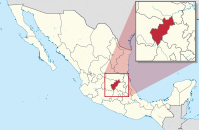
The Mexican state of Querétaro [ keˈɾetaɾo ] (also Querétaro de Arteaga ), officially Free and Sovereign State of Querétaro ( Spanish Estado Libre y Soberano de Querétaro ) lies between Guanajuato and Hidalgo . It has about 1.8 million inhabitants. The people live mainly from livestock farming ; the area around the capital is heavily industrialized.
geography
The state is 11,699 km² and is located in the highlands of Mexico between the chains of the Western and Eastern Sierra Madre .
Population development
| year | population |
|---|---|
| 1950 | 286.238 |
| 1960 | 355.045 |
| 1970 | 485,523 |
| 1980 | 739.605 |
| 1990 | 1,051,235 |
| 1995 | 1,250,476 |
| 2000 | 1,404,306 |
| 2005 | 1,598,139 |
| 2010 | 1,827,937 |
| 2015 | 2,038,372 |
administration
Santiago de Querétaro is the capital of the state of Querétaro. It is located about 200 km northwest of Mexico City and is known for its historic old town .
The state is divided into 18 administrative districts ( municipios ).
economy
In the fertile valleys, cotton, maize, coffee and beans are mainly grown, while cattle is mainly raised in the mountains. There are large deposits of mercury, opals, and other precious stones.
Web links
- State homepage (Spanish)
Aguascalientes | Baja California | Baja California Sur | Campeche | Chiapas | Chihuahua | Coahuila | Colima | Durango | Guanajuato | Guerrero | Hidalgo | Jalisco | México | Mexico City | Michoacan | Morelos | Nayarit | Nuevo León | Oaxaca | Puebla | Querétaro | Quintana Roo | San Luis Potosí | Sinaloa | Sonora | Tabasco | Tamaulipas | Tlaxcala | Veracruz | Yucatán | Zacatecas
Coordinates: 20 ° 50 ′ N , 99 ° 51 ′ W