
Tlaxcala (State)
| Tlaxcala | ||
|---|---|---|
|
 .svg) |
|
| Capital | Tlaxcala | |
| surface | 4016 km² (rank 31 ) | |
| population | 1,169,936 (ranked 28 ) | |
| Population density | 293 inhabitants per km² (2010 census) |
|
| governor |
Marco Antonio Mena Rodríguez ( PRI ) (2017-2021) |
|
| Federal MPs |
Morena = 2 PES = 1 (3 federal constituencies) |
|
| Senators |
Morena = 2 PAN = 1 |
|
| ISO 3166-2 | MX-TLA | |
| Postal abbreviation | Tlax. | |
| Website | www.tlaxcala.gob.mx | |

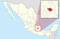
The state of Tlaxcala [ tla (k) sˈkala ], officially Free and Sovereign State of Tlaxcala ( Spanish Estado Libre y Soberano de Tlaxcala ) is located in central Mexico and borders the states of Hidalgo , México and above all Puebla , by which it is almost completely surrounded . With 1,169,936 inhabitants (as of 2010) on 4016 km², it is the smallest Mexican state in terms of area. The capital is Tlaxcala .
The state of Tlaxcala is divided into 60 Municipios .
history
Before the arrival of the Spaniards, Tlaxcala was an independent state that was at constant war with the Aztecs . In the “ flower wars ” of the Aztecs against their neighbors, the aim was to make as many prisoners as possible so that they could be sacrificed to the gods. The geographically closest Tlaxcaltecs were most affected, so it is not surprising that after a few skirmishes they finally welcomed the Spaniards with open arms. The Tlaxcalteks were instrumental in the conquest of Tenochtitlán and bore the brunt of the war. Only the chief's son Xicohténcatl defied the orders of his father and the other chiefs. When he wanted to start a rebellion, Hernán Cortés had him captured and hanged.
Population development
| year | population |
|---|---|
| 1950 | 284,551 |
| 1960 | 346,699 |
| 1970 | 420,638 |
| 1980 | 556,597 |
| 1990 | 761.277 |
| 1995 | 883.924 |
| 2000 | 962.646 |
| 2005 | 1,068,207 |
| 2010 | 1,169,936 |
| 2015 | 1,272,847 |
Web links
Individual evidence
- ^ Bernal Díaz del Castillo: History of the Conquest of Mexico . 1988, p. 463.
- ↑ Mexico: States and Cities - Population Statistics in Maps and Tables. Retrieved July 28, 2018 .
Coordinates: 19 ° 26 ′ N , 98 ° 10 ′ W
Aguascalientes | Baja California | Baja California Sur | Campeche | Chiapas | Chihuahua | Coahuila | Colima | Durango | Guanajuato | Guerrero | Hidalgo | Jalisco | México | Mexico City | Michoacan | Morelos | Nayarit | Nuevo León | Oaxaca | Puebla | Querétaro | Quintana Roo | San Luis Potosí | Sinaloa | Sonora | Tabasco | Tamaulipas | Tlaxcala | Veracruz | Yucatán | Zacatecas