
Hidalgo (state)
| Hidalgo | ||
|---|---|---|
|
 .svg) |
|
| Capital | Pachuca de Soto | |
| surface | 20,813 km² (rank 26 ) | |
| population | 2,665,018 (ranked 17th ) | |
| Population density | 128 inhabitants per km² (2010 census) |
|
| governor |
Omar Fayad Meneses ( PRI ) (2016-2022) |
|
| Federal MPs |
Morena = 7 (7 federal constituencies) |
|
| Senators |
Morena = 2 PRI = 1 |
|
| ISO 3166-2 | MX-HID | |
| Postal abbreviation | Hgo. | |
| Website | www.hidalgo.gob.mx | |

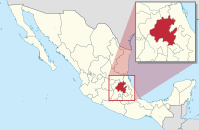
Hidalgo [ iˈðalɣo ], officially Free and Sovereign State of Hidalgo ( Spanish Estado Libre y Soberano de Hidalgo ), is a central state of Mexico , which was formed in 1869 and is located north of the capital. It is named after Miguel Hidalgo , who initiated Mexico's struggle for independence with his address Grito de Dolores . It has an area of 20,813 km² and about 2.6 million inhabitants. The capital is Pachuca de Soto .

geography
The state is centrally located in Mexico, in the north it borders on the states of San Luis Potosí and Veracruz , Puebla in the east, in the south Tlaxcala and Mexico and in the west on Querétaro .
The state is characterized by three different geographical regions, on the one hand the mountain ranges of the Sierra Madre Oriental and the Sierra Volcánica Transversal and, in the eastern part, the coastal lowlands.
Administrative division

Administratively, the state is divided into 84 municipalities . The biggest cities are:
Population development
| year | population |
|---|---|
| 1950 | 850.394 |
| 1960 | 994.598 |
| 1970 | 1,193,845 |
| 1980 | 1,547,493 |
| 1990 | 1,888,366 |
| 1995 | 2,112,473 |
| 2000 | 2,235,591 |
| 2005 | 2,345,514 |
| 2010 | 2,665,018 |
| 2015 | 2,858,359 |
tourism
Hidalgo is divided into 6 tourist regions Corredores , these are:
- Corredor de la Montaña (mountain corridor), different climate zones and ecosystems for camping and extreme sports
- Corredor de los Balnearios (recreation corridor), various hot springs that can reach up to 38 ° C
- Corredor Tulancingo y los 4 elementos ( Tulancingo and the 4 elements):
- Water , lagoons and waterfalls for sport fishing
- Air , hot air balloon rides
- Fire , cast iron products from Apulco
- Country , beautiful landscape
- Corredor de las Haciendas (Corridor of the Haciendas ), most of the state's 176 haciendas from the 16th to 19th centuries
- Corredor Sierra de la Huasteca (Gerbirgskette of la Huasteca ), ecotourism in lush vegetation and rivers
- Corredor Tolteca ( Toltec corridor), history of the Toltecs
Others
The state's most famous attraction is the Tula ruins , believed to have been the capital of the Toltecs .
On January 18, 2019, an explosion occurred near the small town of Tlahuelilpan when residents tried to draw gasoline from a leaky pipeline . 107 people died.
The economy is mainly determined by mining (silver, gold, lead, copper, zinc) and agriculture.
Web links
- State website (Spanish)
Individual evidence
- ↑ Tourism of the state of Hidalgo, accessed on January 29, 2019 ( Memento from March 14, 2010 in the Internet Archive )
- ↑ More than 100 dead after the pipeline disaster in Mexico. In: tagesspiegel.de , January 25, 2019, accessed on January 28, 2019.
Aguascalientes | Baja California | Baja California Sur | Campeche | Chiapas | Chihuahua | Coahuila | Colima | Durango | Guanajuato | Guerrero | Hidalgo | Jalisco | México | Mexico City | Michoacan | Morelos | Nayarit | Nuevo León | Oaxaca | Puebla | Querétaro | Quintana Roo | San Luis Potosí | Sinaloa | Sonora | Tabasco | Tamaulipas | Tlaxcala | Veracruz | Yucatán | Zacatecas
Coordinates: 20 ° 29 ′ N , 98 ° 52 ′ W