
Sinaloa
| Sinaloa | ||
|---|---|---|
|
 .svg) |
|
| Capital | Culiacan | |
| surface | 57,365 km² (rank 18 ) | |
| population | 2,767,761 (ranked 15th ) | |
| Population density | 48 inhabitants per km² (2010 census) |
|
| governor |
Quirino Ordaz Coppel ( PRI ) (2017-2021) |
|
| Federal MPs |
Morena = 4 PT = 3 (7 federal constituencies) |
|
| Senators |
Morena = 2 PRI = 1 |
|
| ISO 3166-2 | MX-SIN | |
| Postal abbreviation | Sin. | |
| Website | www.sinaloa.gob.mx | |

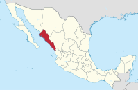
Map of Sinaloa |

Sinaloa [ sinaˈloa ] officially Free and Sovereign State of Sinaloa ( Spanish Estado Libre y Soberano de Sinaloa ) is a state in western Mexico on the Gulf of California . It has about 2.8 million inhabitants on 57,365 km².
The most important cities are the capital Culiacán with about 675,000 inhabitants, Mazatlán , a popular travel destination for tourists from the USA , and Los Mochis in the north of the state.
geography
With an area of 57,365 km² (roughly the size of Croatia ), Sinaloa is one of the medium-sized Mexican states. The area is bounded to the west - along a 622 km long coastline - by the Gulf of California. It is also bordered by Sonora in the north, Chihuahua and Durango in the east and Nayarit in the south .
Sinaloa is divided into three regions. The flat coastal plain in the west ("Zona de Llanura Costera") covers 46% of the total area. The mountainous north and south-east ("Zona Montañosa"), which makes up 40% of Sinaloas, is part of the Sierra Madre Occidental . The narrow, elongated piece of land in between represents the western foothills of the mountains ("Zona de Pie de Monte") and covers 14% of the area of Sinaloa.
The climate in the entire state is tropical to subtropical with relatively low seasonal temperature fluctuations. The summers are hot with an average of 36 ° C; Temperatures of up to 44 ° C are then possible. Maximum temperatures of over 20 ° C are also reached in winter, but it can cool down to around 10 ° C at night. The annual mean temperature is 25 ° C. The climate is less uniform in terms of precipitation: While the northwest and other parts of the state near the coast have a very dry climate, the east of Sinaloa has a humid climate. The average rainfall in Sinaloa is 790 mm per year.
| Jan | Feb | Mar | Apr | May | Jun | Jul | Aug | Sep | Oct | Nov | Dec | |
|---|---|---|---|---|---|---|---|---|---|---|---|---|
| Culiacán (60 m above sea level) | 20th | 21st | 22nd | 25th | 27 | 30th | 30th | 30th | 30th | 29 | 24 | 21st |
| Los Mochis (11 m above sea level) | 19th | 20th | 22nd | 25th | 27 | 31 | 32 | 32 | 31 | 29 | 24 | 20th |
| El Palmito (2,320 m above sea level) | 13 | 13 | 14th | 17th | 18th | 20th | 18th | 19th | 19th | 18th | 15th | 14th |
Demographics
In 2010, Sinaloa had about 2.77 million inhabitants, 50.3% of whom were female and 49.7% of whom were male. The median age was 26 years.

Population development
| year | population |
|---|---|
| 1970 | 1,266,528 |
| 1980 | 1,849,879 |
| 1990 | 2,204,054 |
| 1995 | 2,425,675 |
| 2000 | 2,536,844 |
| 2005 | 2,608,442 |
| 2010 | 2,767,761 |
| 2015 | 2,966,321 |
politics
Administrative division
Sinaloa is divided into 18 Municipios .
Governors
education
The Universidad Autónoma de Sinaloa is the “universidad pública”, the public university of the state of Sinaloa.
Campus in:
economy
Sinaloa is much more agricultural than most other Mexican states. The share of the primary sector in the gross domestic product is around 13.0% (national average: 1.6%). With a share of 19.3% of GDP, the secondary sector is comparatively underdeveloped (national average: 34.9%). The tertiary sector is responsible for the largest share of Sinaloa's economy with 67.7% (national average: 63.5%).
With a value of 0.796, Sinaloa was ranked 4th among the 31 states of Mexico in the Human Development Index in 2015 .
crime
The organized crime is - as in much of Mexico - a big problem. In some regions of the state, the power of cartels exceeds that of the state. The Sinaloa cartel is known .
Culture
Sinaloa's cuisine is particularly rich in fish and seafood obtained from fishing in the Gulf of California. Among other things, shrimp , mussels , oysters and numerous edible fish are processed , as well as poultry .
Web links
Individual evidence
- ↑ http://cuentame.inegi.org.mx/monografias/informacion/sin/territorio/default.aspx?tema=me&e=25
- ↑ http://cuentame.inegi.org.mx/monografias/informacion/sin/territorio/clima.aspx?tema=me&e=25
- ↑ http://smn.cna.gob.mx/index.php?option=com_content&view=article&id=171:sinaloa&catid=14&Itemid=2
- ↑ http://www.inegi.org.mx/prod_serv/contenidos/espanol/bvinegi/productos/censos/poblacion/2010/panora_socio/sin/Panorama_Sin.pdf
- ↑ Mexico: States and Cities - Population Statistics in Maps and Tables. Retrieved July 27, 2018 .
- ↑ http://cuentame.inegi.org.mx/monografias/informacion/sin/economia/default.aspx?tema=me&e=25
- ↑ http://cuentame.inegi.org.mx/monografias/informacion/Mex/Economia/
- ^ Sub-national HDI - Area Database - Global Data Lab. Retrieved August 12, 2018 .
- ↑ http://eleconomista.com.mx/foro-economico/2015/04/15/ingobernabilidad-sinaloa
- ↑ http://www.inafed.gob.mx/work/enciclopedia/EMM25sinaloa/index.html
Aguascalientes | Baja California | Baja California Sur | Campeche | Chiapas | Chihuahua | Coahuila | Colima | Durango | Guanajuato | Guerrero | Hidalgo | Jalisco | México | Mexico City | Michoacan | Morelos | Nayarit | Nuevo León | Oaxaca | Puebla | Querétaro | Quintana Roo | San Luis Potosí | Sinaloa | Sonora | Tabasco | Tamaulipas | Tlaxcala | Veracruz | Yucatán | Zacatecas
Coordinates: 24 ° 57 ' N , 107 ° 32' W