Los Mochis
| Los Mochis | ||
|---|---|---|
|
Coordinates: 25 ° 47 ′ N , 108 ° 59 ′ W Los Mochis on the map of Sinaloa
|
||
| Basic data | ||
| Country | Mexico | |
| State | Sinaloa | |
| Municipio | Ahome | |
| Residents | 256,613 (2010) | |
| City insignia | ||
| Detailed data | ||
| Website | ||
Los Mochis is a city on the Pacific coast of Mexico , with approx. 260,000 inhabitants the third largest city in the Mexican state of Sinaloa and the seat of the Municipio Ahome .
history
An internationally known colony was founded in the area at the end of the 19th century by the utopian Albert K. Owen . But she only survived for about 30 years. The city was actually founded in 1893 by the American businessman Benjamin Johnston , who made a fortune with sugar cane . He built a sugar refinery around which today's Los Mochis developed.
Today Los Mochis is a business town in the middle of the El Fuerte Valley, one of the most fertile regions in Mexico. The main street is Calle Gabriel Leyva with shops, a market, banks, cafes and restaurants.
climate
Los Mochis has a hot and dry climate. The dry season with an arid climate lasts from October to July. Only the two late summer months of August and September, when it is often humid, are humid . The daytime temperatures are well over 20 ° C all year round. In summer 40 ° C is regularly reached, in extreme cases up to 48 ° C were measured. The night-time low temperatures rarely drop into the single-digit range, even in winter; in summer they are around 25 ° C. The annual mean temperature is 26 ° C.
| Los Mochis (1981-2010) | ||||||||||||||||||||||||||||||||||||||||||||||||
|---|---|---|---|---|---|---|---|---|---|---|---|---|---|---|---|---|---|---|---|---|---|---|---|---|---|---|---|---|---|---|---|---|---|---|---|---|---|---|---|---|---|---|---|---|---|---|---|---|
| Climate diagram | ||||||||||||||||||||||||||||||||||||||||||||||||
| ||||||||||||||||||||||||||||||||||||||||||||||||
|
Average Monthly Temperatures and Rainfall for Los Mochis (1981-2010)
Source: smn.cna.gob.mx
|
||||||||||||||||||||||||||||||||||||||||||||||||||||||||||||||||||||||||||||||||||||||||||||||||||||||||||||||||||||||||
Attractions
The Parque Sinaloa with the Jardín Botánico (Blvd. Castro / Rosales) is worth seeing . There are many plant and tree species to be seen here and an interesting collection of native cacti. The small Museo Regional is also very interesting , in which the history of the region around Los Mochis is presented in a very clear and varied way.
traffic
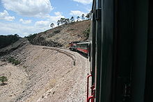
Los Mochis is served by several long-distance bus companies. There is also Los Mochis Airport to the southwest of the city . The city is also the starting point for a ride on the Chepe railway to Chihuahua, which is known for its spectacular views .
The small port town of Topolobampo is located on the Gulf of California, 24 km south of the city . There is the ferry terminal for ships to La Paz , Baja California .
sons and daughters of the town
- Alfonso Humberto Robles Cota (1931–2017), Roman Catholic Bishop of Tepic
- Francisco Labastida Ochoa (* 1942), politician (PRI)
- Laura Harring (born 1964), American actress
- Omar Bravo (* 1980), football player
- Antonio DeMarco (* 1986), lightweight boxer
- Hugo Ruiz (* 1986), super bantamweight boxer
- Javier Orozco (* 1987), football player
Web links
- Gobierno municipal de Ahome (Spanish)


