La Paz (Baja California Sur)
| La Paz | ||
|---|---|---|
|
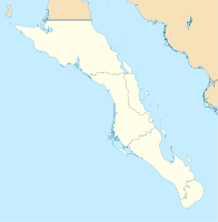
Coordinates: 24 ° 9 ′ N , 110 ° 19 ′ W La Paz on the map of Baja California Sur
|
||
| Basic data | ||
| Country | Mexico | |
| State | Baja California Sur | |
| Municipio | La Paz | |
| Residents | 215,178 (2010) | |
| City insignia | ||
| Detailed data | ||
| height | 10 m | |
| Post Code | 23000 | |
| prefix | 612 | |
| Time zone | UTC −7 | |
| City Presidency | Víctor Castro Cosío | |
| Website | ||
| Beach promenade in La Paz | ||
La Paz is the capital of the Mexican state Baja California Sur and an important regional economic center. It has about 215,000 inhabitants and is located on the southeast side of the California peninsula ( Baja California ), at the exit of the Gulf of California into the Pacific , between the coastal mountains and the Bay of La Paz. La Paz is the seat of the Municipio La Paz .
traffic
La Paz has the Manuel Márquez de León International Airport with connections to Mexico and the USA. There are two ferry connections by sea to Mazatlán in the southeast (440 km) and to Topolobampo near Los Mochis in the northeast (220 km).
economy
Major industries are industry (including silver mining ), fishing (including pearl fishing), and agriculture . In the area of tourism , many residents are also busy.
Since the survey in 2000 (then 163,000 inhabitants) the population has risen sharply. One reason for this is that Laz Paz has the highest median income in Mexico at $ 27 a day; the lowest average wage is only US $ 4.35. Therefore, many immigrants from poor regions come to La Paz and Baja California.
Research and education
Three of the leading marine biology research institutes in Latin America are located in La Paz . The research conditions are favorable because the Gulf of California has a wide variety of water zones with different living conditions. This has also attracted other educational institutions, so that today La Paz has a very high level of education and the largest number of environmental experts in Mexico.
tourism
Ecotourism is a significant source of income because people come to see the attractions of the sea (e.g. gray whales, manta rays) as well as the diversity of species on land. Numerous islands in the Gulf of California have been protected by UNESCO as World Heritage organic reserves since 2005 . The Holy Spirit archipelago (Espiritu-Santos), which borders the Bay of La Paz in the southeast, is a popular tourist destination.
Sons and daughters
- Francisco Cornejo (1892–1963), painter and sculptor
- Claude Bloodgood (1937-2001), American murderer and chess player
- Paola Espinosa (* 1986), water diver
- Antonio López (* 1989), football player
- Yuli Verdugo (* 1997), track cyclist
Climate table
| La Paz | ||||||||||||||||||||||||||||||||||||||||||||||||
|---|---|---|---|---|---|---|---|---|---|---|---|---|---|---|---|---|---|---|---|---|---|---|---|---|---|---|---|---|---|---|---|---|---|---|---|---|---|---|---|---|---|---|---|---|---|---|---|---|
| Climate diagram | ||||||||||||||||||||||||||||||||||||||||||||||||
| ||||||||||||||||||||||||||||||||||||||||||||||||
|
Average monthly temperatures and rainfall for La Paz
Source: wetterkontor.de
|
|||||||||||||||||||||||||||||||||||||||||||||||||||||||||||||||||||||||||||||||||||||||||||||||||||||||||||||||||||||||||||||||||||||||||||||||||||||||||||||||||||||||||||||||||||||||||||||||||||


