Río Balsas
| Río Balsas | ||
|
Río Balsas |
||
| Data | ||
| location | Mexico | |
| origin | Confluence of the San Martín and Zahuapan rivers | |
| muzzle |
Pacific Ocean Coordinates: 17 ° 56 '25 " N , 102 ° 8' 10" W 17 ° 56 '25 " N , 102 ° 8' 10" W |
|
| Mouth height |
0 m
|
|
| length | 771 km | |
| Catchment area | 112,320 km² | |
| Reservoirs flowed through | El Infiernillo | |
| Big cities | Lázaro Cárdenas | |
|
Río Balsas in Mexico |
||
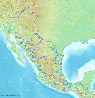
The Río Balsas , also known locally as Río Mezcala or Río Atoyac, is a river in central Mexico . With a length of 771 kilometers, it is one of the longest rivers in Mexico. It rises at the confluence of the San Martín and Zahuapan rivers in the state of Puebla and flows through the Balsas Depression in the Mexican highlands, which is named after the river. In the area of the southern Sierra Madre del Sur , it is dammed to generate energy at the El Infiernillo dam. Adjacent to the city of Lázaro Cárdenas , the river flows into the Pacific Ocean .
Web links
Commons : Balsas River - collection of images, videos and audio files


