Uruapan
| Uruapan | ||
|---|---|---|
|
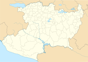
Coordinates: 19 ° 25 ′ N , 102 ° 3 ′ W Uruapan on the map of Michoacan
|
||
| Basic data | ||
| Country | Mexico | |
| State | Michoacan | |
| Municipio | Uruapan | |
| City foundation | 1536 | |
| Residents | 264,439 (2010) | |
| City insignia | ||
| Detailed data | ||
| height | 1634 m | |
| prefix | 452 | |
| Website | ||
| Uruapan - city view | ||
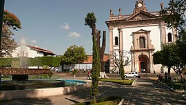
| Uruapan - center | ||
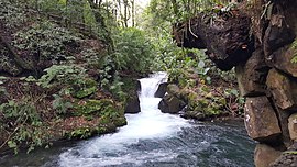
| Barranca del Cupatitzio National Park | ||
Uruapan (completely Uruapan del Progreso ) is a large city in the Mexican state of Michoacán and one of the oldest cities in Mexico. Uruapan is the administrative seat of the Municipio Uruapan .
Location and climate
Uruapan is surrounded by the up to 3800 m high mountains at an altitude of about 1650 m . The closest towns are Morelia and Pátzcuaro (approx. 110 km and 58 km to the northeast, respectively); the port city of Lazaro Cárdenas is about 235 km south on the Pacific coast . Uruapan has an international airport, the Aeropuerto Internacional de Uruapan (airport code: UPN). The climate is temperate to warm; Rain (approx. 1625 mm / year) falls predominantly in the summer half-year.
Population development
| year | 1900 | 1950 | 2000 | 2010 |
| Residents | 9,808 | 31,420 | 225,816 | 264,439 |
The vast majority of the population is of Indian descent; Mestizos are also numerous .
economy
The area around the city has always been characterized by agriculture because of the sufficient rainfall and fertile soil. In the last decades of the 20th century, Uruapan has become the most important center of avocado cultivation in Mexico (and therefore worldwide). The city itself is characterized by small trade ( tianguis ) and handicrafts as well as all kinds of services.
history
The name Uruapan comes from the Tarascan ulhupani and means “place where the trees always bear fruit”. The history of the city's founding can no longer be reconstructed, but it is ascribed to the Franciscan Juan de San Miguel and dates back to 1536. However, several archaeological sites have been found in the region , none of which, with the exception of Lienzo de Jucutacato , have yet been developed.
Attractions
- The center of the city is the Jardín Morelos ; Here are the town hall and the Iglesia de la Inmaculada Concepción , built in the 16th century . On the northeast side of the square is the colonial- era building complex Huatápera , which is now used as a museum.
- Uruapan is famous for its many cafes and bars; a large part of public life takes place here.
- The only 1.40 m wide house on Calle Carrillo Puerto Número 50-C is one of the narrowest in the world.
- Surroundings
- The Barranca del Cupatitzio National Park is widely famous and one of the main attractions; several springs arise here that supply the city and the surrounding area with water. There you can also find the famous "Devil's Kick". a horseshoe-shaped imprint in a stone.
- Approx. La Tzararacua waterfall is located 12 km south of the city .


