
Ubin
| Pulau Ubin | ||
|---|---|---|
 |
||
| Waters | Strait of Johor | |
| Geographical location | 1 ° 24 '35 " N , 103 ° 57' 42" E | |
|
||
| length | 8 kilometers | |
| width | 1.7 km | |
| surface | 10.2 km² | |
| Highest elevation | Puaka 74 m |
|
| Residents | about 100 9.8 inhabitants / km² |
|
| main place | Kampong Pulau Ubin | |
 |
||

Pulau Ubin ( Malay for German "Granite Island", formerly Pulau Batu Ubin ) is an island in northeast Singapore .
geography
Pulau Ubin is located on the Strait of Johor between Malaysia and Singapore . The island is 8 km long, 1.3 to 1.7 km wide and 10.2 square kilometers in size. The island is estimated to be 200 million years old. There are a couple of small rivers. In the north of the island are the Sungei Besar and the Sungei Mamam, in the south the Sungei Jelutorg and the Sungei Puaka. The highest point is the 74 meter high Puaka Hill.
The smaller islands of Pulau Sekudu and Pulau Ketam are southeast and southwest of Pulau Ubin, respectively.
population
In 1970 Pulau Ubin had 2,028 residents. 1599 of them were Chinese , 411 Malay and 15 Indian . Since then, the population has decreased significantly due to the shutdown of the mines and the government's relocation program. Today only about 100 people live on the island. Most of them are still Chinese. A large part of the population is concentrated in the village near the landing stage from which ships go to the main island. Part of the population lives scattered all over the island. Many live in isolated houses or tiny villages.
Flora and fauna
Despite its proximity to the urbanized main island of Singapore, Pulau Ubin has an extremely high biodiversity. Larger mammals such as otters , wild boars or long-tailed macaques regularly cross the few streets. Many endangered bird species live on the island, including the yellow-crowned bulbul . In the course of the renaturalization after the mines were closed, oriental hornbills , among other things, were able to settle again.
economy
There used to be some granite mines on Pulau Ubin, from which the name "Granite Island" comes. Around 1970 the mines were abandoned and the government started a resettlement program to make Pulau Ubin an attraction for nature lovers. Many residents of the island rent bicycles to tourists, work in restaurants, crab farms or are fishermen.
tourism
Nowadays, tourism is the main source of income for the people of Pulau Ubin. Visitors can travel to the island at irregular intervals via ten-minute tours in small fishing boats of twelve people for three S $ each way. Near the landing stage, in the only place on the island that offers opportunities to stop off, there are numerous bike rentals that allow tourists to explore the island by bike or to the Ketam Mountain Bike Park in the west of the island (45ha, 10km route, free entry, opened in 2008) invite.
Web links
- Travel to Asia: Pulau Ubin - Singapore as it once was Süddeutsche Zeitung online, March 2, 2011
Individual evidence
- ↑ Wildlife of Ub in English, accessed July 15, 2016

Village on Pulau Ubin
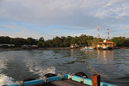
Pulau Ubin jetty

