Uluguru
| Uluguru | ||
|---|---|---|
|
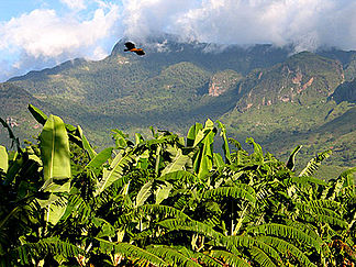
Uluguru Mountains near Morogoro |
||
| Highest peak | Kimhandu ( 2646 m ) | |
| location | Tanzania | |
|
|
||
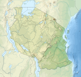
| Coordinates | 7 ° 10 ′ S , 37 ° 40 ′ E | |
Uluguru refers to a mountain range in the Morogoro region in Tanzania . The mountain range was named after a people of the same name in the region. In Swahili, Uluguru means "land of the Luguru". Luguru are the "people from the high mountains" in contrast to the Kaguru who live further north , the "people from the low mountains". The mountain range is 50 km long and extends between the city of Morogoro in the north to the Selous Game Reserve in the south. The highest peak is the Kimhandu with 2646 meters.
Climate and vegetation
The mountain range intercepts tapering clouds, which leads to heavy rainfall . On the eastern slopes of the Ulugurus, up to 2000 mm of precipitation falls per year. The upper mountain regions are densely forested and act as water reservoirs. The Ruvu River , which leads to Bagamoyo, begins its course here.
The tropical mountain forest of the Ulugurus is one of the oldest mountain forests in East Africa. About 30 species - including the Uluguru bush shrike and the Lorevidges sunbird - live exclusively in the Uluguru Mountains. There are also 200 endemic plant species.
Despite protective measures, deforestation occurs again and again in the Ulugurus. The result is erosion such as mountain slopes slipping and flooding.
Projects
Since 1999, the Wildlife Conservation Society (WCS) has been working with the local population on solutions to protect the remaining primeval forest on a permanent basis and, at the same time, to ensure a lasting existence for the inhabitants of the mountains.


