Wairopi
| Wairopi (bridge) | ||
|---|---|---|
|
|
||
| Coordinates | 8 ° 54 ′ S , 147 ° 59 ′ E | |
| Basic data | ||
| Country | Papua New Guinea | |
| Oro | ||
| ISO 3166-2 | PG-NPP | |

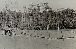
The makeshift bridge over the fast flowing Kumusi near Wairopi in the northern section of the Kokoda Track.

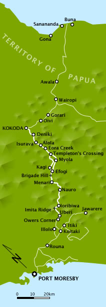
Map of the Kokoda Track from 1942 with Wairopi . The map has been rotated so that the top of the image faces northeast.
Wairopi is the name of a bridge in Papua New Guinea that spans the Kumusi River. Wairopi is on the road that connects Popondetta , the capital of the province of Ora , with Kokoda and is also part of the Kokoda Track .
The name Wairopi is Melanesian pidgin . It was from English Wire Rope Bridge derived what cable bridge means.
history
During the retreat of the Imperial Japanese forces along the Kokoda Track during the Kokoda Track Campaign in World War II , the Japanese Major General Horii Tomitarō drowned when he tried to cross the Kumusi at Wairopi after the Battle of Oivi-Gorari .
Individual evidence
- ↑ Wairopi. In: Pacific Wrecks. June 6, 2016, accessed August 17, 2018 .
- ^ Peter Brune: A Bastard of a Place . Ed .: Allen & Unwin. 2004, ISBN 1-74114-403-5 , pp. 419 .
- ↑ Patrick Lindsay: The Spirit of Kokoda: Then and Now . Ed .: ardie Grant Books. 2002, ISBN 1-74066-075-7 , pp. 122 .
