Weizhou Dao
| Weizhou Dao | ||
|---|---|---|
| Church in Shentang Village | ||
| Waters | Gulf of Tonkin , South China Sea | |
| Geographical location | 21 ° 3 '0 " N , 109 ° 7' 0" E | |
|
|
||
| length | 6.5 km | |
| width | 4.04 km | |
| surface | 24.74 km² | |
| Highest elevation | 90 m | |
| Residents | approx. 16,000 647 inhabitants / km² |
|
| main place | Nanwan | |
| Weizhou Dao | ||
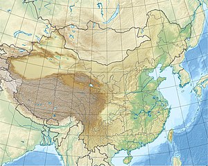
Weizhou Dao ( Chinese 涠洲岛 , Pinyin Wéizhōu Dǎo , English Weizhou Island - "Weizhou Island") is a Chinese island in the Gulf of Tonkin ( Beibu Wan ) . It is located 56 km west of the Leizhou Peninsula , 35 km south of the city of Beihai of the Guangxi Autonomous Region of the Zhuang Nationality east of Vietnam . With an area of around 25 km², it is the largest island in Guangxi.
Weizhou
Administratively, the localities of Weizhous were combined to form the large community Weizhou ( 涠洲 镇 , Wéizhōu zhèn ) and belong to the Haicheng district of Beihai . The Weizhou Municipality consists of 53 localities, which are administered by nine village committees and two neighborhood committees. The largest town on the island is Nanwan (南 湾; Chinese for "south bay").
population
The island has about 16,000 inhabitants, most of which are Hakka .
Volcanic island
The island is a volcanic island . It is the largest and geologically youngest volcanic island in China. Recently the Weizhoudao National Volcanic Geopark ( 北海 涠洲岛 火山 国家 地质 公园 , BeiHai WeiZhouDao HuoShan GuoJia DiZhen GongYuan , English Beihai Weizhoudao Volcano National Geopark ) was established.
Individual evidence
- ^ Weizhou Island Beihai Tourist Development Co., Ltd .: Weizhou Island Landscape. 2010. p. 2f.
See also
- List of Chinese volcanoes
- Weizhoudao Volcano (WeiZhouDao HuoShan)
Web links
- Beihai Weizhou Island, Weizhou Dao (English)
- Info page (chinese)


