Whale Bay
| Whale Bay | ||
|---|---|---|
|
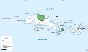
Map of the South Orkney Islands with Whale Bay (right of center) |
||
| Waters | Orwell Bight | |
| Land mass | South Orkney Islands | |
| Geographical location | 60 ° 43 '59 " S , 45 ° 9' 58" W | |
|
|
||
The Whale Bay is a small bay in the archipelago of the South Orkney Islands . It lies between the southeast end of Coronation Island and the northwest shore of Matthews Island .
The Norwegian whaling captain Petter Sørlle was the first to map the bay between 1912 and 1913. He named them as Hvalbugten (Norwegian for Whale Bay ). Scientists from the British Discovery Investigations , who surveyed the bay in 1933, translated the Norwegian name into English.
Web links
- Whale Bay in the Geographic Names Information System of the United States Geological Survey (English)
- Whale Bay on geographic.org (English)

