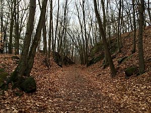
Whittemore Glen State Park
|
Whittemore Glen State Park
|
||
| location | Naugatuck , Middlebury , New Haven County , USA | |
| surface | 0.98 km² | |
| Geographical location | 41 ° 31 ' N , 73 ° 4' W | |
|
|
||
| Setup date | 1918 | |
| administration | Dept. of Energy & Environmental Protection, Connecticut | |
Whittemore Glen State Park (also: Whittemore Glen State Park Scenic Reserve ) is a state park in the US state of Connecticut in the area of the parishes of Naugatuck and Middlebury . It borders the most south-westerly tip of Waterbury . The park offers hiking and horseback riding on the Larkin State Park Trail .
geography
The park extends over 98 hectares (242 acres) south of CT 63 . In a direct connection to the north is the municipal park of Waterbury at Hopbrook Lake (Hopbrook Dam) and the Hopbrook Golf Course . To the south, the park is bounded by the Larkin State Park Trail . The Naugatuck River runs a few hundred meters further east . The rolling hills are interspersed with swampy spots and small lakes. The most important body of water on the site is the Pigeon Brook , which drains over the Hopbrook to the Naugatuck. In addition, the park has no public facilities.
See also
Web links
- Whittemore Glen State Park Connecticut Department of Energy and Environmental Protection
Individual evidence
- ^ Geographic Names Information System . United States Geological Survey.
- ^ State Parks and Forests : Funding, Recruiting, and Referrals. (PDF)
- ^ Whittemore Glen State Park . In: State Parks and Forests . Connecticut Department of Energy and Environmental Protection. Retrieved February 5, 2013.
- ↑ Larkin State Park Trail Map . In: State Parks and Forests . Connecticut Department of Energy and Environmental Protection. September 28, 2010. Retrieved April 18, 2013.

