Wood Bay
| Wood Bay | ||
|---|---|---|
|
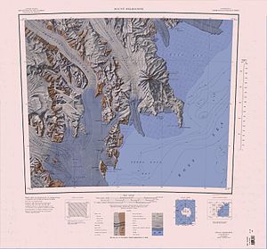
Topographic map sheet Mount Melbourne (1: 250,000) with Wood Bay |
||
| Waters | Ross Sea | |
| Land mass | Victoria Land , East Antarctica | |
| Geographical location | 74 ° 13 ′ 0 ″ S , 165 ° 30 ′ 0 ″ E | |
|
|
||
| Islands | Kay Island | |
| Tributaries | Tinker glacier | |
The Wood Bay is a large bay on the southern Borchgrevink Coast to the east of the East Antarctic Victoria Land . it lies between Cape Johnson and the Aviator Glacier tongue in the north and Cape Washington in the south.
It was discovered in 1841 by James Clark Ross during his Antarctic expedition (1839-1843). It is named after Lieutenant James Frederick Lewis Wood (1820–1864) of the HMS Erebus , one of the two research vessels on the expedition. Kay Island is located in the northern part of Wood Bay .
Web links
- Wood Bay in the Geographic Names Information System of the United States Geological Survey (English)
- Wood Bay on geographic.org (English)
Individual evidence
- ^ John Stewart: Antarctica - An Encyclopedia . Vol. 2, McFarland & Co., Jefferson and London 2011, ISBN 978-0-7864-3590-6 , p. 1723 (English).

