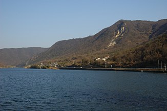
Yoshii (river)
| Yoshii | ||
| Data | ||
| location | Okayama Prefecture | |
| River system | Yoshiigawa river system | |
| source | Mikuni-yama 35 ° 17 ′ 25 ″ N , 133 ° 56 ′ 46 ″ E |
|
| Source height | 1252 m | |
| muzzle |
Seto Inland Sea Coordinates: 34 ° 36 ′ 15 ″ N , 134 ° 2 ′ 16 ″ E 34 ° 36 ′ 15 ″ N , 134 ° 2 ′ 16 ″ E |
|
| Mouth height | 0 m | |
| Height difference | 1252 m | |
| Bottom slope | 9.4 ‰ | |
| length | 133 km | |
| Catchment area | 2110 km² | |
| Residents in the catchment area | approx. 280,000 | |
The Yoshii River ( Japanese 吉井川 Yoshii-gawa ) is a river in Okayama Prefecture in Japan with a length of 133 km. Along with the Asahi and Takahashi, it is one of the three main rivers of the prefecture and, like these, flows into the Seto Inland Sea . The Yoshii is a Class-A river according to the size classification of the Japanese Ministry of Land, Infrastructure, Transport and Tourism .
Individual evidence
- ↑ a b Information from the Ministry of Land, Infrastructure, Transport and Tourism. Retrieved April 24, 2019 (jp).
Web links
Commons : Yoshii River - collection of pictures, videos and audio files
