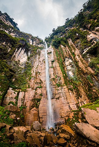
Yumbilla
| Yumbilla | ||
|---|---|---|
| Coordinates | 5 ° 55 '11.6 " S , 77 ° 54' 4.3" W | |
|
|
||
| place | Cuispes District , Bongará Province , Amazonas Region , Peru | |
| Number of fall levels | 3 | |
| Falling watercourse | Cocahuayco | |
| Estuarine waters | Cocahuayco → Utcubamba | |
At around 870 meters in three stages, the Yumbilla is one of the highest waterfalls on earth. It only carries water during the rainy season and is located in the Cuispes district in the Bongará province in the Peruvian Amazon region .
The approximate height of the waterfall was announced on June 10, 2007 by the Instituto Geográfico Nacional del Perú (ING) in a report in the El Comercio newspaper . It would be the third highest known waterfall in the world and displace the Gocta waterfall a few kilometers to the south in fourth place.
The waterfall has long been known to the residents of the area, but its importance and dimensions only became known in 2007. In the meantime, access routes have been built for visitors: From the last village of Cuispes there is still 5 km of gravel road and another 1.5 hours' walk through mountain rainforest to the waterfall. Then one reaches the base of the second case level.

