Zahrener See
| Zahrener See | ||
|---|---|---|

|
||
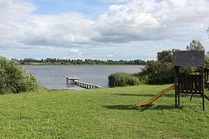
| The lake with the bathing area Zahren | ||
| Geographical location | Ludwigslust-Parchim district | |
| Drain | Dig to Elde | |
| Places on the shore | Zahren , Gallin, Kressin | |
| Data | ||
| Coordinates | 53 ° 31 '25 " N , 12 ° 7' 17" E | |
|
|
||
| Altitude above sea level | 52 m above sea level NHN | |
| surface | 66.9 ha | |
The Zahrener See is located north of Lübz in the Ludwigslust-Parchim district in Mecklenburg-Western Pomerania . The larger southern part is in the Gallin-Kuppentin municipal area , the smaller northern part in the Neu Poserin municipality . The eponymous place Zahren is located on the west bank of the lake. In addition to Zahren, the towns of Gallin (in the southeast) and Kressin (in the north) are in the immediate vicinity of the lake. The elongated body of water is divided into a shallow north basin and a larger and deeper south basin. The area around the lake is mostly swampy. The lake has a length of over two kilometers with a width of over 600 meters in the southern part. In the northern part, the width of the lake reaches about 300 meters. The lake is over five meters deep in the south basin. The outflow of the lake is in the south and represents the connection to the Elde .
The Parchim – Neubrandenburg railway runs south of the lake .
