Bludenz
|
Borough Bludenz
|
||
|---|---|---|
| coat of arms | Austria map | |
|
|
||
| Basic data | ||
| Country: | Austria | |
| State : | Vorarlberg | |
| Political District : | Bludenz | |
| License plate : | BZ | |
| Surface: | 29.94 km² | |
| Coordinates : | 47 ° 9 ' N , 9 ° 49' E | |
| Height : | 588 m above sea level A. | |
| Residents : | 14,845 (January 1, 2020) | |
| Population density : | 496 inhabitants per km² | |
| Postal code : | 6700 | |
| Area code : | 05552 | |
| Community code : | 8 01 03 | |
| NUTS region | AT341 | |
| UN / LOCODE | AT BLU | |
| Address of the municipal administration: |
Werdenbergerstrasse 42 6700 Bludenz |
|
| Website: | ||
| politics | ||
| Mayor : | Josef Katzenmayer ( ÖVP ) | |
|
Local council : (2015) (33 members) |
||
| Location of Bludenz in the Bludenz district | ||
 Logo of the city of Bludenz |
||
| Source: Municipal data from Statistics Austria | ||
Bludenz ( standard German pronunciation: [ ˈblu: dents ], , local Vorarlbergerisch : [ ˈbludats ]) is a city in the Austrian state of Vorarlberg . The city is the seat of the district administration Bludenz and June 30, 2018 14,577 (primary residences) plus. 1098 (more residences) inhabitants, is the sixth largest municipality in Vorarlberg.
Geography and climate
The city center of Bludenz is located at about 570 meters above sea level at the southwestern foot of the Lechquellen Mountains , terraced above the valley floor of the Ill and laid out on part of the debris fan of the Galgentobelbach . The official altitude for Bludenz is 588 m. This refers to the location of the Laurentiuskirche, which is slightly elevated above the town center . The highest point of the municipality is formed by the summit of the Weißen Rössle , 2214 m , northwest of Ausserbraz . A small part of the municipal area east of Stallehr even extends over the Alfenz into Verwall . This is the Garnilawald , which grows on the northern slopes of Davennakopf, Davenna and Zwölferkopf above the Alfenzwerk reservoir . Parts of the mountain forests in the north of Bludenz belong to the " Natura 2000 " European protection area "Klostertaler Bergwälder", which extends from the Galgentobel to Klösterle .
The city lies at the intersection of the Walgau , Brandnertal (Rätikon), Montafon (Silvretta) and Klostertal (Arlberg) valleys . Bludenz likes to market itself as the “five valleys town”, but the fifth valley, the Große Walsertal , only joins the Walgau near Ludesch, a few kilometers west of Bludenz. 48.5 percent of the community area is forested. Neighboring communities of Bludenz are Nüziders , Raggal , Innerbraz , Bartholomäberg , St. Anton im Montafon , Lorüns , Stallehr and Bürs .

The drinking water for Bludenz is drawn from several hundred meters above the city, at the foot of the western flanks of the Breithorn and Elsalptürmen , as well as springs located on the southern flank of the Katzenköpfe . The city partly uses the gradient to generate electricity and operates a small drinking water power plant in Hinterplärsch with a maximum output of 125 kW.
Bludenz has a climate that is significantly influenced by the Atlantic Ocean. The average annual precipitation recorded from 1971 to 2000 by the nearby Bürs measuring station is 1341 mm, the average annual temperature 7.9 ° C. However, the official records for most of the populated area of Bludenz already show an average annual rainfall of between 1500 and 1800 mm. The north-eastern areas on the slopes, e.g. B. Rungelin, even get 1800 to 2100 mm / a. On the summit areas of Hohem Fraßen and Breithorn, which are drained to the south and west of the Galgentobelbach, an average of 2,400 to 2,700 mm fell, on that of Gams Freiheit and Weißes Rössle even, by Central European standards, enormous 2,700 to 3,000 mm of precipitation per year.
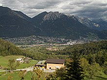
Bludenz is often one of the places with the highest daytime temperatures in Vorarlberg, also due to its proximity to the Brandner Valley, which is known as a pronounced foehn line. The mountains from Hohen Fraßen to Elsspitze and Gams Freiheit, which tower over the city by around 1400 meters, protect Bludenz from cold winds from the north to the northeast.
In the city cemetery there is an automatic weather station from the Central Institute for Meteorology and Geodynamics (ZAMG), the current measured values of which are permanently presented on the Internet.
City structure
The municipality includes the following two localities:
- Ausserbraz
- Bludenz
The community consists of the cadastral community Bludenz. Districts and parcels of Bludenz are:
- Old town
- Ausserbraz
- At the cross
- Bings (is divided into upper and lower bings)
- Brunnenfeld (with St. Peter's Monastery)
- Gasund
- Grubs
- Heap
- Mokry
- Obdorf
- Radin (is divided into upper and lower radin)
- Rungelin (Runggelin)
- Subfield
- Saint Leonhard
- South Tyrolean settlement
history
Early days
The finds on the Montikel (town hill) make Bludenz an important archaeological site in western Austria. The steeply sloping rock carried a Bronze Age hilltop settlement that remained populated until the end of the La Tène period . In the corridor "Unter dem Stein" (today Untersteinstraße) at the southern foot of the Montikels, weapons and equipment made of iron and jewelry made of bronze were found during excavation work between 1830 and 1935.
Animal and human bones were embedded in a fire rubble horizon exposed in 1900. Pieces of pottery, weapons (spearheads, Lanz shoes, Hellebardenäxte , sword fragments, scabbards and a helmet fragment), equipment (knives, sickles, key rings, car fittings, bridles , an adze and a stove shovel), jewelry ( brooches are, needles, bracelets and belt accessories) to be assigned to the Celtic or inner-Alpine-Rhaetian type. The period is assumed to be from the 5th to the 1st century AD and, from today's perspective, it is seen as the dumping of a sacrificial site. Most of the finds have not been preserved and can only be reconstructed from earlier records.
Bludenz from 830
The town of Bludenz was first mentioned in a document in 830 in the so-called “Churrätischen Reichsurbar” under the name versions “Pludono” and “Pluteno” used side by side. In 842 the Carolingian register of goods mentions the settlement as "Pludeno". The names are probably of pre-Roman origin and are derived from the Indo-European root term “pleud”, which can be translated as “flow”. In view of the extensive marshes on the Ill, the Latin “ad paludines” (“near the marshes”) is also being discussed as the namesake.
From 1098 to 1629 the plague occurred nineteen times in Bludenz - it claimed a particularly large number of victims in 1143 and 1591.
In 1265 the town of Bludenz was founded by the Werdenbergers , and Hugo I von Werdenberg granted town charter in 1274.
Duke Friedrich IV. ("With the empty pocket") fled after his ostracism at the Council of Constance over the Arlberg to Tyrol. He spent March 30, 1416 in Bludenz (memory in legends of his request to be admitted to the Upper Gate).

In 1420 the city and rule of Bludenz passed to Austria. This year, delegates from Bludenz and the Montafon paid homage to their new Lord Duke Friedrich IV, who confirmed their privileges. The entire mining area in Montafon, in Walgau, around Nüziders and in Klostertal belonged to Austria only after the destruction of Sonnenberg Castle in 1473.
In 1525 the Reformation failed in Bludenz. The Habsburgs ruled Bludenz alternately from Tyrol and Upper Austria ( Freiburg im Breisgau ).
In 1444 and again in 1491 the city burned down together with the gates , the castle (later Baroque castle) and the St. Laurentius Church.
In the first half of the 16th century there were reports of a smelter in Bludenz, which smelted ores from Lobinger (Kristbergsattel) and Kristberg, but also ores from the area around Nüziders and Bludenz.
On November 1, 1638, another fire destroyed almost the entire city; Only the upper gate with two neighboring houses as well as the church and castle were spared from the flames. In 1682 another fire destroyed most of the wooden houses in the city.
In October 1730, the Tyrolean imperial baron Franz Andreas von Sternbach, who had become very wealthy as a mining entrepreneur, acquired the unified pledge of Bludenz-Sonnenberg.
19th and 20th centuries
From 1806 to 1814 the city belonged to Bavaria , then again to Austria. When it passed to Bavaria in 1806, Bludenz came to the Sonnenberg district court , whose seat was Nüziders until 1810 and then the city. After Vorarlberg returned to the Austrian state association in 1814, the Lords of Sternbach were no longer granted high jurisdiction. In 1854 the remaining fiefdoms were removed - but Gayenhofen Castle remained their private property until 1936.
In 1872 the city received its first railway connection through the Lindau – Bludenz railway line.
On August 23, 1873, the Austrian and German Alpine Club merged to form the German and Austrian Alpine Club (DuOeAV) in the former rifle house next to Gayenhofen Castle .
After the construction of the colored weaving mill (1871) and in the wake of the construction of the Arlbergbahn (1884), a large number of immigrants from Trentino , what was then known as “Welschtirol”, settled in Bludenz . The part of the town, which is mainly inhabited by them, was soon referred to as the "Welsches Viertel". Around 1900, almost a fifth of the Bludenz population was Italian as their mother tongue.
When Vorarlberg tried to separate itself from the newly formed Republic of German-Austria and to join the Swiss Confederation at the time of the greatest economic hardship, Bludenz, along with two villages in the Bregenzerwald, was the only larger town in the country to speak out against it in the vote in May 1919.
After Austria was annexed to the German Reich in 1938, Bludenz became a district town in the Reichsgau Tirol-Vorarlberg . District leaders were Hans Bernard and Wernfried Richter. The Hitler-Mussolini Agreement in 1939 brought about the establishment of the South Tyrolean settlement .
The tower of the Holy Cross Church served as a flight observation post from 1943 and an air watch was installed on the Muttersberg . Anti- aircraft guns were stationed at the Bürs substation and at the Bludenz train station in 1943/1944, and air raid tunnels were built in both the Unterstein and the Mokry . Bludenz was liberated from the Nazi dictatorship by French troops in May 1945 and was subsequently part of the French zone of occupation in Austria from 1945 to 1955 . In June 1946 there were still 182 political prisoners in the Bludenz district, in the Mokry and Rungelin camps (in the area of today's Beim Kreuz settlement). Some inmates of the Rungelin camp are said to have laid out the so-called “political path” in the Letzi Forest above Lorüns and carried out forest work.
21st century
Since the beginning of the 21st century, Bludenz has advertised with the title “Alpenstadt Bludenz”.
Population development
Population development in Bludenz
Source: Statistics Austria

In 1967 about half of the city's residents were born. 40 percent came from the rest of Austria and ten percent from abroad. In the 1970s and 1980s in particular, there was a strong influx of foreign workers, who mainly found employment in industrial companies.
At the end of 2002 the proportion of foreigners was 16.9 percent. With the neighboring communities, especially Nüziders and Bürs, Bludenz forms a uniform settlement and economic area with around 25,000 inhabitants.
politics
mayor
- around 1724: Bernhardin Leu
- around 1779: Johann Josef Berchtel
- 1867–1909: Josef Wolf
- 1910–1919: Andreas Konzett , CSP
- around 1921: Matthias Längle, CSP
- 1945–1970: Eduard Dietrich, ÖVP
- 1970–1983: Hermann Stecher , SPÖ
- 1983–1995: Heinz Wiedemann, SPÖ
- 1995–2005: Othmar Kraft, ÖVP
- 2005–: Josef Katzenmayer, ÖVP
After the municipal council elections in 2015, the city council of Bludenz has 33 members and is composed as follows: ÖVP 14 seats, SPÖ 13 seats, Open Citizens List (Greens) 3 seats and FPÖ 3 seats.
| ÖVP | SPÖ | Open Citizens List (Greens) | FPÖ |
|---|---|---|---|
| 14th | 13 | 3 | 3 |
Josef "Mandi" Katzenmayer has been mayor of the city since 2005. In the mayor's direct election in 2015, Katzenmayer had to go to the runoff election against his SPÖ challenger Mario Leiter after neither of the two managed to get an absolute majority of the votes in the first ballot. Katzenmayer won with 50.2 percent of the votes and was thus confirmed in office.
The SPÖ top candidate Mario Leiter, who was elected Vice Mayor and lost in the mayor runoff, announced on April 11, 2015 that the SPÖ would contest the runoff election. In November 2015, the Constitutional Court confirmed irregularities in applying for and issuing voting cards and canceled the result of the mayor's runoff election. Mayor Katzenmayer was re-elected on December 20, 2015 with 54.56% of the vote.
Katzenmayer announced that he would not stand for the mayoral election scheduled for March 15, 2020, which has been postponed indefinitely due to the Covid 19 pandemic .
City Councilor Bludenz
- Josef Katzenmayer (ÖVP) - Mayor
- Mario Leiter (SPÖ) - Vice Mayor; Deputy Commander of the City Police; City councilor for urban and spatial planning, company settlement and youth
- Gerhard Krump (ÖVP) - City Councilor for Finance
- Johann Bandl (ÖVP) - City Councilor for Economy
- Christoph Thoma (ÖVP) - City Councilor for Culture and Associations
- Arthur Tagwerker (SPÖ) - City councilor for civil engineering and cemetery affairs
- Wolfgang Weiss (SPÖ) - City Councilor for Traffic, Mobility and Public Transport
- Martina Lehner (OBL) - Councilor for Education and Families
- Joachim Weixlbaumer (FPÖ) - City Councilor for Building Construction
coat of arms
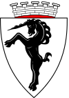
| Blazon : “In the silver shield a black rising unicorn . A silver wall crown with five visible battlementsrests on the shield. " | |
| Justification of the coat of arms: The traditional coat of arms was awarded to the city of Bludenz by the Vorarlberg state government on February 8, 1929. The unicorn embodies an ancient symbol of unrestrained power, enduring strength and virgin purity. |
Economy and Infrastructure
The largest private companies in Bludenz are the Getzner Textil company (founded by Christian Getzner ), the Fohrenburg brewery and the Suchard chocolate factory . Other larger companies are the ÖBB , which operates extensive facilities in Bludenz, as well as the city administration (around 270 employees) and the state hospital .
In 1903 the Swiss watch manufacturer Obrecht & Co settled in Bludenz in the house of the manufacturer “Dörler” in Rathausgasse. In 1906 the production of pocket watches moved to the new building in Klarenbrunnstrasse and the watch factory was continued as Plangg & Pfluger from 1922 to 1967.
In 1834, Karl Blum founded Vorarlberg's first modern paper mill on the site of the burned down “Brunnental” spinning mill, and the building was later taken over by the Swiss chocolate manufacturer Suchard. The chocolate factory began production in Bludenz in 1888 as a subsidiary of Philipp Suchard's Swiss parent company. Every year in the city center, the “Milka Chocolate Festival”, an advertising event aimed specifically at children, is held.
The Bludenz retail sector sees itself under great pressure from the two shopping centers built on the Bludenz city limits in the Bürser municipality. There were violent political disputes over the newly built indoor swimming pool "Valblu", the hospital and the artificial ice toboggan run, as well as a shopping center that was built in the old Kronenhaus in the old town of Bludenz.
In 2003 there were 260 commercial businesses with 3863 employees and 282 apprentices. A total of 6345 employees subject to wage tax were counted.
Protective structures and precautions against debris flows and floods
Above all, the partially vertical, several hundred meter high rock walls of the 2009 m high Breithorn (also called Gaisberg), the Elsspitze ( 1980 m ) and the Elsalptürme in between provide constant weathering material, which from the Galgentobelbach depending on the water flow into the city area, and in extreme cases even into which Ill can be transported. Although huge masses of rock were necessary to fill the 3.6 km² large alluvial cone through the stream, there were no devastating debris deposits as far as the traditions go back. That is why there were hardly any structural precautions against debris flows.
When heavy rain fell after a cold spell in December 1918, a mudslide penetrated to the Lindau – Bludenz railway line. As a result, in the side branches of the Galgentobelbach, especially in the Muttersberg- and Mittlawaldtobel at the feet of the above mentioned. Rock walls, first torrent barriers built in the 1920s and 1930s.
After the Second World War , the construction of the stream continued. A medium flood in December 1991, which in turn was caused by heavy rain following a cold wave, deposited around 20,000 m³ of debris and wild wood in the lower reaches. As a result of the construction work, however, it only caused relatively little damage.
The Daneubrücke, located at the north-eastern end of the South Tyrolean settlement at an altitude of 661 m, continues to pose a considerable risk potential. If it were blocked by driftwood and rubble, the flood-carrying brook would overflow the banks to the left and right of the bridge and, due to the convex shape of the surface of the alluvial cone, roll through the densely built-up South Tyrolean settlement and through Obdorf. For this reason, a large rubble and wild wood retention barrier was built in 2004 above the bridge, at the northeast end of the easily accessible part of the Galgentobel. Below this there is a bedload collection basin with a maximum capacity of around 5000 m³ and a slot barrier. In addition, dams were built in Hinterplärsch. If the basin is full, these should limit the stream breaking out to the side. Some of the worn protective structures from the pre-war period had to be replaced.
In March 2007, around 10,000 m³ of rock fell into the Muttersbergtobel. These are now gradually being carried away by the stream and again show the need for building measures.
Another bottleneck is the very low passage of the stream under the ÖBB site. In order to reduce the risk of a blockage there, a further catchment basin for solids and an additional slot barrier was built north of the nearby federal road bridge. The bottom of the passage under the track system as well as the rest of the stream up to the Ill is covered with steel rails so that the dragging force of the water quickly removes rubble from this neuralgic area.
The assessment basis for the construction measures after the floods of 1991 were a downpour with 70 mm of rain within one hour over the entire catchment area (7.2 km²) of the creek, as well as continuous rain with 168 mm / d on frozen or water-saturated soil. For the former, an average water flow of 42 to 56 m³ / s was calculated, depending on the calculation model, for the latter, a daily water load of 750,000 m³, which contains 75,000 m³ of debris and wild wood. An average water flow of 50 m³ / s in the creek is regarded as an "HQ 150" (a flood that statistically occurs once every 150 years). Furthermore, it had to be taken into account that debris that penetrated into the Ill had already accumulated it several times and / or pushed it away to the southwest.
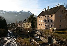
Numerous garden sheds of the South Tyrolean settlement and other buildings (see picture above) in the vicinity of the stream were demolished on official orders. These would either have obstructed the drainage or, being carried away by the stream, supplied additional propellant, which promotes blockages.
With a HQ 300 of the Ill, major flooding in the urban area is to be expected.
Illwerke vkw AG also maintains a Typhon warning system, which is intended to warn the population in Montafon, Bludenz, Brandnertal and Walgau of tidal waves. If the dam of the Silvretta or Kopssee breaks when the water is fully blocked , the tidal wave would hit Bludenz after about 45 minutes and this up to a height of about 562 m. ü. A. put under water. The station area would then be about 4 m high flooded. In the event of such an alarm, which is rehearsed annually in November, the fire brigade sirens are also switched on and the church bells (storm chimes lasting at least 20 minutes) are rung.
education
There are seven kindergartens in Bludenz.
There were 5064 students on site in January 2003, 844 of them at general secondary schools (AHS; Bundesgymnasium and Bundesrealgymnasium Bludenz ) and 2,875 at vocational colleges (Federal Trade Academy, tourism schools). In Bludenz there is also the state vocational school (LBS: metal, mechatronics, automotive, retail and office).
Culture
One of Bludenz's cultural centers is the “Remise”. Concerts ranging from early music to world music to jazz, cabaret, theater, readings, film screenings and exhibitions are on the program all year round. The Landesstudio Vorarlberg of the ORF recorded concerts there every now and then and broadcast them. An inn is connected to the "Remise". Since 1988 there has been a festival for new and contemporary music with the Bludenzer Days of Contemporary Music .
traffic
Bludenz, with its location in Walgau and at the entrance to the three valleys Klostertal , Montafon and Brandnertal, is an important traffic junction in the south of Vorarlberg. In particular, the east-west connection through the Walgau and Klostertal to the neighboring country of Tyrol by means of a railway line and expressway is important for the development of Bludenz as a traffic junction.
railroad
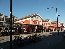
Bludenz station, opened in 1872, is now a branch station on the Lindau – Bludenz railway, the Arlbergbahn and the Bludenz – Schruns railway , which opened in 1905 (the latter operated by the private Montafonerbahn ). These routes are electrified. There is a lively dissolution and formation of freight trains at the city's marshalling yard. Among other things, crossing the Arlberg route often requires shortening the trains and pulling additional locomotives. As the starting point of the western ramp of the Arlbergbahn, Bludenz is of particular importance and has therefore become a “railway town”.
The city is well integrated into the rail network. In Bludenz there is an express train to Innsbruck / Vienna and Feldkirch / Bregenz / Zurich that stops almost every hour during the day. Furthermore, at least two regional trains run from Bludenz to Bregenz / Lindau every hour from early in the morning until late at night. On the nights before Saturdays, Sundays and public holidays, there is even a continuous hourly train service between Bludenz and Bregenz. Public transport to the Montafon is operated by the Montafonerbahn, which runs every half hour or hour, and whose operating times were extended to around midnight a few years ago. This also serves the “Bludenz-Moos” and “Brunnenfeld- Stallehr ” stops in the municipality .
After the regional train service between Bludenz and Langen am Arlberg was initially thinned out, and has been completely discontinued since 2010, the bus line to Klostertal took over the sole connection of the places on the railway line to the public transport.
automobile
Bludenz is the end point of the Rheintal-Walgau autobahn A 14, which turns into the Arlberg expressway S 16. There are four motorway junctions in the town's municipal area, namely Bludenz / Nüziders , Brandnertal , Bludenz / Bürs and Bludenz-Ost / Montafon . There is also a connection point in the area of the S 16, namely Bings . The Bludenz / Bürs junction will be generously converted and expanded by 28.8 million euros. Completion is scheduled for the end of 2021.
Parts of the old town are set up as a pedestrian zone , including the middle section of Werdenbergerstrasse, through which through traffic used to run.
Noise pollution from road traffic
This is considerable due to the traffic on the A 14 / S 16, which runs very close to the outside of the city limits. In 2017, an average of 28,000 vehicles per day passed the section between the Brandnertal and Bludenz / Bürs exits. In the station area, to the northwest of the same in a strip that extends approximately to St.-Anna-Straße, in Mokry, in large parts of the Klarenbrunn settlement and in Brunnenfeld, a 24-hour continuous noise exposure averaged over day, evening and night was recorded in 2017 of 55 to 60 dB (A) determined. Some houses in Unter bings and Unterradin directly on the S 16 are exposed to non-stop sound with averaged 55 to 70 dB (A) - sometimes even despite the noise barrier.
Another significant noise pollution comes from road traffic in Bludenz. The width of the strip along state road 190, which runs through the urban area for a length of about 4.3 km and in which there is an averaged 24-hour continuous sound exposure of at least 55 dB (A), is up to approx 100 m. In some streets east of the station, some of which are densely lined with residential buildings, there are even continuous levels between 60 and 75 dB (A). In the central part of Werdenbergerstrasse, which has been converted into a pedestrian zone, only a 100 m short section is exposed to averaged sound of <55 dB (A) around the clock.
Due to a decrease in the sound pressure level during the sound propagation in the open of only approx. 3 dB per doubling of the distance, the noise emissions from the A 14 / S 16 and the road traffic in the Bludenz / Nüziders settlement area up to the peaks of Hohen Frassen, Elsspitze and Gams Freiheit can be heard clearly in many of the slopes in the north and north-east of Bludenz with hiking trails and in the hillside settlements such as Rungelin, Halde and Oberdaneu.
bus
Public city transport consists of three city bus routes that connect the districts of Südtiroler Siedlung , Brunnenfeld and Rungelin with the train station. Lines 1 and 2 run every half hour from approx. 6:00 a.m. to 8:30 p.m. Line 3 runs mostly every hour, it is out of service on Sundays and public holidays. The city bus routes close on Saturdays, Sundays and public holidays between around 5:30 p.m. and 6:00 p.m. The city bus timetables are coordinated with the train timetable.
Land bus routes run from the post office and Bludenz train station to the Walgau, Brandner Valley and Klostertal.
All buses and trains in the Bludenz area can be used with tickets from the Vorarlberg transport association.
Muttersberg cable car
The former cable car, the valley station of which is in Hinterplärsch, was replaced in 2002 by a detachable single-cable gondola lift with eight-person gondolas. The travel time each way is around ten minutes. The cable car operates daily from around the end of April to the beginning of November, otherwise Friday to Sunday from 9:00 a.m. to 5:00 p.m. In the period around Christmas and New Year's Eve, operations are suspended due to revision work. During the operating hours of the railway, the valley station is served by city bus line 1.
Sports & Freetime
- Alpinism
- The Bludenz district group of the Vorarlberg section of the Austrian Alpine Club is the largest alpine sports club in the city.
- Football in the Sparkassenarena
- In 1926 the first soccer field was opened in the municipality of Bludenz under the name "Fohrenburgstadion". 1973 saw the groundbreaking for the stadium construction. The stadium was opened on March 31, 1975 and has been called the “Sparkassenarena” since 2007.
- Valblu adventure pool
- In 1879, the manufacturer Johann Gassner left the pond originally designed as a “fire pond” (water reservoir for the Bludenz volunteer fire brigade founded in 1869) and the associated “bathing establishment in the Halde” to the city. The outdoor swimming pool was opened on August 1, 1958 (source: Bludenz aktuell April 1977), in 1967 the newly built swimming pool in the outdoor swimming pool was released for use and in 1975 the groundbreaking for the indoor swimming pool took place. In 1991 the company had to be closed for technical reasons. From 1996 to 1998 it was converted into the “Valblu” adventure pool and in 2004 the groundbreaking ceremony for its extension. In 2005, after a construction period of 15 months, the “Val Blu Resort Hotel” opened. In 2017/18 extensive renovation work and a redesign of the outdoor pool area took place. In the future, the heat supply for the pool is to take place via a district heating pipe or be supplemented , depending on how much production waste heat is generated at Getzner Textil . The heating systems already in the bathroom are therefore retained.
- Hinterplärsch recreation area
- Behind the valley station of the Muttersberg cable car, at the Rodlerheim, a natural ice rink was created for decades when the weather was appropriate. Currently (2019), however, the site is occupied by the construction site for the new artificial ice rink.
- From 1967 to December 2015 there was a natural ice toboggan run built into the shady slopes in Hinterplärsch, on which u. a. 1981 the Junior European Championship and 1984 the Junior World Championship took place. A controversial new construction of an artificial ice toboggan run on the same site has started after several delays after the financing was described as secured. The 2019 Junior Championship was supposed to take place here as a prerequisite for the 2020 Junior World Championship to be awarded to Bludenz, but the groundbreaking ceremony was not carried out until the end of October 2018. As a result of cost increases and a financing gap, it is now to be shortened by 70 meters, initially built without a protective roof and completed in autumn 2020. The 2020 Junior World Championships have therefore now been awarded to the ice rink in Igls ( Innsbruck ). An artificial ice rink is being planned.
Muttersberg
- Bludenz's local mountain is the Muttersberg . This stands in the municipality of Nüziders . "Muttersberg" (derived from the family name Muther or mother) is colloquially mostly referred to as the Madeisakopf ( 1402 m ), a wooded head in front of the Hohem Fraßen to the southwest. The mountain station of the Muttersberg cable car and the large restaurant built next to it are located near it. In a narrower sense, the term "Muttersberg" refers to the area of the scattered settlement interspersed with forest and pasture areas to the northwest and below the Madeisakopf, mostly on and below the forest road to the Tiefensee saddle. This also belongs to Nüziders.
Culture and sights
Sights are the originally preserved upper and lower city gates , the Nepomuk fountain and Werdenbergerstrasse with the arcades .
Churches and monasteries
- Laurentiuskirche
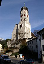
- City Parish Church of the Holy Cross
- Parish church of the South Tyrolean settlement
- Bings Parish Church
- Former hospital church in Kirchgasse
- Dominican convent of St. Peter
- Franciscan monastery (formerly Capuchin monastery) and monastery church
- Antonius Church in Rungelin
- Evang. Parish Church of the Good Shepherd
City fortifications
Parts of the former city fortifications of Bludenz are still preserved today. The approximately 100 houses in the city were surrounded and fenced in with a double curtain wall, seven towers and three gates. The city gate in the east of the city ("Montafonertor" or "Kapuzinertor") was demolished in 1846.
- Lower gate
- Built at the end of the 15th century, this gate was subsequently rebuilt several times. It is also called Mühletor or Bürsertor .
- Upper gate
- Built at the end of the 15th century, rebuilt in 1774 and 1920, it is also called Herzog-Friedrich-Tor or Feldkircher Tor . In 1416 Duke Friedrich IV fled (with an empty pocket) coming from Constance through the Upper Gate into the city; he was taken in Bludenz and brought safely over the Arlberg by the townspeople .
- The Bludenz City Museum is located in the Upper Gate . A few meters away, a covered church staircase, built in the 17th century, is one of the five castle staircases leading to the hill to St. Laurentius Church and Gayenhofen Castle.
- Powder tower
- in the southwest of the city, was built at the end of the 15th century.
Secular buildings
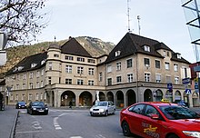

- The castle is located in the structural ensemble with the parish church dominating the city and today serves as the official building of the district authority Bludenz.
- Cotton spinning mill at the Getzner factory (1883–1886)
- The spinning mill in Klarenbrunn is a special example of Vorarlberg's industrial building, as it came into the country from English sources via Swiss companies.
- The balanced, elongated two-story brick building was designed by the engineering office John Felber from Manchester and has a significant pillar and iron structure. Here a synthesis was created between the old multi-storey hall buildings with wooden construction and the old "industrial sheds".
- In its structural and functional conception, the building is a striking example of industrial building from the late 19th century.
- District Court (1927–1929)
- Building by Willibald Braun
- Arcades in Werdenbergerstrasse
- This street is named after the Counts of Werdenberg-Montfort , the former lords of Bludenz. On the right and left it is framed by town houses and patrician houses, which were built after the town fire in 1638. Its magnificent facades, gables and gates are worth seeing. The arcades, which make the pedestrian zone almost a covered inner city, have a southern appearance. Two of the houses on Werdenbergerstrasse after the city fire in 1638, the “Getzner” house (catering and offices) and the Tschofenhaus (restaurant and hotel; facade design by Konrad Honold , 1964), will be converted into listed buildings as part of the 2017/18 inner city renewal process.
- Dörflingerhaus
- This house in Rathausgasse was mentioned as early as 1365 and houses a cafe.
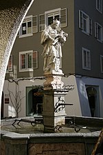
- Nepomuk Fountain (1730)
- The fountain designed by Johann Ladner represents St. Nepomuk, who is considered the patron saint against defamation and suspicion.
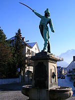
- Riedmiller monument
- This memorial for Bernhard Riedmiller , a captain of the Bludenz riflemen in the Napoleonic Wars (1796–1799), was designed in 1905 by Georg Matt . The Neyer brothers appear as donors of monuments.
The Neyer family carried the name "Deli Neyers" or "Tille Neyers", named after Franz Fidel Neyer. An ancestor by the name of Fidel Neyer fought honorably with his brothers in Riedmiller's company in 1799. An Andreas Neyer is mentioned in a document as an ensign in 1796. At least five Neyer - more people than any other citizen of Bludenz - took part in the defensive battles against the French. The Neyer brothers, who came from a very old bourgeois family in Bludenz, who were mentioned in a document as early as 1472, were wealthy and thus set a monument to their family. With the sum of 16,000 crowns spent on this monument, a small house in the old town of Bludenz could be purchased at that time. Of the four monument donors, only the innkeeper and economist Lorenz Neyer experienced the unveiling of the monument.
Personalities
Honorary citizen of the city
- Franz Freiherr von Auffenberg (around 1790), Swabian major general
- Friedrich Freiherr von Hotze (1739–1799), Lieutenant Field Marshal in the Prussian Army
- Franz Freiherr von Jellachich (1746–1810), Austrian Lieutenant Field Marshal
- Karl Graf von Belrupt-Tissac (1826–1903), Governor of Vorarlberg
- Josef Wolf (1829–1909), Mayor of Bludenz
- Dean Franz Anton Bickel (1850–1916) parish priest of Bludenz
- Josef Wichner (1852–1923), writer
- Andreas Konzett (1861–1938), mayor and member of the state parliament of Bludenz
- Johann Matthias Jehly (1863–1950), community school councilor
- Matthias Längle (1869–1952), Mayor of Bludenz
- Guy Schlesser (1896–1970), general of the French occupation forces
- Andre Gassner (1883–1959), industrialist and member of the state parliament
- Adolf Ammann (1898–1967), parish priest of Bludenz
- Ferdinand Graf von Beust (around 1870), formerly Austro-Hungarian Chancellor, since 1870 honorary citizen of the city of Bludenz
sons and daughters of the town
- Manuela Auer (* 1965), politician (SPÖ)
- Bertram Batlogg (* 1950), physicist
- Dietmar Berchtold (* 1974), soccer player
- Christof Bitschi (* 1991), politician (FPÖ)
- Wolfgang Burtscher (* 1959), lawyer and director general in the European Commission
- Peter Bußjäger (* 1963), lawyer and historian
- Heinrich Comploj (1879–1967), painter, graphic artist and teacher
- Adolf Concin (* 1956), politician and lawyer
- Martin Frainer (* 1977), music producer and composer
- Bettina Götz (* 1962), architect and university professor
- Elmar Grabherr (1911–1987), State Office Director
- Grete Gulbransson (1882–1934), writer and local poet
- Roland Haas (* 1958), artist
- Jakob Hannibal I of Hohenems (1530–1587), count and military leader
- Anton Jehly (1860–1928), painter and restorer
- Jakob Jehly (1854–1897), painter
- Rainer Juriatti (* 1964), writer and screenwriter
- Anton Jussel (1816–1878), Governor (1873–1878)
- Hans Michael Kohler (* 1956), painter
- Heribert Konzett (1912–2004), physician, head of the Innsbruck Pharmacological Institute
- Gerhard Lechner (1937–2017), physician, head of the University Clinic for Radiodiagnostics at the Medical University of Vienna
- Rudi Lins (* 1944), racing car driver
- Georg Margreitter (* 1988), soccer player at 1. FC Nürnberg
- Michael Matt (* 1993), ski racer
- Gerhard Mayer (* 1967), diplomat, Austria's ambassador to Venezuela
- Martina Mittelberger (* 1967), writer
- Edgar Morscher (* 1941), philosopher
- Siegbert Morscher (* 1939), lawyer
- Jonas Müller (* 1997), luge rider
- Hugo Paterno (1896–1944), customs officer, victim of National Socialism
- Herwig Pecoraro (* 1957), state opera singer in Vienna
- Heilwig Pfanzelter (* 1953), TV journalist, actress and singer in Vienna
- Volker Plangg (* 1953), conductor and composer
- Wilhelm Proeckl (1940-2019), politician (SPÖ)
- Paul Renner (* 1957), painter
- Walter Renner (* 1946), lawyer and politician
- Guido Schmidt (1901–1957), diplomat and politician
- Thomas Steu (* 1994), luge rider
- Johannes Strolz (* 1992), ski racer
- Matthias Strolz (* 1973), co-founder of the NEOS party, member of the National Council
- Andrea Tagwerker (* 1970), luge rider
- Ingrid Thurnher (* 1962), television journalist and news anchor
- Manfred Tschaikner (* 1957), historian, archivist and educator
- Stefan Vögel (* 1969), playwright and cabaret artist
- Markus Wallner (* 1967), politician (ÖVP) and governor of Vorarlberg
- Karl Wilhelm Walter (1880–1948), Vice Mayor and Member of the State Parliament
- Andreas Weigel (* 1961), literary scholar and cultural journalist
- Josef Wichner (1852–1923), writer
- Herbert Willi (* 1956), composer and conductor
- Harald Witwer (* 1977), politician
- Helmut Zimmermann (* 1948), politician (SPÖ)
- Daniel Zugg (* 1993), ski mountaineer
- Leonardo Zottele (* 1999), football player
People working in the city
- Josef Prantl (1895–1951), composer and city music director
- Joseph Renner Jr. (1868–1934), music director in Bludenz, composer, later church musician at Regensburg Cathedral
- Bernhard Riedmiller (1757–1832), innkeeper and freedom fighter during the Napoleonic era
- Wilhelm Schramm (* 1952), designer and bookmaker
- Susi Weigel (1914–1990), Austrian children's book illustrator and animator
- Albrecht III. von Werdenberg-Heiligenberg-Bludenz († 1420), last Count of Bludenz
Town twinning
Bludenz maintains a partnership with the following cities:
- Plettenberg in Germany (since 1988)
- Borgo Valsugana in Italy (since 1991)
Trivia
Opposite Bludenz, on the other side of the Ill, in the Rätikon , stands the 2107 m high Bludenzer Mittagsspitze , a steep elevation from a Bludenz perspective in a side ridge of the Vandanser Steinwand . The mountain is in the south of the city, where the sun is at noon.
literature
- Benedikt Bilgeri: The Arlberg and the beginnings of the city of Bludenz. In: Writings of the Association for the History of Lake Constance and its Surroundings. Vol. 90, 1972, pp. 1–17 (digital copy)
- Johann Moser: Bludenzer people and houses description 1784 to 1789. Edition and evaluation. History Association Region Bludenz, 2013, ISBN 978-3-901833-34-2 .
Web links
- Website of the city of Bludenz
- Web presence of the Vorarlberg Alpine region for the city of Bludenz
- 80103 - Bludenz. Community data, Statistics Austria .
Individual evidence
- ↑ "Vorarlberg population cut-off date June 30, 2018", p. 17, publisher: Land Vorarlberg, see: https://www.vorarlberg.at/pdf/bevoelkerungjuni2018.pdf
- ↑ Alpenstadt Bludenz city map - official city map on a scale of 1: 9000, edition November 2014, publisher: Bludenz Stadt-Marketing GmbH, Werdenberger Str. 42, 6700 Bludenz
- ↑ vogis.cnv.at
- ↑ Explanatory board at the small drinking water power plant in Bludenz-Hinterplärsch
- ↑ zamg.ac.at
- ↑ vorarlberg.at
- ↑ zamg.ac.at
- ↑ Statistics Austria: Population on January 1st, 2020 by locality (area status on January 1st, 2020) , ( CSV )
- ^ Susanne Sievers , Otto Helmut Urban , Peter C. Ramsl: Lexicon for Celtic Archeology. A – K and L – Z. (= Communications from the prehistoric commission in the publishing house of the Austrian Academy of Sciences . Volume 73). Vienna 2012, ISBN 978-3-7001-6765-5 , p. 191.
- ↑ Manfred Tschaikner : A brief history of the city . From: Bludenzer Geschichtsblätter . Issue 50, 2nd edition. 2003.
- ↑ Niederstätter 1996, pp. 99-100.
- ↑ Burmeister 1996, p. 127.
- ^ Jochen Hofmann, Christian Wolkersdorfer: The historical mining in the Montafon.
- ↑ a b c Manfred Tschaikner : Bludenz reading book. ISBN 978-3-901325-46-5 .
- ↑ Markus Barnay: Vorarlberg Guide. What citizenship applicants should know about our country. Bregenz 2006, p. 11. (PDF; 3.1 MB).
- ↑ Montafon Local History Museum Schruns; Special exhibition Montafon 1945–1955
- ^ Statistics Austria, A look at the city of Bludenz, population development. Retrieved March 14, 2020 .
- ↑ Katzenmayer elected with a lead of 27 votes. Article on vorarlberg.ORF.at from March 29, 2015.
- ↑ SPÖ Bludenz wants to contest the election . Article on vorarlberg.orf.at from April 11, 2015.
- ↑ knowledge WI3 / 2015 of the Constitutional Court of 23 November 2015, available on the Legal Information System of the Republic of Austria (RIS).
- ↑ Bludenz: Katzenmayer remains mayor . Article on vorarlberg.ORF.at from December 20, 2015, accessed on December 20, 2015.
- ↑ a b Bludenz aktuell, edition No. 170, p. 4, see also https://www.bludenz.at/fileadmin/daten/pdf/Bludenz-Aktuell/Bludenz_aktuell_Nr._170_f%C3%BCr_HP.pdf
- ↑ Plangg & Pfluger watch factory (Watch Wiki)
- ^ Annette Bleyle: Origin and development of Vorarlberg industry. (PDF) In : wirtschaftsarchiv-v.at. Retrieved December 19, 2015 .
- ↑ City of Bludenz Kronenhaus opening ( Memento from January 8, 2014 in the Internet Archive )
- ^ Debris flow in the Galgentobel (Vorarlberg State Library)
- ↑ a b cdnl.vol.at/2008/04/Verbauungsprojekt_Galgentobel.pdf
- ↑ Rock fall in the Muttersberg Tobel. In: oesterreich.orf.at. March 17, 2007, accessed November 12, 2018 .
- ↑ Flood Risk Management Plan 2015, risk area Ill - Walgau and tributaries 8007, p. 4, publisher: Federal Ministry of Agriculture, Forestry, Environment and Water Management, Stubenring 1, 1010 Vienna, DVR (data processing register number): 0000183
- ↑ Alarm plan from 2018 of the Office of the City of Bludenz, see https://www.bludenz.at/fileadmin/user_upload/Typhon_kops_silvretta_und_vermunt_18_12_2018.pdf
- ^ RIS - Ordinance of the state government on warning and alarm signals - state law consolidates Vorarlberg, version dated October 2nd, 2019. Retrieved October 2, 2019 .
- ↑ "Probealarm in the Bludenz district" in: http://www.regionews.at/newsdetail/Probealarm_im_Bezirk_Bludenz-167194
- ↑ a b c Timetable Vorarlberg Süd 2018, publisher: Verkehrsverbund Vorarlberg, Herrengasse 14, 6800 Feldkirch
- ↑ A 14 Rheintal / Walgau Autobahn junction Bludenz-Bürs. Retrieved on March 25, 2020 (German).
- ↑ Asfinag card mileage 2017, see: https://www.laerminfo.at/laermkarten/lösungen/verkehrsdaten/daten_autobahnen/as_2018.html
- ↑ Noise maps. Retrieved on August 26, 2018 (German).
- ↑ maps.laerminfo.at
- ↑ stefangoebel: 7.3 Sound propagation outdoors. August 6, 2018, accessed on September 26, 2019 (German).
- ↑ Negotiating paper on the 15th public meeting of the city council of Bludenz, which took place on November 17, 2016, p. 14, publisher: Office of the City of Bludenz, November 21, 2016.
- ↑ Great confidence in the planned toboggan run in Bludenz. November 17, 2016, accessed October 8, 2019 .
- ↑ Construction work for Bludenzer Eiskanal started. In: vorarlberg.ORF.at . October 25, 2018, accessed October 25, 2018 .
- ↑ Negotiating paper from the Bludenz city council meeting on February 27, 2020.
- ↑ Junior World Championships 2020 now in Innsbruck
- ↑ Financing of Bludenzer Eiskanal clarified. In: vorarlberg.ORF.at . October 16, 2018, accessed October 17, 2018 .
- ^ History of the District Commission Bludenz
- ↑ City center in constant change (January 26, 2017)
- ↑ Christoph Vallaster: honorary citizen in Vorarlberg. 1986, ISBN 3-85258-001-3 .
- ↑ Text booklet for the CD: The Regensburg Cathedral Organ - Franz Josef Stoiber plays works by Bach, Renner, Dupré and improvisations on the new Rieger organ (2010). Label: Motet
