
Bludesch
|
Bludesch
|
||
|---|---|---|
| coat of arms | Austria map | |
 |
|
|
| Basic data | ||
| Country: | Austria | |
| State : | Vorarlberg | |
| Political District : | Bludenz | |
| License plate : | BZ | |
| Surface: | 7.59 km² | |
| Coordinates : | 47 ° 12 ' N , 9 ° 45' E | |
| Height : | 529 m above sea level A. | |
| Residents : | 2,384 (Jan 1, 2020) | |
| Population density : | 314 inhabitants per km² | |
| Postal code : | 6719 | |
| Area code : | 05550 or 05525 | |
| Community code : | 8 01 04 | |
| NUTS region | AT341 | |
| Address of the municipal administration: |
Hauptstrasse 9 6719 Bludesch |
|
| Website: | ||
| politics | ||
| Mayor : | Michael Tinkhauser | |
|
Local council : (2015) (21 members) |
||
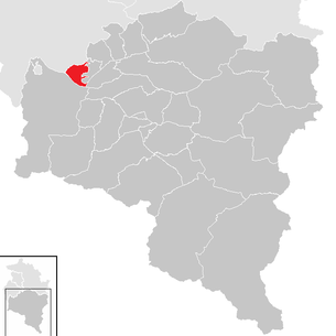
| Location of Bludesch in the Bludenz district | ||
  |
||
 View over Bludesch to the Zimba |
||
| Source: Municipal data from Statistics Austria | ||


Bludesch is a municipality with 2384 inhabitants (as of January 1, 2020) in the Bludenz district ( Vorarlberg / Austria ). It is located in Walgau and, along with Thuringia and Ludesch, belongs to the Blumenegg communities. The Gais parcel with the Walgau barracks located there is also of great importance .
geography
Bludesch is located in the westernmost state of Austria - Vorarlberg - in the Bludenz district. Bludesch is located in the mountainous southern Vorarlberg (Südvorarlberg) at 529/540 meters above sea level in the central Walgau. The mountains immediately surrounding it reach heights of 2000 to 2600 meters. The river Ill flows through the up to five kilometers wide Walgau ; its most important tributary is the Lutz . The Lutz with the stem syllable lut / lud gives its name to the villages Ludesch, Bludesch and the family name Zerlauth (zurlutt / zerlut) as well as a large number of lut-related field names in the Walsertal. For many millennia, the rivers Lutz and Ill have ensured that the Walgau has a layer of stone and gravel up to 180 m deep, which proves to be a large groundwater reservoir for the drinking water supply. However, these debris quantities have also often muddy the agricultural areas, so that the Walgauer appear to be “rocky but poor in humus”. Today, reading stones collected at the respective basic borders still adorn the landscape, which is partially protected as a Hägi . 44.0% of the community area is planted with alluvial and high forest, the agricultural areas are designated with around 40%. More than a thousand years ago and in the Middle Ages, the vineyard area in the hillside and valley locations was around 10% of the comparable total area. The annual rainfall is 1400 mm in the middle range.
Neighboring communities
| Schlins | Schnifis | |
.svg)
|
Thuringia | |
| Nenzing | Ludesch |
history
The Walgau ( vallis drusiana ) already had permanent settlements at the beginning of Roman rule . The local population of the Rhaetians was influenced over time by the Romans , Alemanni and later Walser . The place name Bludesch was first mentioned in 842 as villa pludassis . It goes back to the Celtic pa-lut (by the Lutz ).
Pludassis / Bludasco was probably settled in the late 2nd century Rhaetian, was in the course of the conquests by Drusus and Tiberius in 15 BC. BC Roman province and thus part of the Raetia prima . Christianization began as early as the 5th century. The inheritance agreement of the Carolingians of Verdun 842/843 names a royal court and a church in Bludesch; the unnamed church in cise villa is evidently a separate church and does not belong to the bishop in Chur.
The Franconian clerk-counts became the Udalrichingen in the 10th century, followed by the Montforters and the lords of Brandis and Sulz . When the Vorarlberg lands were sold "in pieces" to the Habsburgs in the 14th and 15th centuries , only the small rule of Blumenegg with the villages of Bludesch, Thuringia and Ludesch (all located on the Lutz) remained; Blumenegg became a free, imperial rule in 1431.
In 1614 the Weingarten monastery acquired the rule of Blumenegg and sold it to Habsburg / Austria in 1804. After the brief interlude of the Bavarian occupation (1806 to 1814), Austria finally took over the small rule of Blumenegg. In 1839, the centuries of compulsory labor was lifted. Until 1848 Bludesch was represented in the "Great Gnos" ", but formed a special kind of" double community " with the neighboring municipality of Thuringia with its own municipal administration. Thuringia and Bludesch were one municipality until 1849. In the course of the establishment of the district offices in Vorarlberg, Bludesch became Assigned to the Bludenz district in 1849 and since then has been an independent municipality in every respect, including the neighboring village of Gais.
Population development

From 1981 to 2001 the birth balance and migration balance were positive. From 2001 to 2011 the birth balance remained positive, but emigration increased.
Culture and sights
- Parish church Bludesch : The parish church of St. James was built in 1651/1652 according to plans by the baroque master builder Michael Beer ; it is his first pilaster church. Interesting are those of Josef Bergöntzle built organ (1804) and the high altar (1651). The Bergöntzle organ comes from the Silbermann school , was deposited in the turmoil of the French Revolution in Alsace and brought to Bludesch in 1804 and installed in the parish church. Parish church and organ have been the venue for the “Bludescher Organ Concerts” since 1971.
- The Romanesque branch church Zitz hl. Nikolaus is the oldest church in Vorarlberg . It was first mentioned in a document in 842; Due to new pictures of the foundation masonry , a pre-Romanesque building around 450/500 is no longer excluded. The oldest remaining part is the nave in the early Romanesque style (700–800). The frescoes uncovered in 1950 and dated to the first third of the 14th century show the Last Judgment , the procession of the Blessed with Peter at the gate of heaven and two scenes from the Passion of Christ . The train of the damned is shown in further pictures as a story of the fall into hell and the seven deadly sins. In 2006 a curtain painting was discovered in the lowest image field (register) on the north wall. The outstanding feature of the Nikolauskirche is the tower, which is made of broken stone and tuff stone up to the top; the lower tower quadrant dates from around the 10th century, the upper structure with early Gothic pinnacles corresponds to the 13th century.
- Former lung sanatorium Gaisbühel : The property was built in 1917–1920 as a “sanatorium for tuberculosis sufferers”, placed on the highest possible level of self-preservation and therefore equipped with its own manor, completed in 1925 on land owned by the state. The manor was leased and operated for 60 years. The development of the sanatorium led from the special ward to the chronic hospital to the acute hospital and in 2005 to the relocation of oncology and pulmonology to Feldkirch. This marked the end of the sanatorium, the listed building by architect Willi Braun is now empty.
- The Unterhalden residence was built around 1640.
- Jordan Castle Ruins: First mentioned in 1578 under this name, it was built by Christoph Brockh as a dwelling for temporary agricultural use (viticulture). Georg Ludwig von Lindenspeur acquired the estate around 1637 and expanded it into his hunting and summer residence in 1653. After several changes of ownership in 1842, only the walls of a two-story, undeveloped house are mentioned. The ruin has been privately owned since 2009 and has largely fallen into disrepair.
politics
In the 2015 municipal council and mayoral election in Bludesch, a unified list called "GEMEINSAM - List for Bludesch and Gais", to which all 21 members of the Bludesch municipal council belong since then . Mayor is Michael Tinkauser, who was re-elected as the only candidate with 86.66% of the votes in the direct mayor election 2015.
Economy and Infrastructure
The Blumenegg region experienced during the first third of the 19th century - like other places in Vorarlberg - an industrialization that was shaped to a large extent by the textile industry. In 1830 the "Müller'sche Roth- und Bunthfärberei" was established in the district of Gais, and in 1837 the "kkprivil.Spinnerey & Weberey" by Escher-Kennedy-Douglass in Thuringia.
Both companies shaped the region and the village structure for well over a hundred years. The lordly subject, who did labor service, became the company-dependent manufacturer. At the same time, viticulture , which had prevailed until then, lost its importance from the middle of the 19th century until it came to a complete standstill around 1900. It has only been revived since 1990.
The factory in Thuringia was shut down before the end of the 20th century; Apartments were created from multi-storey factory buildings. The factory in Gais survived the compulsory compensation in 2005, was acquired in 2007 as "Delunamagma" and ended in 2010 as a cleared construction site, free of any structure.
The building and operation of the Walgau barracks was decisive for the community of Bludesch . In 1989 the groundbreaking for the construction of the new barracks of the Austrian Armed Forces took place. In the same year the barracks were opened and Bludesch became a garrison location. From 1990 to 1999, more than 120 apartments were built in the local area. In addition, there was the settlement of a doctor and their own pharmacy, a post office and several bank branches, restaurants and new shops.
In 2003 there were 34 commercial businesses with 572 employees and 24 apprentices. There were 662 employees subject to wage tax. Agriculture plays a subordinate role.
In Bludesch there are two kindergartens and a school with (as of January 2003) 155 students. Half of the kindergarten next to the school in Bludesch was demolished on April 1, 2018. The library will be relocated to the school garden of the primary school in Bludesch at the beginning of autumn.
Personalities
- Michael Beer (* around 1605–1666), architect and builder, planned and built the Bludesch parish church
- Engelbert Luger (1861–1926), painter and politician, created a fresco in the parish church of Bludesch
- Johann Müller (1875–1940), innkeeper and politician in Bludesch, member of the Vorarlberg state parliament
- Herbert Keßler (1925–2018), lawyer and politician born in Bludesch, Governor of Vorarlberg
- Gerhard Köhlmeier (1938–2006), politician who died in Bludesch, mayor and member of the Vorarlberg state parliament
- Christoph Enzenhofer (* 1949), organ builder, runs his workshop in Bludesch
- Ernst Konzett (* 1955), officer and military commander of Vorarlberg, was the commander of the 23rd Jäger Battalion in Bludesch
Web links
- Homepage of the Bludesch community
- Statistics on Bludesch from Statistics Austria
- Article of the Federal Monuments Office (BDA) on the subsidiary church of St. Nicholas in Bludesch-Zitz (October 2007)
Individual evidence
- ↑ Idyllic: In the Oberland from village to village. In: Neue Vorarlberger Tageszeitung , October 28, 2016.
- ^ Statistics Austria, A look at the community of Bludesch, population development. Retrieved April 4, 2019 .
- ^ Filial church St. Nikolaus in Bludesch-Zitz
- ↑ Michael Unterwurzacher, Beate Rüf, Diethard Sanders, " Quelltuff in Vorarlberg - Education, Use, Material-Technical Properties ", Vorarlberger Naturschau, 19, p. 211, Dornbirn 2006.

Bartholomäberg | Blons | Bludenz | Bludesch | Fire | Bürs | Bürserberg | Dalaas | Fontanella | Gaschurn | Innerbraz | Klösterle | Lech | Lorüns | Ludesch | Nenzing | Nüziders | Raggal | St. Anton im Montafon | St. Gallenkirch | St. Gerold | Schruns | Silbertal | Sunday | Stallhr | Thuringia | Thuringian Mountain | Tschagguns | Vandans