
List of places in the municipality of Manatuto

The list of places in the municipality of Manatuto indicates which villages are in each suco of the East Timorese municipality of Manatuto and what geographical coordinates and altitude they have.
Maps
The Manatuto community

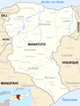
The municipality of Manatuto within the boundaries until 2015


list
The Barique Administration Office

The Laclo Administration Office
| Administrative office of Laclo | |||||||
|
|||||||
| Suco Hohorai | |||||||
| places | position | height | places | position | height | ||
| Anicolaun | 8 ° 37 ′ 6 ″ S, 125 ° 48 ′ 13 ″ E | 673 m | Hatu Ermera | 8 ° 36 ′ 25 ″ S, 125 ° 45 ′ 52 ″ E | 846 m | ||
| Reabuticeon | 8 ° 35 ′ 12 ″ S, 125 ° 50 ′ 37 ″ E | 248 m | Rehab | 8 ° 35 ′ 24 ″ S, 125 ° 48 ′ 15 ″ E | 329 m | ||
| Robai | 8 ° 36 ′ 28 "S, 125 ° 48 ′ 20" E | 561 m | Sabomata | 8 ° 37 ′ 45 ″ S, 125 ° 46 ′ 52 ″ E | 681 m | ||
| Uniabeuk | 8 ° 36 ′ 55 "S, 125 ° 48 ′ 41" E | 625 m | |||||
| Suco Lacumesac | |||||||
| places | position | height | places | position | height | ||
| Bua | 8 ° 35 ′ 1 ″ S, 125 ° 49 ′ 6 ″ E | 276 m | Hatu Conan | 8 ° 33 ′ 50 ″ S, 125 ° 49 ′ 45 ″ E | 271 m | ||
| Hohorai | 8 ° 33 '26 "S, 125 ° 54" 43 "E | 177 m | Labubu | 8 ° 36 ′ 59 ″ S, 125 ° 49 ′ 44 ″ E | 499 m | ||
| Laclo | 8 ° 33 ′ 18 ″ S, 125 ° 54 ′ 34 ″ E | 177 m | Maloroc | 8 ° 35 ′ 4 ″ S, 125 ° 51 ′ 55 ″ E | 222 m | ||
| Nacaleo | 8 ° 33 ′ 15 ″ S, 125 ° 55 ′ 9 ″ E | 159 m | Readodoc | 8 ° 33 ′ 12 ″ S, 125 ° 54 ′ 21 ″ E | 236 m | ||
| Sacatin | 8 ° 33 ′ 52 "S, 125 ° 53 ′ 56" E | 179 m | Tahagamu | 8 ° 33 ′ 2 ″ S, 125 ° 53 ′ 2 ″ E | 254 m | ||
| Umaheuk | 8 ° 36 ′ 55 "S, 125 ° 48 ′ 41" E | 625 m | Umanaruk | 8 ° 33 ′ 22 ″ S, 125 ° 54 ′ 57 ″ E | 159 m | ||
| Umasurat | 8 ° 33 ′ 18 ″ S, 125 ° 54 ′ 50 ″ E | 159 m | |||||
| Suco Laicore | |||||||
| places | position | height | places | position | height | ||
| Bahadic | 8 ° 36 ′ 2 ″ S, 125 ° 53 ′ 23 ″ E | 237 m | Licore | 8 ° 34 '22 "S, 125 ° 55' 34" E | 235 m | ||
| Rehato | 8 ° 34 '43 "S, 125 ° 54' 45" E | 228 m | Tuha | 8 ° 36 ′ 26 ″ S, 125 ° 51 ′ 7 ″ E | 295 m | ||
| Suco Uma Caduac | |||||||
| places | position | height | places | position | height | ||
| Cut | 8 ° 28 ′ 40 ″ S, 125 ° 53 ′ 25 ″ E | 0 m | Behedan | 8 ° 29 ′ 39 ″ S, 125 ° 57 ′ 8 ″ E | 35 m | ||
| Beuah | 8 ° 28 ′ 48 ″ S, 125 ° 55 ′ 4 ″ E | 188 m | Condar | 8 ° 31 ′ 58 ″ S, 125 ° 57 ′ 41 ″ E | 126 m | ||
| Hahi Hoho | 8 ° 33 ′ 8 ″ S, 125 ° 55 ′ 20 ″ E | 187 m | Huiali | 8 ° 29 ′ 2 ″ S, 125 ° 50 ′ 22 ″ E | 106 m | ||
| Ili-mano | 8 ° 28 ′ 35 ″ S, 125 ° 51 ′ 25 ″ E | 0 m | Ilimbab | 8 ° 31 ′ 23 ″ S, 125 ° 54 ′ 6 ″ E | 841 m | ||
| Kera | 8 ° 33 '28 "S, 125 ° 51' 37" E | 242 m | Osuun | 8 ° 28 ′ 37 ″ S, 125 ° 52 ′ 45 ″ E | 0 m | ||
| Subau | 8 ° 28 ′ 51 ″ S, 125 ° 55 ′ 24 ″ E | 157 m | |||||
| Suco Uma Naruc | |||||||
| places | position | height | places | position | height | ||
| Fahilacor | 8 ° 39 ′ 15 ″ S, 125 ° 47 ′ 49 ″ E | 397 m | Matilau | 8 ° 39 ′ 20 ″ S, 125 ° 49 ′ 0 ″ E | 342 m | ||
The Laclubar Administrative Office
| Laclubar administrative office | |||||||
|
|||||||
| Suco Batara | |||||||
| places | position | height | places | position | height | ||
| Are ain | 8 ° 44 ′ 6 ″ S, 125 ° 55 ′ 0 ″ E | 980 m | Balulin | 8 ° 44 ′ 43 "S, 125 ° 54 ′ 16" E | 1074 m | ||
| Fatuha | 8 ° 44 ′ 26 ″ S, 125 ° 54 ′ 30 ″ E | 1074 m | Lihutula | 8 ° 44 ′ 23 ″ S, 125 ° 55 ′ 7 ″ E | 1012 m | ||
| Werulun | 8 ° 44 ′ 23 ″ S, 125 ° 54 ′ 40 ″ E | 1074 m | |||||
| Suco Fatumaquerec | |||||||
| places | position | height | places | position | height | ||
| Mayfu | 8 ° 43 '48 "S, 125 ° 51' 50" E | 1333 m | Laramera | 8 ° 43 ′ 24 ″ S, 125 ° 58 ′ 39 ″ E | 1009 m | ||
| Lisuata | 8 ° 43 ′ 21 ″ S, 125 ° 58 ′ 45 ″ E | 979 m | Manukasak | 8 ° 43 ′ 29 ″ S, 125 ° 58 ′ 27 ″ E | 1009 m | ||
| Sasahi | 8 ° 43 ′ 6 ″ S, 125 ° 58 ′ 42 ″ E | 841 m | |||||
| Suco Funar | |||||||
| places | position | height | places | position | height | ||
| Funar | 8 ° 45 ′ 2 ″ S, 125 ° 52 ′ 7 ″ E | ? | Sassahi | 8 ° 46 ′ 20 ″ S, 125 ° 53 ′ 5 ″ E | ? | ||
| Suco Manelima | |||||||
| places | position | height | places | position | height | ||
| Aman Un | 8 ° 48 ′ 20 ″ S, 125 ° 55 ′ 13 ″ E | 940 m | Calohan | 8 ° 45 ′ 24 ″ S, 125 ° 55 ′ 38 ″ E | 1124 m | ||
| Hatomanuc | 8 ° 47 '30 "S, 125 ° 55' 52" E | 950 m | Laceno | 8 ° 48 ′ 32 ″ S, 125 ° 55 ′ 10 ″ E | 940 m | ||
| Lafulau | 8 ° 48 ′ 10 ″ S, 125 ° 55 ′ 19 ″ E | 1004 m | Mane-atun | 8 ° 46 ′ 44 ″ S, 125 ° 55 ′ 31 ″ E | 1199 m | ||
| Manelima | 8 ° 46 ′ 1 ″ S, 125 ° 54 ′ 0 ″ E | 1246 m | |||||
| Suco Orlalan | |||||||
| places | position | height | places | position | height | ||
| Bamatac | 8 ° 45 ′ 7 ″ S, 125 ° 54 ′ 6 ″ E | 1192 m | Hatolalan | 8 ° 44 ′ 56 ″ S, 125 ° 56 ′ 28 ″ E | 1068 m | ||
| Hatomalos | 8 ° 44 ′ 47 ″ S, 125 ° 56 ′ 7 ″ E | 1037 m | Laclubar | 8 ° 44 ′ 47 ″ S, 125 ° 54 ′ 40 ″ E | 1120 m | ||
| Lawado | 8 ° 45 ′ 2 ″ S, 125 ° 54 ′ 17 ″ E | 1120 m | Le'i | 8 ° 45 ′ 21 ″ S, 125 ° 57 ′ 40 ″ E | 1204 m | ||
| Nauleau | 8 ° 45 ′ 15 ″ S, 125 ° 57 ′ 25 ″ E | 1204 m | Orlalan | 8 ° 45 ′ 6 ″ S, 125 ° 55 ′ 0 ″ E | 1077 m | ||
| Pualaca | 8 ° 47 ′ 26 ″ S, 125 ° 58 ′ 10 ″ E | ? | Torilalan | 8 ° 45 ′ 3 ″ S, 125 ° 54 ′ 34 ″ E | 1120 m | ||
| Suco Sananain | |||||||
| places | position | height | places | position | height | ||
| Fatu-Uc | 8 ° 38 ′ 23 "S, 125 ° 58 ′ 34" E | 316 m | Take a rest | 8 ° 38 ′ 32 "S, 125 ° 58 ′ 34" E | 316 m | ||
| Tanusa | 8 ° 38 ′ 35 ″ S, 125 ° 58 ′ 36 ″ E | 316 m | Waidarec | 8 ° 38 ′ 33 ″ S, 125 ° 58 ′ 38 ″ E | 316 m | ||
The Laleia Administration Office
| Laleia Administration Office | |||||||
|
|||||||
| Suco Cairui | |||||||
| places | position | height | places | position | height | ||
| Bia-Ba'e | 8 ° 36 ′ 33 ″ S, 126 ° 8 ′ 37 ″ E | 184 m | Corohoco | 8 ° 36 ′ 21 ″ S, 126 ° 8 ′ 39 ″ E | 184 m | ||
| Rai-Bu | 8 ° 36 ′ 18 ″ S, 126 ° 8 ′ 41 ″ E | 184 m | Rai-Mea | 8 ° 36 ′ 26 ″ S, 126 ° 8 ′ 38 ″ E | 184 m | ||
| Samalai | 8 ° 34 ′ 37 ″ S, 126 ° 9 ′ 36 ″ E | 125 m | Uai-nunu | 8 ° 36 ′ 26 ″ S, 126 ° 8 ′ 45 ″ E | 184 m | ||
| Uatu-Sili | 8 ° 36 ′ 22 ″ S, 126 ° 8 ′ 47 ″ E | 205 m | |||||
| Suco Haturalan | |||||||
| places | position | height | places | position | height | ||
| Hatu Carau | ? | Ralan | 8 ° 32 ′ 20 ″ S, 126 ° 9 ′ 53 ″ E | 121 m | |||
| Uma-Iuc | 8 ° 32 '28 "S, 126 ° 9' 44" E | 80 m | Ueboro | 8 ° 32 '26 "S, 126 ° 9' 55" E | 122 m | ||
| Suco Lifau | |||||||
| places | position | height | places | position | height | ||
| Laleia | 8 ° 32 ′ 16 ″ S, 126 ° 10 ′ 0 ″ E | 156 m | Lenao | 8 ° 32 '16 "S, 126 ° 9' 44" E | ? | ||
| Lifau | 8 ° 32 ′ 15 ″ S, 126 ° 9 ′ 50 ″ E | 121 m | Uma-Rentau | 8 ° 31 '55 "S, 126 ° 9' 43" E | ? | ||
The Manatuto Administration Office
| Manatuto Administration Office | |||||||
|
|||||||
| Suco Ailili | |||||||
| places | position | height | places | position | height | ||
| Belbato (West) | 8 ° 32 ′ 46 ″ S, 126 ° 0 ′ 4 ″ E | ? | Nunuli | 8 ° 31 ′ 51 ″ S, 125 ° 59 ′ 19 ″ E | 72 m | ||
| Nai | 8 ° 31 ′ 56 "S, 125 ° 59 ′ 56" E | ? | Rembor | 8 ° 32 ′ 40 ″ S, 125 ° 57 ′ 55 ″ E | 96 m | ||
| Suco Aiteas | |||||||
| places | position | height | places | position | height | ||
| Belbato | 8 ° 31 ′ 39 ″ S, 126 ° 0 ′ 18 ″ E | ? | Carlilu | 8 ° 32 ′ 2 ″ S, 126 ° 0 ′ 24 ″ E | 109 m | ||
| Lahuoae | 8 ° 31 ′ 16 ″ S, 126 ° 0 ′ 25 ″ E | 63 m | |||||
| Suco Cribas | |||||||
| places | position | height | places | position | height | ||
| Athoc | 8 ° 40 ′ 31 ″ S, 125 ° 59 ′ 33 ″ E | 509 m | Tuquete | 8 ° 40 ′ 34 ″ S, 125 ° 59 ′ 26 ″ E | 509 m | ||
| Suco Iliheu | |||||||
| places | position | height | places | position | height | ||
| Ili-Huli | 8 ° 32 ′ 20 ″ S, 125 ° 56 ′ 46 ″ E | 113 m | I-Un | 8 ° 32 '36 "S, 125 ° 56" 35 "E | 149 m | ||
| Suco Ma'abat | |||||||
| places | position | height | places | position | height | ||
| Aitehen | 8 ° 30 ′ 46 ″ S, 126 ° 1 ′ 50 ″ E | 21 m | Berato | 8 ° 30 ′ 52 ″ S, 126 ° 1 ′ 12 ″ E | 29 m | ||
| Dadean Huhun | 8 ° 31 ′ 9 ″ S, 126 ° 2 ′ 35 ″ E | 2 m | Ma'abat | 8 ° 30 ′ 45 ″ S, 126 ° 1 ′ 14 ″ E | 29 m | ||
| Manatuto | 8 ° 30 ′ 41 ″ S, 126 ° 0 ′ 47 ″ E | 0 m | Soraha | 8 ° 31 '35 "S, 126 ° 1' 29" E | 74 m | ||
| Suco Sau | |||||||
| places | position | height | places | position | height | ||
| Ailili | 8 ° 30 ′ 43 "S, 126 ° 0 ′ 42" E | 0 m | Aiteas | 8 ° 30 ′ 38 ″ S, 126 ° 0 ′ 57 ″ E | 0 m | ||
| Iun | 8 ° 30 ′ 50 ″ S, 126 ° 0 ′ 57 ″ E | 29 m | Malarahu | 8 ° 31 ′ 18 ″ S, 125 ° 59 ′ 52 ″ E | 52 m | ||
| Manatuto | 8 ° 30 ′ 41 ″ S, 126 ° 0 ′ 47 ″ E | 0 m | Obrato | 8 ° 30 ′ 15 ″ S, 125 ° 59 ′ 51 ″ E | 0 m | ||
| Obrato 1 | 8 ° 29 ′ 50 ″ S, 125 ° 59 ′ 40 ″ E | 0 m | sow | 8 ° 30 ′ 36 ″ S, 126 ° 0 ′ 40 ″ E | 0 m | ||
Soibada Administrative Office
| Soibada Administrative Office | |||||||
|
|||||||
| Suco Fatumaquerec | |||||||
| places | position | height | places | position | height | ||
| Hisuala | 8 ° 51 ′ 39 ″ S, 125 ° 56 ′ 5 ″ E | 613 m | Sasahi | 8 ° 51 ′ 45 ″ S, 125 ° 56 ′ 10 ″ E | 565 m | ||
| Uma Querec | 8 ° 51 ′ 41 ″ S, 125 ° 56 ′ 25 ″ E | 569 m | |||||
| Suco Leo hat | |||||||
| places | position | height | places | position | height | ||
| Leo hat | 8 ° 52 ′ 3 ″ S, 125 ° 56 ′ 36 ″ E | 535 m | Malushum | 8 ° 51 '57 "S, 125 ° 56" 43 "E | 535 m | ||
| Malus Hun | 8 ° 49 ′ 47 ″ S, 125 ° 59 ′ 16 ″ E | ? | |||||
| Suco Manlala | |||||||
| places | position | height | places | position | height | ||
| Dauloroc | 8 ° 51 ′ 41 ″ S, 125 ° 56 ′ 42 ″ E | 569 m | Lehutula | 8 ° 51 ′ 27 ″ S, 125 ° 56 ′ 33 ″ E | 569 m | ||
| Manlala | 8 ° 51 ′ 33 ″ S, 125 ° 56 ′ 47 ″ E | 543 m | Soibada | 8 ° 51 '36 "S, 125 ° 56" 33 "E | 638 m | ||
| Suco Maun-Fahe | |||||||
| places | position | height | places | position | height | ||
| Maun-Fahe | 8 ° 49 ′ 52 ″ S, 125 ° 55 ′ 18 ″ E | 706 m | Teras | 8 ° 49 ′ 41 ″ S, 125 ° 55 ′ 14 ″ E | 787 m | ||
| Suco Samoro | |||||||
| No bigger places available | |||||||
See also
supporting documents
The spelling of the place names follows, if available, the information on the administrative divisions in:
- Jornal da República: Diploma Ministerial n ° 16/2017 , with corrections dated May 9, 2017
The list of localities is created with the following maps:
- Timor-Leste GIS-Portal ( Memento from June 30, 2007 in the Internet Archive )
- UNMIT maps of the districts 2008
If the place names are spelled differently, the information from the GIS portal is followed. The other spellings for individual places can be found in the article on the individual sucos in the country.
The sea heights and coordinates were taken from:
Places listed on Global Gazetteer that are not confirmed by a map will not be included in the list.
Coordinates that are not listed on Global Gazetteer are determined with the help of Google Maps .
Individual evidence
The administrative borders within East Timor changed in 2015. This article must therefore be checked and updated if necessary. See New Administrative Boundaries .