
List of places in the municipality of Cova Lima

The list of places in Cova Lima indicates which places are in each suco of the East Timorese municipality of Cova Lima and what geographical coordinates and altitude they have.
Maps

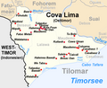
The municipality of Cova Lima

The Fatululic Administration Office

The Fatumean Administration Office

The Fohorem Administrative Office

The administrative office of Maucatar

The Suai Administration Office
The Tilomar Administration Office

The Zumalai Administrative Office


list
The Fatululic Administration Office
| Administrative Office of Fatululic | |||||||
|
|||||||
| Suco Fatululic | |||||||
| places | position | height | places | position | height | ||
| Aitoun | 9 ° 12 ′ 20 ″ S, 125 ° 6 ′ 55 ″ E | 1542 m | Beco | 9 ° 11 ′ 19 ″ S, 125 ° 8 ′ 20 ″ E | 1189 m | ||
| Beidasi | 9 ° 11 ′ 12 ″ S, 125 ° 8 ′ 27 ″ E | ? | Fatululic | 9 ° 11 ′ 27 ″ S, 125 ° 7 ′ 55 ″ E | 1348 m | ||
| Suco Taroman | |||||||
| places | position | height | places | position | height | ||
| Fatuloro | 9 ° 13 ′ 12 ″ S, 125 ° 10 ′ 54 ″ E | 621 m | Lia Nain | 9 ° 11 ′ 38 ″ S, 125 ° 10 ′ 35 ″ E | 678 m | ||
| Macous | 9 ° 12 ′ 40 ″ S, 125 ° 10 ′ 49 ″ E | 621 m | Taroman | 9 ° 11 ′ 52 ″ S, 125 ° 10 ′ 39 ″ E | 692 m | ||
| Tialai | 9 ° 12 ′ 4 ″ S, 125 ° 10 ′ 48 ″ E | ? | |||||

The Fatumean Administration Office
The Fohorem Administrative Office
| Administrative Office Fohorem | |||||||
|
|||||||
| Suco Dato Rua | |||||||
| places | position | height | places | position | height | ||
| Aitos | 9 ° 17 ′ 16 ″ S, 125 ° 4 ′ 1 ″ E | 543 m | Beihutuk | 9 ° 16 ′ 19 ″ S, 125 ° 4 ′ 53 ″ E | 780 m | ||
| Fatulidun | 9 ° 15 ′ 55 ″ S, 125 ° 3 ′ 27 ″ E | 835 m | Hali laran | 9 ° 14 ′ 29 ″ S, 125 ° 4 ′ 27 ″ E | ? | ||
| Halitaran | 9 ° 15 ′ 36 ″ S, 125 ° 3 ′ 38 ″ E | 934 m | Weluli | 9 ° 16 ′ 37 ″ S, 125 ° 3 ′ 54 ″ E | 779 m | ||
| Suco Dato Tolu | |||||||
| places | position | height | places | position | height | ||
| Cussilulik | 9 ° 14 ′ 55 ″ S, 125 ° 9 ′ 38 ″ E | 563 m | Fatu Cabuar Leten | 9 ° 15 ′ 0 ″ S, 125 ° 8 ′ 43 ″ E | 669 m | ||
| Lawacou | 9 ° 15 ′ 29 ″ S, 125 ° 11 ′ 8 ″ E | 446 m | Sou | 9 ° 15 ′ 39 ″ S, 125 ° 8 ′ 42 ″ E | 573 m | ||
| Who | 9 ° 15 ′ 34 ″ S, 125 ° 10 ′ 17 ″ E | 450 m | |||||
| Suco Fohoren | |||||||
| places | position | height | places | position | height | ||
| Baukama | 9 ° 17 ′ 50 ″ S, 125 ° 8 ′ 43 ″ E | 335 m | Fatuc laran | 9 ° 17 ′ 39 ″ S, 125 ° 5 ′ 35 ″ E | 503 m | ||
| Fatuhesi | 9 ° 17 '18 "S, 125 ° 5' 46" E | 427 m | Fatuc Bitic Laran | 9 ° 16 ′ 54 ″ S, 125 ° 5 ′ 29 ″ E | 595 m | ||
| Fohoren | 9 ° 17 ′ 1 ″ S, 125 ° 5 ′ 22 ″ E | 595 m | Lo'o Hali | 9 ° 16 ′ 55 ″ S, 125 ° 5 ′ 5 ″ E | 670 m | ||
| Loroquida | 9 ° 17 ′ 16 ″ S, 125 ° 8 ′ 47 ″ E | 325 m | Maubesi | 9 ° 17 ′ 15 ″ S, 125 ° 6 ′ 59 ″ E | 363 m | ||
| Nularan | 9 ° 16 ′ 48 ″ S, 125 ° 5 ′ 54 ″ E | 506 m | Sadahur | 9 ° 17 ′ 0 ″ S, 125 ° 5 ′ 39 ″ E | 595 m | ||
| Suco Lactos | |||||||
| places | position | height | places | position | height | ||
| Fatuc laran | 9 ° 15 ′ 8 ″ S, 125 ° 5 ′ 57 ″ E | ? | Lactos | 9 ° 14 '47 "S, 125 ° 5' 42" E | 986 m | ||
| Kiohor | 9 ° 15 ′ 33 ″ S, 125 ° 5 ′ 39 ″ E | 840 m | |||||
The administrative office of Maucatar
| Administrative office of Maucatar | |||||||
|
|||||||
| Suco Belecasac | |||||||
| places | position | height | places | position | height | ||
| Hasain | 9 ° 16 ′ 5 ″ S, 125 ° 18 ′ 9 ″ E | 116 m | Ila | 9 ° 16 ′ 4 ″ S, 125 ° 18 ′ 10 ″ E | ? | ||
| Suco Holpilat | |||||||
| places | position | height | places | position | height | ||
| Ager | 9 ° 11 ′ 7 ″ S, 125 ° 12 ′ 21 ″ E | 642 m | Airik | 9 ° 13 ′ 53 ″ S, 125 ° 13 ′ 10 ″ E | 685 m | ||
| Holpilat | 9 ° 13 ′ 23 "S, 125 ° 12 ′ 53" E | 741 m | Holuban | 9 ° 12 ′ 47 "S, 125 ° 12 ′ 34" E | 860 m | ||
| Lela | 9 ° 11 ′ 22 ″ S, 125 ° 12 ′ 26 ″ E | 599 m | Leogore | 9 ° 14 ′ 11 ″ S, 125 ° 13 ′ 11 ″ E | 685 m | ||
| Manulor | 9 ° 13 ′ 5 ″ S, 125 ° 12 ′ 42 ″ E | 860 m | Nainare | 9 ° 12 ′ 27 ″ S, 125 ° 12 ′ 41 ″ E | 759 m | ||
| Suco Matai | |||||||
| places | position | height | places | position | height | ||
| Lohorai | 9 ° 18 ′ 9 ″ S, 125 ° 17 ′ 2 ″ E | 30 m | Maior | 9 ° 17 ′ 53 ″ S, 125 ° 15 ′ 24 ″ E | 70 m | ||
| Matai | 9 ° 17 ′ 57 ″ S, 125 ° 15 ′ 55 ″ E | 61 m | My Krus Minar | 9 ° 18 ′ 3 ″ S, 125 ° 16 ′ 0 ″ E | 61 m | ||
| Quiar | 9 ° 18 ′ 21 ″ S, 125 ° 16 ′ 30 ″ E | 29 m | |||||
| Suco Ogues | |||||||
| places | position | height | places | position | height | ||
| Baulela | 9 ° 17 ′ 29 ″ S, 125 ° 13 ′ 53 ″ E | 163 m | Bergel | 9 ° 14 ′ 34 ″ S, 125 ° 14 ′ 8 ″ E | ? | ||
| Foho Rua | 9 ° 17 ′ 35 ″ S, 125 ° 14 ′ 0 ″ E | 163 m | Oges | 9 ° 15 ′ 52 ″ S, 125 ° 12 ′ 50 ″ E | 460 m | ||
| Ogues | 9 ° 17 ′ 32 ″ S, 125 ° 14 ′ 2 ″ E | 163 m | |||||
The Suai Administration Office
| Suai Administrative Office | |||||||
|
|||||||
| Suco Beco | |||||||
| places | position | height | places | position | height | ||
| Aidantuic | 9 ° 14 ′ 4 ″ S, 125 ° 22 ′ 11 ″ E | 97 m | Bakau | 9 ° 14 ′ 9 ″ S, 125 ° 23 ′ 45 ″ E | ? | ||
| Beco | 9 ° 12 '35 "S, 125 ° 23' 44" E | 115 m | Beco 1 | 9 ° 13 ′ 20 ″ S, 125 ° 23 ′ 24 ″ E | ? | ||
| Haemanu | 9 ° 15 ′ 14 "S, 125 ° 20 ′ 44" E | 71 m | Lewalu | 9 ° 8 ′ 18 ″ S, 125 ° 21 ′ 21 ″ E | 276 m | ||
| Maucola | 9 ° 12 ′ 15 ″ S, 125 ° 23 ′ 54 ″ E | 100 m | Teda | 9 ° 8 ′ 21 ″ S, 125 ° 20 ′ 26 ″ E | 330 m | ||
| Tobur | 9 ° 8 ′ 18 ″ S, 125 ° 19 ′ 28 ″ E | 621 m | |||||
| Suco Camenaça | |||||||
| places | position | height | places | position | height | ||
| Camenaça | 9 ° 19 ′ 9 ″ S, 125 ° 17 ′ 1 ″ E | 1 m | Futuisin | 9 ° 19 ′ 20 ″ S, 125 ° 16 ′ 59 ″ E | 0 m | ||
| Manequin | 9 ° 19 ′ 3 ″ S, 125 ° 16 ′ 47 ″ E | 1 m | Sanfuc | 9 ° 18 ′ 18 ″ S, 125 ° 17 ′ 47 ″ E | 6 m | ||
| Suco Debos | |||||||
| places | position | height | places | position | height | ||
| Ahinarai | 9 ° 18 ′ 47 "S, 125 ° 15 ′ 26" E | 13 m | Asumats | 9 ° 19 ′ 9 ″ S, 125 ° 15 ′ 45 ″ E | 8 m | ||
| Bonuc | 9 ° 19 ′ 4 ″ S, 125 ° 15 ′ 7 ″ E | ? | Busacucun | 9 ° 19 ′ 42 "S, 125 ° 13 ′ 47" E | 51 m | ||
| Busakukua | 9 ° 19 ′ 38 ″ S, 125 ° 14 ′ 2 ″ E | ? | Fatukoan | 9 ° 20 ′ 33 ″ S, 125 ° 12 ′ 11 ″ E | 111 m | ||
| Kulite | 9 ° 19 ′ 1 ″ S, 125 ° 9 ′ 38 ″ E | 300 m | Laconac Babu | 9 ° 20 ′ 14 "S, 125 ° 12 ′ 23" E | 98 m | ||
| Laconac Besic | 9 ° 20 ′ 1 ″ S, 125 ° 13 ′ 14 ″ E | 79 m | Lookeu | 9 ° 17 ′ 41 ″ S, 125 ° 13 ′ 21 ″ E | ? | ||
| Orun | 9 ° 18 ′ 17 ″ S, 125 ° 14 ′ 49 ″ E | 29 m | Serankotek | 9 ° 19 ′ 34 ″ S, 125 ° 14 ′ 12 ″ E | 51 m | ||
| Suai | 9 ° 18 ′ 45 ″ S, 125 ° 15 ′ 20 ″ E | 13 m | Talioan | 9 ° 19 ′ 47 ″ S, 125 ° 14 ′ 42 ″ E | 23 m | ||
| Suco Labarai | |||||||
| places | position | height | places | position | height | ||
| There is | 9 ° 17 ′ 6 ″ S, 125 ° 18 ′ 55 ″ E | 22 m | Holba | 9 ° 15 ′ 58 ″ S, 125 ° 19 ′ 34 ″ E | 79 m | ||
| Holbelis | 9 ° 18 ′ 5 ″ S, 125 ° 17 ′ 23 ″ E | 22 m | Meop | 9 ° 15 ′ 59 ″ S, 125 ° 19 ′ 36 ″ E | 79 m | ||
| Suco Suai Loro | |||||||
| places | position | height | places | position | height | ||
| Acar laran | 9 ° 21 ′ 1 ″ S, 125 ° 14 ′ 46 ″ E | 6 m | Audian | 9 ° 19 ′ 58 ″ S, 125 ° 16 ′ 41 ″ E | 0 m | ||
| Beiau | 9 ° 20 ′ 49 ″ S, 125 ° 16 ′ 58 ″ E | 0 m | Lo'o | 9 ° 20 ′ 52 ″ S, 125 ° 16 ′ 39 ″ E | 1 m | ||
| Mane Icun | 9 ° 20 ′ 49 ″ S, 125 ° 16 ′ 11 ″ E | 0 m | Sucabe laran | 9 ° 20 ′ 6 ″ S, 125 ° 15 ′ 46 ″ E | 1 m | ||
| Suco Loro | 9 ° 20 ′ 44 ″ S, 125 ° 16 ′ 27 ″ E | 0 m | Sularan | 9 ° 20 ′ 30 ″ S, 125 ° 16 ′ 27 ″ E | 0 m | ||
The Tilomar Administration Office
| Tilomar administrative office | |||||||
|
|||||||
| Suco Beiseuc | |||||||
| places | position | height | places | position | height | ||
| Bear | 9 ° 18 ′ S , 125 ° 5 ′ E | 357 m | Fatuc Metan | 9 ° 20 ′ 54 ″ S, 125 ° 5 ′ 31 ″ E | 353 m | ||
| Foholulic | 9 ° 18 ′ 39 ″ S, 125 ° 4 ′ 6 ″ E | 496 m | Maubesi | 9 ° 19 ′ 49 ″ S, 125 ° 3 ′ 52 ″ E | 514 m | ||
| Niquiir | 9 ° 20 ′ 44 ″ S, 125 ° 4 ′ 18 ″ E | 428 m | Tulaeduc Bawah | 9 ° 25 ′ 26 ″ S, 125 ° 6 ′ 43 ″ E | 18 m | ||
| Walabaru | 9 ° 26 ′ 3 ″ S, 125 ° 6 ′ 25 ″ E | 15 m | Walatama | 9 ° 21 ′ 43 "S, 125 ° 4 ′ 54" E | 341 m | ||
| We Taba | 9 ° 25 ′ 17 ″ S, 125 ° 6 ′ 45 ″ E | ? | |||||
| Suco Casabauc | |||||||
| places | position | height | places | position | height | ||
| Casabauc 1 | 9 ° 23 ′ 0 ″ S, 125 ° 11 ′ 45 ″ E | 81 m | Casabauc 2 | 9 ° 23 ′ 2 ″ S, 125 ° 12 ′ 18 ″ E | 44 m | ||
| Cawa Uman | 9 ° 22 ′ 9 ″ S, 125 ° 11 ′ 8 ″ E | 126 m | Coloama | 9 ° 22 ′ 50 ″ S, 125 ° 11 ′ 18 ″ E | ? | ||
| Maudemo | 9 ° 22 ′ 49 ″ S, 125 ° 11 ′ 13 ″ E | 98 m | Tabolo | 9 ° 21 ′ 11 ″ S, 125 ° 11 ′ 12 ″ E | 156 m | ||
| Suco Lalawa | |||||||
| places | position | height | places | position | height | ||
| Ai Oan | 9 ° 20 ′ 38 ″ S, 125 ° 7 ′ 22 ″ E | ? | Halemea | 9 ° 20 ′ 32 ″ S, 125 ° 6 ′ 51 ″ E | 328 m | ||
| Halemea Bawah | 9 ° 24 ′ 21 ″ S, 125 ° 8 ′ 30 ″ E | 35 m | Kota Foun | 9 ° 20 ′ 35 ″ S, 125 ° 7 ′ 6 ″ E | 328 m | ||
| Maudemo | 9 ° 20 ′ 46 ″ S, 125 ° 6 ′ 45 ″ E | 324 m | Salale Bot | 9 ° 24 ′ 41 ″ S, 125 ° 7 ′ 29 ″ E | ? | ||
| Tilomar | 9 ° 20 ′ 26 ″ S, 125 ° 6 ′ 48 ″ E | 328 m | Tulaeduc | 9 ° 20 ′ 5 ″ S, 125 ° 6 ′ 3 ″ E | 18 m | ||
| Suco Maudemo | |||||||
| places | position | height | places | position | height | ||
| Besac Oan | 9 ° 23 '39 "S, 125 ° 9' 36" E | ? | Caicoli | 9 ° 23 ′ 21 ″ S, 125 ° 10 ′ 8 ″ E | ? | ||
| Kuitaok | 9 ° 21 ′ 57 ″ S, 125 ° 9 ′ 40 ″ E | 190 m | Salele | 9 ° 23 '25 "S, 125 ° 9' 51" E | 16 m | ||
The Zumalai Administrative Office
| Zumalai administrative office | |||||||
|
|||||||
| Suco Fatuleto | |||||||
| places | position | height | places | position | height | ||
| Lale | 9 ° 6 ′ 56 ″ S, 125 ° 24 ′ 51 ″ E | 310 m | Loegolo | 9 ° 7 ′ 4 ″ S, 125 ° 25 ′ 8 ″ E | 310 m | ||
| Zulo Tas | 9 ° 6 ′ 45 ″ S, 125 ° 24 ′ 42 ″ E | 311 m | |||||
| Suco Lepo | |||||||
| places | position | height | places | position | height | ||
| Zulo | 9 ° 6 ′ 36 ″ S, 125 ° 24 ′ 30 ″ E | 320 m | Zulo Tas | 9 ° 6 ′ 45 ″ S, 125 ° 24 ′ 42 ″ E | 311 m | ||
| Suco Lour | |||||||
| places | position | height | places | position | height | ||
| Salasa | 9 ° 8 ′ 18 ″ S, 125 ° 27 ′ 37 ″ E | 244 m | |||||
| Suco Mape | |||||||
| No bigger places in the Suco | |||||||
| Suco Raimea | |||||||
| places | position | height | places | position | height | ||
| Audian | 9 ° 11 ′ 53 ″ S, 125 ° 27 ′ 14 ″ E | 82 m | Bebora | 9 ° 11 ′ 16 ″ S, 125 ° 30 ′ 6 ″ E | ? | ||
| Beilaco A | 9 ° 11 ′ 51 ″ S, 125 ° 29 ′ 3 ″ E | 82 m | Beilaco B | 9 ° 12 ′ 1 ″ S, 125 ° 29 ′ 5 ″ E | 82 m | ||
| Fatukao | 9 ° 10 ′ 25 ″ S, 125 ° 27 ′ 13 ″ E | 157 m | Hare Cain | 9 ° 11 ′ 1 ″ S, 125 ° 29 ′ 15 ″ E | 145 m | ||
| Heli Key | 9 ° 10 ′ 52 ″ S, 125 ° 28 ′ 59 ″ E | ? | Holitol | 9 ° 11 ′ 16 ″ S, 125 ° 29 ′ 51 ″ E | 115 m | ||
| Leonti | 9 ° 10 ′ 47 "S, 125 ° 28 ′ 31" E | 138 m | Lepokanua | 9 ° 8 ′ 54 ″ S, 125 ° 27 ′ 33 ″ E | 232 m | ||
| Loro | 9 ° 12 ′ 41 ″ S, 125 ° 27 ′ 44 ″ E | 63 m | Map | 9 ° 9 ′ 18 ″ S, 125 ° 27 ′ 13 ″ E | 199 m | ||
| Naguidal | 9 ° 8 ′ 40 ″ S, 125 ° 27 ′ 32 ″ E | 244 m | Oebata | 9 ° 11 ′ 19 ″ S, 125 ° 30 ′ 59 ″ E | 106 m | ||
| Oerbora | 9 ° 11 ′ 17 ″ S, 125 ° 30 ′ 10 ″ E | 115 m | Oeulitai | 9 ° 11 ′ 20 ″ S, 125 ° 30 ′ 36 ″ E | 114 m | ||
| Raifila | 9 ° 10 ′ 41 ″ S, 125 ° 28 ′ 7 ″ E | 166 m | Raimea | 9 ° 12 ′ 42 ″ S, 125 ° 27 ′ 44 ″ E | 63 m | ||
| Uma Claran | 9 ° 12 ′ 49 ″ S, 125 ° 27 ′ 41 ″ E | 45 m | Zobete | 9 ° 9 '56 "S, 125 ° 26" 57 "E | 180 m | ||
| Suco Tashilin | |||||||
| places | position | height | places | position | height | ||
| Baura Icun | 9 ° 12 ′ 0 ″ S, 125 ° 24 ′ 38 ″ E | 106 m | Culu Oan | 9 ° 13 ′ 22 ″ S, 125 ° 26 ′ 9 ″ E | 30 m | ||
| Galitaz | 9 ° 11 ′ 45 "S, 125 ° 25 ′ 26" E | 118 m | Holgeda | 9 ° 11 ′ 25 ″ S, 125 ° 25 ′ 41 ″ E | 118 m | ||
| Karetamute | 9 ° 10 ′ 39 ″ S, 125 ° 26 ′ 22 ″ E | 150 m | Obugmil | 9 ° 11 ′ 0 ″ S, 125 ° 26 ′ 5 ″ E | 140 m | ||
| Tashilin | 9 ° 11 ′ 50 ″ S, 125 ° 25 ′ 16 ″ E | 92 m | |||||
| Suco Ucecai | |||||||
| No bigger places in the Suco | |||||||
| Suco Zulo | |||||||
| places | position | height | places | position | height | ||
| Dilukede | 9 ° 9 ′ 44 ″ S, 125 ° 26 ′ 48 ″ E | 199 m | Maliseran | 9 ° 9 ′ 56 ″ S, 125 ° 26 ′ 35 ″ E | 169 m | ||
| Quimaque | 9 ° 4 ′ 29 ″ S, 125 ° 23 ′ 5 ″ E | ? | Zulokota | 9 ° 9 ′ 14 ″ S, 125 ° 27 ′ 1 ″ E | 210 m | ||
| Zumalai | 9 ° 9 ′ 27 ″ S, 125 ° 27 ′ 2 ″ E | 199 m | |||||
See also
supporting documents
The spelling of the place names follows, if available, the information on the administrative divisions in:
- Jornal da Républica with the Diploma Ministerial n. ° 199/09 ( Memento of February 3, 2010 in the Internet Archive ) (Portuguese; PDF; 323 kB)
The list of localities is created with the following maps:
- Timor-Leste GIS-Portal ( Memento from June 30, 2007 in the Internet Archive )
- UNMIT maps of the districts 2008
If the place names are spelled differently, the information from the GIS portal is followed. The other spellings for individual places can be found in the article on the individual sucos in the country.
The sea heights and coordinates were taken from:
Places listed on Global Gazetteer that are not confirmed by a map will not be included in the list.
Coordinates that are not listed on Global Gazetteer are determined with the help of Google Maps .
The administrative borders within East Timor changed in 2015. This article must therefore be checked and updated if necessary. See New Administrative Boundaries .