
Brusly, Louisiana: Difference between revisions
Modified historical population template (via CenPop script) |
Red Director (talk | contribs) |
||
| (43 intermediate revisions by 24 users not shown) | |||
| Line 1: | Line 1: | ||
{{Use mdy dates|date=April 2024}} |
|||
{{Geobox |
|||
{{Infobox settlement |
|||
| Settlement |
|||
| name = Brusly, Louisiana |
|||
<!-- *** Name section *** --> |
|||
| |
| official_name = Town of Brusly |
||
| native_name |
| native_name = |
||
| native_name_lang = |
|||
| other_name = |
|||
| other_name = |
|||
| other_name1 = |
|||
| |
| settlement_type = Town |
||
| image_skyline = Brusly Oak.jpg |
|||
<!-- *** Image *** --> |
|||
| imagesize = |
|||
| image = Brusly Oak.jpg |
|||
| image_alt = |
|||
| image_size = |
|||
| image_caption |
| image_caption = The Famous Brusly Oak |
||
| image_flag = Flag of Brusly, Louisiana.png |
|||
<!-- *** Symbols *** --> |
|||
| image_seal = |
|||
| flag = |
|||
| image_blank_emblem = Logo of Brusly, Louisiana.png |
|||
| flag_size = |
|||
| blank_emblem_type = Logo |
|||
| symbol = |
|||
| etymology = |
|||
| symbol_size = |
|||
| nickname = |
|||
| symbol_type = |
|||
| motto = |
|||
<!-- *** Country etc. *** --> |
|||
| anthem = |
|||
| country = United States |
|||
| image_map = File:West Baton Rouge Parish Louisiana Incorporated and Unincorporated areas Brusly Highlighted.svg |
|||
| state = Louisiana |
|||
| mapsize = |
|||
| region = [[West Baton Rouge Parish, Louisiana|West Baton Rouge]] |
|||
| map_alt = |
|||
| region_type = Parish |
|||
| map_caption = Location of Brusly in West Baton Rouge Parish, Louisiana. |
|||
<!-- *** Geography *** --> |
|||
| image_map1 = Louisiana in United States (US48).svg |
|||
| area_imperial = 2.2 |
|||
| mapsize1 = |
|||
| area_land_imperial = 2.2 |
|||
| map_alt1 = |
|||
| area_water_imperial = 0.0 |
|||
| map_caption1 = Location of Louisiana in the United States |
|||
| area_water_percentage = auto |
|||
| pushpin_map = |
|||
| area_percentage_round = 2 |
|||
| pushpin_label_position = |
|||
| area_round = 1 |
|||
| pushpin_label = |
|||
| location = |
|||
| pushpin_map_alt = |
|||
| lat_d = 30 |
|||
| pushpin_mapsize = |
|||
| lat_m = 23 |
|||
| pushpin_relief = |
|||
| lat_s = 26 |
|||
| pushpin_map_caption = |
|||
| lat_NS = N |
|||
| coordinates = {{coord|30|23|26|N|91|14|30|W|display=inline,title}} |
|||
| long_d = 91 |
|||
| coor_pinpoint = |
|||
| long_m = 14 |
|||
| coordinates_footnotes = |
|||
| long_s = 30 |
|||
| grid_name = |
|||
| long_EW = W |
|||
| grid_position = |
|||
| elevation_imperial = 23 |
|||
| subdivision_type = Country |
|||
| elevation_round = 1 |
|||
| subdivision_name = United States |
|||
<!-- *** Population *** --> |
|||
| subdivision_type1 = State |
|||
| population_as_of = 2000 |
|||
| subdivision_name1 = Louisiana |
|||
| population = 2020 |
|||
| subdivision_type2 = Parish |
|||
| population_density_imperial = 924.1 |
|||
| subdivision_name2 = [[West Baton Rouge Parish, Louisiana|West Baton Rouge]] |
|||
| population_density_round = 1 |
|||
| subdivision_type3 = |
|||
<!-- *** Government *** --> |
|||
| subdivision_name3 = |
|||
| established_type = Established |
|||
| subdivision_type4 = |
|||
| established = 1901 |
|||
| subdivision_name4 = |
|||
| mayor = Joey Normand (elected 2012) |
|||
| established_title = Established |
|||
<!-- *** Various codes *** --> |
|||
| established_date = 1901 |
|||
| timezone = [[North American Central Time Zone|CST]] |
|||
| established_title1 = |
|||
| utc_offset = -6 |
|||
| established_date1 = |
|||
| timezone_DST = [[North American Central Time Zone|CDT]] |
|||
| established_title2 = |
|||
| utc_offset_DST = -5 |
|||
| established_date2 = |
|||
| postal_code = |
|||
| established_title3 = |
|||
| postal_code_type = |
|||
| established_date3 = |
|||
| area_code = [[Area code 225|225]] |
|||
| established_title4 = |
|||
| area_code_type = |
|||
| established_date4 = |
|||
| code2_type = |
|||
| established_title5 = |
|||
| code2 = |
|||
| established_date5 = |
|||
<!-- *** Free fields *** --> |
|||
| established_title6 = |
|||
| free_type = |
|||
| established_date6 = |
|||
| free = |
|||
| established_title7 = |
|||
| free1_type = |
|||
| established_date7 = |
|||
| free1 = |
|||
| extinct_title = |
|||
<!-- *** Map section *** --> |
|||
| extinct_date = |
|||
| map = Louisiana Locator Map.PNG |
|||
| founder = |
|||
| map_size = |
|||
| named_for = |
|||
| map_caption = Location of Brusly in Louisiana |
|||
| seat_type = |
|||
| map_locator = Louisiana |
|||
| seat = |
|||
| map1 = Map of USA LA.svg |
|||
| seat1_type = |
|||
| map1_caption = Location of Louisiana in the United States |
|||
| seat1 = |
|||
<!-- *** Website *** --> |
|||
| government_footnotes = |
|||
| website = |
|||
| government_type = |
|||
| governing_body = |
|||
| leader_party = |
|||
| leader_title = Mayor |
|||
| leader_name = Scot Rhodes |
|||
| leader_title1 = |
|||
| leader_name1 = |
|||
| total_type = |
|||
| unit_pref = Imperial |
|||
| area_footnotes = <ref name="CenPopGazetteer2020">{{cite web|title=2020 U.S. Gazetteer Files|url=https://www2.census.gov/geo/docs/maps-data/data/gazetteer/2020_Gazetteer/2020_gaz_place_22.txt|publisher=United States Census Bureau|accessdate=March 20, 2022}}</ref> |
|||
| area_total_km2 = 5.73 |
|||
| area_total_sq_mi = 2.21 |
|||
| area_land_km2 = 5.73 |
|||
| area_land_sq_mi = 2.21 |
|||
| area_water_km2 = 0.00 |
|||
| area_water_sq_mi = 0.00 |
|||
| area_water_percent = |
|||
| area_metro_footnotes = |
|||
| area_metro_km2 = |
|||
| area_metro_sq_mi = |
|||
| area_rank = |
|||
| elevation_footnotes = |
|||
| elevation_m = |
|||
| elevation_ft = 23 |
|||
| elevation_point = |
|||
| elevation_max_footnotes = |
|||
| elevation_max_m = |
|||
| elevation_max_ft = |
|||
| elevation_max_point = |
|||
| elevation_max_rank = |
|||
| elevation_min_footnotes = |
|||
| elevation_min_m = |
|||
| elevation_min_ft = |
|||
| elevation_min_point = |
|||
| elevation_min_rank = |
|||
| population_as_of = [[2020 United States Census|2020]] |
|||
| population_footnotes = |
|||
| population_total = 2578 |
|||
| pop_est_as_of = |
|||
| pop_est_footnotes = |
|||
| population_est = |
|||
| population_rank = |
|||
| population_density_km2 = 449.74 |
|||
| population_density_sq_mi = 1164.93 |
|||
| population_metro_footnotes = |
|||
| population_metro = |
|||
| population_density_metro_km2 = |
|||
| population_density_metro_sq_mi = |
|||
| population_density = |
|||
| population_density_rank = |
|||
| population_blank1_title = |
|||
| population_blank1 = |
|||
| population_density_blank1_km2 = |
|||
| population_density_blank1_sq_mi = |
|||
| population_blank2_title = |
|||
| population_blank2 = |
|||
| population_density_blank2_km2 = |
|||
| population_density_blank2_sq_mi = |
|||
| population_demonym = |
|||
| population_note = |
|||
| demographics_type1 = |
|||
| demographics1_footnotes = |
|||
| demographics1_title1 = |
|||
| demographics1_info1 = |
|||
| demographics_type2 = |
|||
| demographics2_footnotes = |
|||
| demographics2_title1 = |
|||
| demographics2_info1 = |
|||
| timezone1 = [[North American Central Time Zone|CST]] |
|||
| utc_offset1 = -6 |
|||
| timezone1_DST = [[North American Central Time Zone|CDT]] |
|||
| utc_offset1_DST = -5 |
|||
| timezone2 = |
|||
| utc_offset2 = |
|||
| timezone2_DST = |
|||
| utc_offset2_DST = |
|||
|postal_code_type = [[ZIP code]] |
|||
|postal_code = 70719<ref>{{cite web|url=https://www.zipdatamaps.com/70719|title=Brusly LA ZIP Code|publisher=zipdatamaps.com|year=2023|access-date=June 16, 2023}}</ref> |
|||
| postal2_code_type = |
|||
| postal2_code = |
|||
| area_code_type = |
|||
| area_code = [[Area code 225|225]] |
|||
| geocode = |
|||
| iso_code = |
|||
| blank_name = [[Federal Information Processing Standards|FIPS code]] |
|||
| blank_info = 22-10600 |
|||
| blank1_name = |
|||
| blank1_info = |
|||
| blank2_name = |
|||
| blank2_info = |
|||
| blank_name_sec2 = |
|||
| blank_info_sec2 = |
|||
| blank1_name_sec2 = |
|||
| blank1_info_sec2 = |
|||
| blank2_name_sec2 = Wikimedia Commons |
|||
| blank2_info_sec2 = |
|||
| website = {{URL|https://www.bruslyla.com/}} |
|||
| footnotes = |
|||
}} |
}} |
||
'''Brusly''' is a [[town]] in [[West Baton Rouge Parish, Louisiana|West Baton Rouge Parish]], [[Louisiana]], |
'''Brusly''' is a [[town]] in [[West Baton Rouge Parish, Louisiana|West Baton Rouge Parish]], [[Louisiana]], United States. The population was 2,589 at the [[2010 United States Census|2010 census]]. It is part of the [[Baton Rouge, Louisiana|Baton Rouge]] [[Baton Rouge metropolitan area|Metropolitan Statistical Area]]. |
||
== History == |
== History == |
||
The town was established in 1901. Its Brusly High School bears the nickname, the Panthers. Its colors are red |
The town was established in 1901. Its Brusly High School bears the nickname, the Panthers. Its colors are red, white and black. Newly elected [[Louisiana House of Representatives|State Representative]] [[Edmond Jordan]] graduated from Brusly High School in 1989. |
||
The [[Cinclare Sugar Mill Historic District]] is located just north of town on LA Highway 1. |
|||
==Geography== |
==Geography== |
||
Brusly is located at {{Coord|30|23|26|N|91|14|30|W|type:city}} (30.390470, -91.241797).<ref name="GR1">{{cite web|url= |
Brusly is located at {{Coord|30|23|26|N|91|14|30|W|type:city}} (30.390470, -91.241797).<ref name="GR1">{{cite web|url=https://www.census.gov/geographies/reference-files/time-series/geo/gazetteer-files.html|publisher=[[United States Census Bureau]]|accessdate=April 23, 2011|date=February 12, 2011|title=US Gazetteer files: 2010, 2000, and 1990}}</ref> |
||
According to the [[United States Census Bureau]], the town has a total area of {{convert|2.2|sqmi|km2}}, all |
According to the [[United States Census Bureau]], the town has a total area of {{convert|2.2|sqmi|km2}}, all land. |
||
==Demographics== |
==Demographics== |
||
| Line 103: | Line 201: | ||
|2000= 2020 |
|2000= 2020 |
||
|2010= 2589 |
|2010= 2589 |
||
|2020= 2578 |
|||
|estyear=2015 |
|||
|footnote=U.S. Decennial Census<ref name="DecennialCensus">{{cite web|url=https://www.census.gov/programs-surveys/decennial-census.html|title=Census of Population and Housing|publisher=Census.gov|accessdate=June 4, 2015}}</ref> |
|||
|estimate=2785 |
|||
|estref=<ref name="USCensusEst2015">{{cite web|url=http://www.census.gov/popest/data/cities/totals/2015/SUB-EST2015.html|title=Annual Estimates of the Resident Population for Incorporated Places: April 1, 2010 to July 1, 2015|accessdate=July 2, 2016}}</ref> |
|||
|footnote=<center>U.S. Decennial Census<ref name="DecennialCensus">{{cite web|url=http://www.census.gov/prod/www/decennial.html|title=Census of Population and Housing|publisher=Census.gov|accessdate=June 4, 2015}}</ref></center> |
|||
}} |
}} |
||
As of the [[census]]<ref name="GR2">{{cite web|url=http://factfinder2.census.gov|publisher=[[United States Census Bureau]]|accessdate=2008-01-31|title=American FactFinder}}</ref> of 2000, there were 2,020 people, 749 households, and 587 families residing in the town. The [[population density]] was 924.1 people per square mile (356.1/km²). There were 783 housing units at an average density of 358.2 per square mile (138.0/km²). The racial makeup of the town was 72.77% [[Caucasian (U.S. Census)|Caucasian]], 25.74% [[African American (U.S. Census)|African American]], 0.15% [[Native American (U.S. Census)|Native American]], 0.15% [[Asian (U.S. Census)|Asian]], 0.15% [[Pacific Islander (U.S. Census)|Pacific Islander]], 0.25% from [[Race (United States Census)|other races]], and 0.79% from two or more races. [[Hispanic (U.S. Census)|Hispanic]] or [[Latino (U.S. Census)|Latino]] of any race were 0.89% of the population. |
|||
{| class="wikitable" style="text-align:right" |
|||
There were 749 households out of which 36.8% had children under the age of 18 living with them, 59.5% were [[Marriage|married couples]] living together, 15.1% had a female householder with no husband present, and 21.5% were non-families. 19.2% of all households were made up of individuals and 8.9% had someone living alone who was 65 years of age or older. The average household size was 2.70 and the average family size was 3.09. |
|||
|+Brusly racial composition as of 2020<ref>{{Cite web|title=Explore Census Data|url=https://data.census.gov/cedsci/table?g=1600000US2210600&tid=DECENNIALPL2020.P2|access-date=December 28, 2021|website=data.census.gov}}</ref> |
|||
!scope="col"| Race |
|||
!scope="col"| Number |
|||
!scope="col"| Percentage |
|||
|- |
|||
!scope="row"| [[White (U.S. Census)|White]] (non-Hispanic) |
|||
| 1,788 |
|||
| 69.36% |
|||
|- |
|||
!scope="row"| [[African American (U.S. Census)|Black or African American]] (non-Hispanic) |
|||
| 601 |
|||
| 23.31% |
|||
|- |
|||
!scope="row"| [[Asian (U.S. Census)|Asian]] |
|||
| 18 |
|||
| 0.7% |
|||
|- |
|||
!scope="row"| [[Race (United States Census)|Other/Mixed]] |
|||
| 54 |
|||
| 2.09% |
|||
|- |
|||
!scope="row"| [[Hispanic (U.S. Census)|Hispanic]] or [[Latino (U.S. Census)|Latino]] |
|||
| 117 |
|||
| 4.54% |
|||
|} |
|||
As of the [[2020 United States census]], there were 2,578 people, 1,033 households, and 764 families residing in the town, reflecting an increase since the 2000 census. |
|||
As of the [[census]]<ref name="GR2">{{cite web |url=https://www.census.gov |publisher=[[United States Census Bureau]] |accessdate=January 31, 2008 |title=U.S. Census website }}</ref> of 2000, there were 2,020 people, 749 households, and 587 families residing in the town. The population density was {{convert|924.1|PD/sqmi|PD/km2|sp=us|adj=off}}. There were 783 housing units at an average density of {{convert|358.2|/sqmi|/km2|sp=us|adj=off}}. The racial makeup of the town was 72.77% [[Caucasian (U.S. Census)|Caucasian]], 25.74% [[African American (U.S. Census)|African American]], 0.15% [[Native American (U.S. Census)|Native American]], 0.15% [[Asian (U.S. Census)|Asian]], 0.15% [[Pacific Islander (U.S. Census)|Pacific Islander]], 0.25% from [[Race (United States Census)|other races]], and 0.79% from two or more races. [[Hispanic (U.S. Census)|Hispanic]] or [[Latino (U.S. Census)|Latino]] of any race were 0.89% of the population. |
|||
In the town the population was spread out with 26.4% under the age of 18, 9.1% from 18 to 24, 27.1% from 25 to 44, 26.4% from 45 to 64, and 11.0% who were 65 years of age or older. The median age was 36 years. For every 100 females there were 92.4 males. For every 100 females age 18 and over, there were 88.2 males. |
|||
There were 749 households, out of which 36.8% had children under the age of 18 living with them, 59.5% were [[Marriage|married couples]] living together, 15.1% had a female householder with no husband present, and 21.5% were non-families. 19.2% of all households were made up of individuals, and 8.9% had someone living alone who was 65 years of age or older. The average household size was 2.70 and the average family size was 3.09. |
|||
In the town, the population was spread out, with 26.4% under the age of 18, 9.1% from 18 to 24, 27.1% from 25 to 44, 26.4% from 45 to 64, and 11.0% who were 65 years of age or older. The median age was 36 years. For every 100 females, there were 92.4 males. For every 100 women age 18 and over, there were 88.2 men. |
|||
The median income for a household in the town was $47,619, and the median income for a family was $55,100. Males had a median income of $37,330 versus $25,719 for females. The [[per capita income]] for the town was $18,060. About 5.9% of families and 6.7% of the population were below the [[poverty line]], including 8.0% of those under age 18 and 13.5% of those age 65 or over. |
The median income for a household in the town was $47,619, and the median income for a family was $55,100. Males had a median income of $37,330 versus $25,719 for females. The [[per capita income]] for the town was $18,060. About 5.9% of families and 6.7% of the population were below the [[poverty line]], including 8.0% of those under age 18 and 13.5% of those age 65 or over. |
||
==Government== |
|||
== Notable natives and residents == |
|||
The town maintains a police department.<ref>{{cite web |title=Police Department |url=https://www.bruslyla.com/government/brusly-police-department/ |publisher=Town of Brusly |accessdate=December 17, 2018}}</ref> |
|||
==Notable people== |
|||
*[[Amie Comeaux]] - country music artist |
*[[Amie Comeaux]] - country music artist |
||
*[[Randall Gay]] - [[National Football League]] cornerback |
*[[Randall Gay]] - [[National Football League]] cornerback |
||
*[[Edmond Jordan]] - lawyer and state representative since May 2016 |
*[[Edmond Jordan]] - lawyer and state representative since May 2016 |
||
*[[William S. Patout III|William S. Patout, III]], [[Iberia Parish]] sugar grower resided in Brusly in the early 1960s. |
*[[William S. Patout III|William S. Patout, III]], [[Iberia Parish]] sugar grower; resided in Brusly in the early 1960s. |
||
*[[Charles P. Adams (college president)|Charles P. Adams]] - founding president of Grambling State University was born in Brusly. |
|||
==References== |
==References== |
||
| Line 126: | Line 255: | ||
==External links== |
==External links== |
||
*[http://www.bruslyla.com/brusly/ Town of Brusly] - Official site. |
*[https://web.archive.org/web/20080915010911/http://www.bruslyla.com/brusly/ Town of Brusly] - Official site. |
||
{{West Baton Rouge Parish, Louisiana}} |
{{West Baton Rouge Parish, Louisiana}} |
||
{{authority control}} |
|||
[[Category:Towns in Louisiana]] |
[[Category:Towns in Louisiana]] |
||
Revision as of 00:58, 1 May 2024
Brusly, Louisiana | |
|---|---|
Town | |
| Town of Brusly | |
 The Famous Brusly Oak | |
 Flag  Logo | |
 Location of Brusly in West Baton Rouge Parish, Louisiana. | |
.svg) Location of Louisiana in the United States | |
| Coordinates: 30°23′26″N 91°14′30″W / 30.39056°N 91.24167°W | |
| Country | United States |
| State | Louisiana |
| Parish | West Baton Rouge |
| Established | 1901 |
| Government | |
| • Mayor | Scot Rhodes |
| Area | |
| • Total | 2.21 sq mi (5.73 km2) |
| • Land | 2.21 sq mi (5.73 km2) |
| • Water | 0.00 sq mi (0.00 km2) |
| Elevation | 23 ft (7 m) |
| Population (2020) | |
| • Total | 2,578 |
| • Density | 1,164.93/sq mi (449.74/km2) |
| Time zone | UTC-6 (CST) |
| • Summer (DST) | UTC-5 (CDT) |
| ZIP code | 70719[2] |
| Area code | 225 |
| FIPS code | 22-10600 |
| Website | www |
Brusly is a town in West Baton Rouge Parish, Louisiana, United States. The population was 2,589 at the 2010 census. It is part of the Baton Rouge Metropolitan Statistical Area.
History
The town was established in 1901. Its Brusly High School bears the nickname, the Panthers. Its colors are red, white and black. Newly elected State Representative Edmond Jordan graduated from Brusly High School in 1989.
The Cinclare Sugar Mill Historic District is located just north of town on LA Highway 1.
Geography
Brusly is located at 30°23′26″N 91°14′30″W / 30.39056°N 91.24167°W (30.390470, -91.241797).[3]
According to the United States Census Bureau, the town has a total area of 2.2 square miles (5.7 km2), all land.
Demographics
| Census | Pop. | Note | %± |
|---|---|---|---|
| 1880 | 216 | — | |
| 1890 | 315 | 45.8% | |
| 1910 | 390 | — | |
| 1920 | 400 | 2.6% | |
| 1930 | 345 | −13.7% | |
| 1940 | 433 | 25.5% | |
| 1950 | 493 | 13.9% | |
| 1960 | 544 | 10.3% | |
| 1970 | 1,282 | 135.7% | |
| 1980 | 1,762 | 37.4% | |
| 1990 | 1,824 | 3.5% | |
| 2000 | 2,020 | 10.7% | |
| 2010 | 2,589 | 28.2% | |
| 2020 | 2,578 | −0.4% | |
| U.S. Decennial Census[4] | |||
| Race | Number | Percentage |
|---|---|---|
| White (non-Hispanic) | 1,788 | 69.36% |
| Black or African American (non-Hispanic) | 601 | 23.31% |
| Asian | 18 | 0.7% |
| Other/Mixed | 54 | 2.09% |
| Hispanic or Latino | 117 | 4.54% |
As of the 2020 United States census, there were 2,578 people, 1,033 households, and 764 families residing in the town, reflecting an increase since the 2000 census.
As of the census[6] of 2000, there were 2,020 people, 749 households, and 587 families residing in the town. The population density was 924.1 inhabitants per square mile (356.8/km2). There were 783 housing units at an average density of 358.2 per square mile (138.3/km2). The racial makeup of the town was 72.77% Caucasian, 25.74% African American, 0.15% Native American, 0.15% Asian, 0.15% Pacific Islander, 0.25% from other races, and 0.79% from two or more races. Hispanic or Latino of any race were 0.89% of the population.
There were 749 households, out of which 36.8% had children under the age of 18 living with them, 59.5% were married couples living together, 15.1% had a female householder with no husband present, and 21.5% were non-families. 19.2% of all households were made up of individuals, and 8.9% had someone living alone who was 65 years of age or older. The average household size was 2.70 and the average family size was 3.09.
In the town, the population was spread out, with 26.4% under the age of 18, 9.1% from 18 to 24, 27.1% from 25 to 44, 26.4% from 45 to 64, and 11.0% who were 65 years of age or older. The median age was 36 years. For every 100 females, there were 92.4 males. For every 100 women age 18 and over, there were 88.2 men.
The median income for a household in the town was $47,619, and the median income for a family was $55,100. Males had a median income of $37,330 versus $25,719 for females. The per capita income for the town was $18,060. About 5.9% of families and 6.7% of the population were below the poverty line, including 8.0% of those under age 18 and 13.5% of those age 65 or over.
Government
The town maintains a police department.[7]
Notable people
- Amie Comeaux - country music artist
- Randall Gay - National Football League cornerback
- Edmond Jordan - lawyer and state representative since May 2016
- William S. Patout, III, Iberia Parish sugar grower; resided in Brusly in the early 1960s.
- Charles P. Adams - founding president of Grambling State University was born in Brusly.
References
- ^ "2020 U.S. Gazetteer Files". United States Census Bureau. Retrieved March 20, 2022.
- ^ "Brusly LA ZIP Code". zipdatamaps.com. 2023. Retrieved June 16, 2023.
- ^ "US Gazetteer files: 2010, 2000, and 1990". United States Census Bureau. February 12, 2011. Retrieved April 23, 2011.
- ^ "Census of Population and Housing". Census.gov. Retrieved June 4, 2015.
- ^ "Explore Census Data". data.census.gov. Retrieved December 28, 2021.
- ^ "U.S. Census website". United States Census Bureau. Retrieved January 31, 2008.
- ^ "Police Department". Town of Brusly. Retrieved December 17, 2018.
External links
- Town of Brusly - Official site.
Municipalities and communities of West Baton Rouge Parish, Louisiana, United States | ||
|---|---|---|
| City | 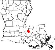 | |
| Towns | ||
| CDP | ||
| Unincorporated communities | ||
| International | |
|---|---|
| National | |
| Geographic | |