
Borgerhout: Difference between revisions
Content deleted Content added
Fgedeckers (talk | contribs) No edit summary Tags: Mobile edit Mobile web edit |
Fgedeckers (talk | contribs) No edit summary Tags: Mobile edit Mobile web edit |
||
| Line 1: | Line 1: | ||
{{expand Dutch|Borgerhout|date=October 2012}} |
|||
{{Infobox settlement |
|||
| name = Borgerhout |
|||
| settlement_type = [[Districts of Antwerp|District]] of [[Antwerp]] |
|||
| image_map = DistrictBorgerhoutLocation.png |
|||
| map_caption = District of Borgerhout within the city of Antwerp |
|||
| image_shield = Blason ville be Borgerhout.svg |
|||
| subdivision_type = Country |
|||
| subdivision_name = {{flag|Belgium}} |
|||
| subdivision_type1 = Region |
|||
| subdivision_name1 = {{BE-VLG}} |
|||
| subdivision_type2 = Province |
|||
| subdivision_name2 = [[Antwerp (province)|Antwerp]] |
|||
| subdivision_type3 = Municipality |
|||
| subdivision_name3 = [[Antwerp]] |
|||
}} |
|||
== People from Borgerhout == |
== People from Borgerhout == |
||
Revision as of 15:20, 24 September 2017
You can help expand this article with text translated from the corresponding article in Dutch. (October 2012) Click [show] for important translation instructions.
|
Borgerhout | |
|---|---|
 Coat of arms | |
 District of Borgerhout within the city of Antwerp | |
| Country | |
| Region | |
| Province | Antwerp |
| Municipality | Antwerp |
People from Borgerhout
Born in Borgerhout
- Bachir Boumaaza (born 1980), known by his pseudonym Athene, gaming social activist and internet personality
- Guillaume Geefs (1805-1883), sculptor
- Floris Jespers (1889-1965), painter
- Nahima Lanjri (born 1968), politician
- Paul Lebeau (1908-1982), academic
- Sister Leontine (1923-2012), pioneer of palliative care[1]
- Milow (Jonathan Vandenbroeck) (born 1981), singer-songwriter
- André Nelis (1935-2012), sailor
- Joris Note (born 1949), writer
- Stan Ockers (1920-1956), cyclist
- Hugues C. Pernath (1931-1975), poet
- Maria Rosseels (1916-2005), journalist and actor
- Michel Seuphor (1901-1999), artist
- Robert Van Straelen (born 1934), economist
- Thomas Vinçotte (1850-1925), sculptor
- Eddy Wauters (born 1933), soccer player
(Former) inhabitants of Borgerhout
- Tom De Cock (born 1983), writer and radio–dj
- Saskia De Coster (born 1976), writer
- Bart Martens (born 1969), politician and a member of the SP.A
- Alfred Ost, (1884-1945), artist
- Anne Provoost (born 1964), writer
- Wouter Van Besien (born 1972), politician, chairman of the ecologist party Groen!
- Tom Van Laere (born 1974), musician
- Erik Van Looy (born 1962), film director
- Rik Van Steenbergen (1924-2003), racing cyclist
- Carl Verbraeken (born 1950), president of the Union of Belgian Composers
Gallery
-
 Borgerhout: "districtshuis"
 -
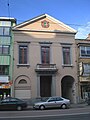 Town hall until 1890
 -
 Reuskens of Borgerhout


References
- ^ "Geschiedenis". www.gza.be. Retrieved 2016-08-28.
External links
Wikimedia Commons has media related to Borgerhout.
51°12′N 04°26′E / 51.200°N 4.433°E
This Antwerp Province location article is a stub. You can help Wikipedia by expanding it. |