
Vilainiai
Vilainiai | |
|---|---|
Village | |
 | |
 Vilainiai Location in Lithuania  Vilainiai Vilainiai (Lithuania) | |
| Coordinates: 55°18′00″N 24°00′11″E / 55.30000°N 24.00306°E | |
| Country | |
| County | |
| Municipality | Kėdainiai district municipality |
| Eldership | Vilainiai Eldership |
| Capital of | Vilainiai Eldership |
| Population (2021) | |
| • Total | 1,157 |
| Time zone | UTC+2 (EET) |
| • Summer (DST) | UTC+3 (EEST) |
Vilainiai (formerly Russian: Вилайни, Polish: Wiłajnie)[1] is a village in Kėdainiai district municipality, in Kaunas County, in central Lithuania. According to the 2021 census, the village had a population of 1157 people.[2] It is located next to the north eastern edge of Kėdainiai, on the left bank of the Nevėžis river. There is a kindergarten, a library, a sports school, a culture house, Water Management Institute of Vytautas Magnus University Agriculture Academy.
History[edit]
Vilainiai has been known since 1744. There was a manor and a watermill till the mid-20th century.[1] It developed largely during the Soviet era as a settlement of Land Improvement Institute.[3]
Demography[edit]
|
| |||||||||||||||||||||||||||||||||||||||
| Source: 1902, 1923, 1959 & 1970, 1979, 1989, 2001, 2011, 2021 | ||||||||||||||||||||||||||||||||||||||||
Images[edit]
-
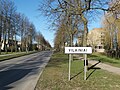 Vilainiai roadsign
 -
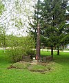 Wayside cross
 -
 Water towers in Vilainiai
 -
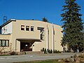 Eldership administration


References[edit]
- ^ a b "Wiłajnie". Geographical Dictionary of the Kingdom of Poland (in Polish). 13. Warszawa: Kasa im. Józefa Mianowskiego. 1893. p. 535.
- ^ "2021 census". Statistikos Departamentas (Lithuania). Retrieved February 3, 2022.
- ^ "Vilainiai". Tarybų Lietuvos enciklopedija (in Lithuanian). Vol. 4. Vilnius: Vyriausioji enciklopedijų redakcija. 1988. p. 516.