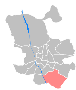
Villa de Vallecas
Villa de Vallecas | |
|---|---|
 | |
| Country | |
| Aut. community | |
| Municipality | |
| Population | 65,162 |
| Madrid district number | 18 |
 | |
Villa de Vallecas ([ˈbiʝa ðe βaˈʝekas], "Village of Vallecas") is one of the 21 districts of the city of Madrid, Spain. It forms, with the district of Puente de Vallecas, the geographical area of Vallecas.
Geography[edit]
Subdivision[edit]
The district is administratively divided into 3 wards (Barrios):
External links[edit]
![]() Media related to Villa de Vallecas at Wikimedia Commons
Media related to Villa de Vallecas at Wikimedia Commons
40°22′47″N 3°37′17″W / 40.379597°N 3.621347°W
