
Ziebach County, South Dakota: Difference between revisions
m A link to a page on wikipedia is not an external link |
NoAmGeogSoc (talk | contribs) →Geography: Adding data on summit points |
||
| Line 29: | Line 29: | ||
==Geography== |
==Geography== |
||
According to the [[United States Census Bureau|U.S. Census Bureau]], the county has a total area of 1,971 [[square mile]]s (5,105 [[km²]]), of which, 1,962 square miles (5,082 km²) of it is land and 9 square miles (23 km²) of it (0.44%) is water. Almost the entire county lies within the [[Cheyenne River Indian Reservation]]. The balance of the county, along its extreme northern [[border|county line]], lies within the [[Standing Rock Indian Reservation]]. It is one of five South Dakota counties that lie entirely on Indian reservations. |
According to the [[United States Census Bureau|U.S. Census Bureau]], the county has a total area of 1,971 [[square mile]]s (5,105 [[km²]]), of which, 1,962 square miles (5,082 km²) of it is land and 9 square miles (23 km²) of it (0.44%) is water. Almost the entire county lies within the [[Cheyenne River Indian Reservation]]. The balance of the county, along its extreme northern [[border|county line]], lies within the [[Standing Rock Indian Reservation]]. It is one of five South Dakota counties that lie entirely on Indian reservations. |
||
The county is a part of the Great Plains and is characterized by rolling grasslands and numerous buttes. The buttes form the highest points of elevation in Ziebach County and their latitude/longitude coordinates, and summit heights are: |
|||
Bessie Butte (44.933596 -101.905714) 2,474 feet (754.08 m)<br /> |
|||
Eagle Butte (44.966092 -101.218762) 2,484 feet (757.12 m)<br /> |
|||
Gray Butte (45.245255 -101.599041) 2,316 feet (705.92 m)<br /> |
|||
High Elk Hill (44.922759 -101.278207) 2,395 feet (730.00 m)<br /> |
|||
Joshua Butte (44.715817 -101.379317) 2,165 feet (659.89 m)<br /> |
|||
Marple Butte (44.958038 -101.584878) 2,484 feet (757.12 m)<br /> |
|||
Mud Butte (44.880819 -101.882936) 2,500 feet (762.00 m)<br /> |
|||
Mud Butte (44.881374 -101.871547) 2,365 feet (720.85 m)<br /> |
|||
Rattlesnake Butte (44.948318 -101.862658) 2,411 feet (734.87 m)<br /> |
|||
Saint Patrick Butte (45.243034 -101.512654) 2,356 feet (718.11 m)<br /> |
|||
Squaw Teat Butte (44.892484 -101.752934) 2,365 feet (720.85 m)<br /> |
|||
Thunder Butte (45.319978 -101.880704) 2,733 feet (833.02 m)<br /> |
|||
===Townships=== |
===Townships=== |
||
Revision as of 22:34, 7 September 2008
Ziebach County | |
|---|---|
 Location within the U.S. state of South Dakota | |
 South Dakota's location within the U.S. | |
| Coordinates: 44°59′N 101°40′W / 44.98°N 101.67°W | |
| Country | |
| State | |
| Named for | Frank M. Ziebach |
| Seat | Dupree |
| Largest city | Dupree |
| Area | |
| • Total | 1,971 sq mi (5,105 km2) |
| • Land | 1,962 sq mi (5,082 km2) |
| • Water | 9 sq mi (23 km2) 0.44% |
| Population (2000) | |
| • Total | 2,519 |
| • Density | 1.3/sq mi (0.5/km2) |
| Time zone | UTC−7 (Mountain) |
| • Summer (DST) | UTC−6 (MDT) |
Ziebach County is a county located in the U.S. state of South Dakota. As of 2000, the population is 2,519. Its county seat is DupreeTemplate:GR. The county's per-capita income makes it one of the poorest counties in the United States. It is alphabetically the last county in the nation.
Geography
According to the U.S. Census Bureau, the county has a total area of 1,971 square miles (5,105 km²), of which, 1,962 square miles (5,082 km²) of it is land and 9 square miles (23 km²) of it (0.44%) is water. Almost the entire county lies within the Cheyenne River Indian Reservation. The balance of the county, along its extreme northern county line, lies within the Standing Rock Indian Reservation. It is one of five South Dakota counties that lie entirely on Indian reservations.
The county is a part of the Great Plains and is characterized by rolling grasslands and numerous buttes. The buttes form the highest points of elevation in Ziebach County and their latitude/longitude coordinates, and summit heights are:
  Bessie Butte 	(44.933596 -101.905714) 2,474 feet (754.08 m)

  Eagle Butte		(44.966092 -101.218762) 2,484 feet (757.12 m)

  Gray Butte 		(45.245255 -101.599041) 2,316 feet (705.92 m)

  High Elk Hill	(44.922759 -101.278207) 2,395 feet (730.00 m)

  Joshua Butte		(44.715817 -101.379317)	2,165 feet (659.89 m)

  Marple Butte		(44.958038 -101.584878)	2,484 feet (757.12 m)

  Mud Butte		(44.880819 -101.882936)	2,500 feet (762.00 m)

  Mud Butte		(44.881374 -101.871547)	2,365 feet (720.85 m)

  Rattlesnake Butte 	(44.948318 -101.862658)	2,411 feet (734.87 m)

  Saint Patrick Butte	(45.243034 -101.512654)	2,356 feet (718.11 m)

  Squaw Teat Butte	(44.892484 -101.752934)	2,365 feet (720.85 m)

  Thunder Butte	(45.319978 -101.880704)	2,733 feet (833.02 m)
Townships
The county is divided into three areas of unorganized territory: Dupree, North Ziebach, and South Ziebach.
Major highways
Adjacent counties
- Corson County, South Dakota - north
- Dewey County, South Dakota - east
- Haakon County, South Dakota - south
- Meade County, South Dakota - southwest
- Perkins County, South Dakota - northwest
Demographics
| Census | Pop. | Note | %± |
|---|---|---|---|
| 1920 | 3,718 | — | |
| 1930 | 4,039 | 8.6% | |
| 1940 | 2,875 | −28.8% | |
| 1950 | 2,606 | −9.4% | |
| 1960 | 2,495 | −4.3% | |
| 1970 | 2,221 | −11.0% | |
| 1980 | 2,308 | 3.9% | |
| 1990 | 2,220 | −3.8% | |
| 2000 | 2,519 | 13.5% | |
| 2007 (est.) | 2,643 |
As of the censusTemplate:GR of 2000, there were 2,519 people, 741 households, and 594 families residing in the county. The population density was 1.3 people per square mile (0.5/km²). There were 879 housing units at an average density of 0.4 per square mile (0.2/km²). The racial makeup of the county was 72.29% Native American, 26.40% White, 0.08% Asian, 0.12% from other races, and 1.11% from two or more races. 0.99% of the population were Hispanic or Latino of any race.
There were 741 households out of which 47.2% had children under the age of 18 living with them, 47.9% were married couples living together, 23.8% had a female householder with no husband present, and 19.8% were non-families. 17.4% of all households were made up of individuals and 5.1% had someone living alone who was 65 years of age or older. The average household size was 3.40 and the average family size was 3.81.
In the county, the population was spread out with 40.6% under the age of 18, 10.8% from 18 to 24, 24.7% from 25 to 44, 16.5% from 45 to 64, and 7.5% who were 65 years of age or older. The median age was 24 years. For every 100 females there were 97.0 males. For every 100 females age 18 and over, there were 98.1 males.
The median income for a household in the county was $18,063, and the median income for a family was $18,672. Males had a median income of $19,038 versus $21,167 for females. The per capita income for the county was $7,463. About 45.20% of families and 49.90% of the population were below the poverty line, including 61.10% of those under age 18 and 27.20% of those age 65 or over.
Cities and towns
- Cherry Creek (unincorporated)
- Dupree
- Eagle Butte (partly in Dewey County)
Municipalities and communities of Ziebach County, South Dakota, United States | ||
|---|---|---|
| Cities | 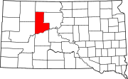 | |
| Unorganized territories | ||
| CDPs | ||
| Other communities | ||
| Indian reservations | ||
| Footnotes | ‡This populated place also has portions in an adjacent county or counties | |
44°59′N 101°40′W / 44.98°N 101.67°W