René Levasseur Island
| René Levasseur Island | ||
|---|---|---|
| Satellite photo | ||
| Waters | Manicouagan Reservoir | |
| Geographical location | 51 ° 23 ′ N , 68 ° 44 ′ W | |
|
|
||
| surface | 2 020 km² | |
| Highest elevation |
Mont Babel 952 m |
|
| Residents | uninhabited | |
| René Levasseur Island | ||
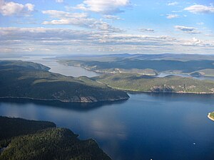
The René-Levasseur Island ( French Île René-Levasseur ) is an island in the Canadian province of Québec . The circular island with a diameter of about 72 km was created in 1970 by the damming of the Rivière Manicouagan .
geography
The 2020 km² island is enclosed by the ring-shaped Manicouagan reservoir . It is densely forested and includes two nature reserves. Its highest point is the 952 meter high Mont Babel . It is the largest island on earth created by human activity and the second largest in an inland lake (after Manitoulin in the Huron Sea ). Another special feature is that the island has a larger area than the lake in which it is located. There are numerous lakes on the island, in which there are again islands.
history
The René Levasseur Island represents the central mountain of an impact crater , the Manicouagan Crater , which was formed about 214 million years ago. In the 1960s, the Daniel Johnson dam was built south of today's island and the Manicouagan was dammed. This is how the island was formed, named after a senior engineer on the dam project.
Web links
Individual evidence
- ↑ Joshua Calder: Largest Lake Islands of the World. October 9, 2005, accessed January 14, 2015 .


