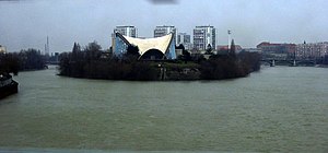
Île Saint-Denis
| Île Saint-Denis | ||
|---|---|---|
| The Île Saint-Denis | ||
| Waters | His | |
| Geographical location | 48 ° 56 '9 " N , 2 ° 20' 23" E | |
|
|
||
| length | 4.4 km | |
| width | 280 m | |
| surface | 1.77 km² | |
| Highest elevation | 33 m | |
| Residents | 7071 (January 1, 2008) 3995 inhabitants / km² |
|
| main place | L'Île-Saint-Denis | |
The Île Saint-Denis is an island in the Seine in the arrondissement Saint-Denis, department Seine-Saint-Denis in the region Île-de-France . Today it corresponds to the commune of L'Île-Saint-Denis . It is named after St. Dionysius , the first bishop of Paris .
geography
The island is surrounded by two arms of the Seine. The left arm, called “petit bras” or “bras de Gennevilliers ”, represents the border between the departments of Seine-Saint-Denis and Hauts-de-Seine . The right arm is called “grand bras” and the canal flows into it Saint-Denis . The Île Saint-Denis in its current form was formed at the end of the 19th century from the merging of several islands of the previous Île Saint-Denis, the Île du Châtelier (also Île Saint-Ouen), the Île des Vannes and the Île du Javeau which explains their unusual length.
The island is 4.4 km long from its southern tip to the northern tip. However, it describes a 6.6 km long arc open to the west with the course of the river. Their maximum width is around 280 meters.

