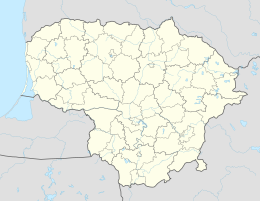
Šilalė
| Šilalė | |||
|
|||
| State : |
|
||
| District : | Tauragė | ||
| Rajong municipality : | Šilalė | ||
| Coordinates : | 55 ° 30 ' N , 22 ° 11' E | ||
| Area (place) : | 3.5 km² | ||
| Inhabitants (place) : | 5,492 (2011) | ||
| Population density : | 1,569 inhabitants per km² | ||
| Time zone : | EET (UTC + 2) | ||
| Telephone code : | (+370) 449 | ||
| Postal code : | 75001 | ||
|
|
|||
Šilalė is a town and seat of the Rajong municipality of the same name in western Lithuania , in the Žemaitija region . It has around 5,500 inhabitants.
The first known mention of the place comes from 1533 in connection with the building of a church. The name of the place is derived from the Lithuanian term šilas '(coniferous) forest'.
Since 1994 there has been a town partnership with Stavenhagen .
Born in Šilalė
- Samuel Mendelsohn (1850–1922), rabbi and Jewish scholar
- Nerijus Numavičius (* 1967), entrepreneur
- Julius Numavičius (* 1973), entrepreneur
- Marijonas Petravičius (* 1979), basketball player
- Ramūnas Navardauskas (* 1988), racing cyclist
Web links
Commons : Šilalė - collection of pictures, videos and audio files
Individual evidence
- ↑ 2011 census. Statistics Departamentas (Lithuania), accessed on August 3, 2017 .


