A969 road
| A969 road in the UK | |
| map | |
| Basic data | |
| Operator: | |
| Start of the street: |
Lerwick ( 60 ° 9 ′ N , 1 ° 10 ′ W ) |
| End of street: |
Lerwick ( 60 ° 9 ′ N , 1 ° 9 ′ W ) |
| Overall length: | 2.6 km (1.6 mi ) |
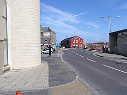
| Buildings near the port | |
The A969 road is an A-road on the Scottish Shetland island of Mainland .
course
The road branches off at a roundabout along the A970 in the south of the island's capital Lerwick . While the A970 runs along the western edge of the city, the A969 forms the main thoroughfare in the inner city area. As Scalloway Road it runs along the southern edge of the city. After 1.1 km the road reaches a roundabout in the southeast of Lerwick, where it bends north to lead first as Church Road , then as an esplanade along the inner-city port facilities. At the northeastern edge the A969 bends in a westerly direction and is led back to the A970 as Commercial Road . It joins this again at a roundabout in the northwest of Lerwick.

