ATOW1996
| ATOW1996 | ||
|---|---|---|
| Waters | Arctic Ocean | |
| Geographical location | 83 ° 40 '34.8 " N , 30 ° 38' 38.6" W | |
|
|
||
| length | 10 m | |
| width | 10 m | |
| surface | 0.01 ha | |
| Highest elevation | 1 m | |
| Residents | uninhabited | |
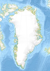
ATOW1996 is a tiny island in the Arctic Ocean north of the island of Greenland .
location and size
ATOW1996 is located about 25 kilometers east of Cape Morris Jesup , the northernmost point of Greenland and 10 kilometers west of Kaffeklubben Island . ATOW1996 is only 10 by 10 meters in size and only protrudes one meter from the water.
Discovery and naming
The tiny island was discovered in 1996 by an American expedition called the American Top Of The World (ATOW). The participants in the expedition intended, among other things, to confirm the existence of the Oodaaq sandbank . Oodaaq was often called the northernmost land area on earth at that time. However, there was no confirmation that Oodaaq is not just a fleeting - that is, sinking back into the sea - sandbar . The ATOW expedition initially held the area it found for Oodaaq. However, this turned out to be a mistake. It turned out that it was an area of land unknown until then, only about 319 meters away from Oodaaq. The members of the expedition named the island after the abbreviation for the name of their expedition, extended by the year.
Status of ATOW1996 as land area
To be recognized as a land area (see island ), it is necessary that the area concerned rises permanently out of the water - even at high tide. ATOW1996 is only very small, only rises about a meter from the water and has no rocky surface. It was therefore initially doubtful whether this point should be viewed as a permanent elevation from the sea or whether it is just a non-permanent sandbank.
However, the Return to the Top of the World (RTOW) expedition led by John Jancik and Ken Zerbst confirmed in July 2001 - five years after its first discovery - that ATOW1996 (still) exists and has a permanent character. This statement has been valid since then. This means that ATOW1996's status as an island is generally recognized.
Northernmost land area on earth?
ATOW1996 is about 71 meters further north than Oodaaq, but the 2001 expedition Return to the Top of the World discovered a land area further north (at 83 ° 41 '6 "N and 30 ° 45' 36" W), which is called RTOW2001 .
On July 6, 2003, an American expedition found a 35-meter-long rock and gravel bank at 83 ° 42 '5.2 "N and 30 ° 38' 49.4" W. This location is about 2.79 kilometers further north than ATOW1996 and still about 1.83 kilometers further north than RTOW2001 . The area was named 83-42 by the expedition participants (based on the latitude) and is also called Schmitt's Island . With regard to this survey, too, it is unclear whether it is to be regarded as permanent and whether it is entitled to the status of the (northernmost) land area on earth (as of August 2007). An expedition from 2008 would speak against this: On January 3, 2009, a program of the German TV station NDR broadcast a report according to which the land point from 2003 could no longer be found, but a new land point ( Ultima Thule 2008 ) at 83 ° 41 ' N , 31 ° 6' W has been detected.
swell
- 1996 American Top Of The World Expedition (English)
- Jancik, John; Richardson, Javana; & Gardiner, Steve (2002). Under the Midnight Sun: The Ascent of John Denver Peak and the Search for the Northernmost Point of Land on Earth. Stars End Creations, ISBN 1-889-12019-7
- Xefer
- Article by Charles Burress in the San Francisco Chronicle, June 17, 2004 ( December 6, 2007 memento on the Internet Archive )
- Article by Andrew C. Revkin from the New York Times, June 8, 2004
