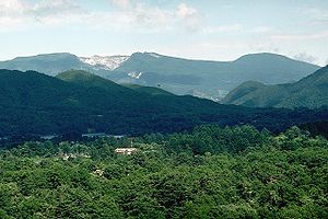
Adatara
| Adatara | ||
|---|---|---|
| height | 1728 m | |
| location | Fukushima Prefecture , Japan | |
| Coordinates | 37 ° 38 '49 " N , 140 ° 16' 52" E | |
|
|
||
| Type | Stratovolcano | |
| rock | Andesite , basalt | |
| Last eruption | 1996 | |
The Adatara ( Jap. 安達太良山 , -yama ) is a stratovolcano on the Japanese island of Honshu .
geography
The forested massif of the Adatara is located east of the Bandai-san volcano , about 15 km southwest of Fukushima .
The Adatara volcanic complex consists of a group of mainly andesitic stratovolcanic domes and lava domes . The Adatara formed during three main eruption cycles approximately 550,000, 350,000 and 200,000 years ago.
The actual Adatara is 1699.6 m high. The highest crater is Minowa-yama ( 箕 輪 山 ) at 1718.4 meters , but the highest elevation is a little west of this at 1728 m, north of the only still active crater Tetsu-zan ( 鉄 山 , dt. "Eisenberg", 1709.3 m).
history
In 1900, 72 workers at a sulfur mine were killed during an outbreak. All historically known eruptions occurred in the 1.2 km wide, 350 m deep crater Numa-no-taira ( ノ 平 平 , dt. "Marsh plain").
The last known outbreak occurred in 1996.
Web links
- Adatara in the Global Volcanism Program of the Smithsonian Institution (English)

