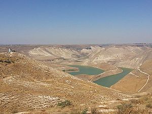
al-wahda dam
| Al-Wahda Dam | |||||||
|---|---|---|---|---|---|---|---|
|
|||||||
|
|
|||||||
| Coordinates | 32 ° 44 '3 " N , 35 ° 52' 31" E | ||||||
| Data on the structure | |||||||
| Lock type: | Rolled concrete - gravity dam | ||||||
| Construction time: | May 26, 2003-2007 | ||||||
| Height above valley floor: | 86 | ||||||
| Height of the structure crown: | 116 m above sea level NN | ||||||
| Building volume: | 1.3 million m³ of concrete | ||||||
| Crown length: | 485 m | ||||||
| Crown width: | 7.2 m | ||||||
| Slope slope on the air side : | 1: 0.8 | ||||||
| Slope slope on the water side : | 1-0 | ||||||
| Operator: | Jordan Valley Authority | ||||||
| Data on the reservoir | |||||||
| Reservoir length | 2.1 | ||||||
| Reservoir width | 0.4 | ||||||
| Storage space | 225 million m³ | ||||||
| Catchment area | 5,900 km² | ||||||
| Design flood : | 1,200 m³ / s (100 a) | ||||||
The al-Wahda Dam , also Wehdah Dam ( Arabic سد الوحدة Sadd al-Waḥda 'dam of unity'), stands at Jarmuk , about 120 km north of Amman on the Syrian - Jordanian border. The dam is about 86 meters high and 485 meters long. The barrier structure is designed as a gravity dammade of rolled concrete . The dam is used for irrigation and is operated by the Jordan Valley Authority in Amman.
The flood relief leads over the top of the wall with a width of 250 m.
The main contractor is the Turkish construction company Özaltin. The project was planned by MWH Global, among others .
A larger dam had previously been planned at this point, but it was never built. The "al-Maqarin dam" was originally supposed to be 171 m high.
See also
Web links
- MWH Global
- al-Wehdah Dam The History of the Project ( Memento from October 9, 2007 in the Internet Archive )
- answers.com: Maqarin Dam
- Al-Wehdah Dam ( Memento from August 8, 2007 in the Internet Archive )
- Jordan joins Syria in dam project BBC News February 9, 2004
literature
- Metz, Helen Chapin, ed. Jordan: A Country Study, 4th edition. Washington, DC: United States Government Printing Office , 1991.
Individual evidence
- ↑ a b al-Wehdah-Damm Data of the Project. Archived from the original on October 9, 2007 ; accessed on May 4, 2015 .

