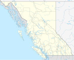
Alberni Valley Regional Airport
| Alberni Valley Regional Airport | ||
|---|---|---|
|
|
||
| Characteristics | ||
| ICAO code | no | |
| IATA code | YPB | |
| Coordinates | ||
| Height above MSL | 76 m (249 ft ) | |
| Transport links | ||
| Distance from the city center | 11 km northwest of Port Alberni | |
| Street |
|
|
| Basic data | ||
| opening | 1993 | |
| operator | Alberni-Clayoquot Regional District | |
| Start-and runway | ||
| 12/30 | 1205 m × 23 m asphalt | |
The Alberni Valley Regional Airport , (IATA: YPB , TC LID: CBS8 ) is six nautical miles (11 km) northwest of Port Alberni , British Columbia , Canada on 76 meters above sea level.
It is a public airport operated by the Alberni-Clayoquot Regional District .
history
The airport opened in September 1993. Since April 25, 2016 the airport has been expanding. The Alberni-Clayoquot Regional District is investing CAD 7.6 million in the project to enlarge the runway from 3952 × 75 feet to 5000 × 100 feet, a new lighting system (LED Runway Landing Light system) and a GPS approach procedure to install.
Web links
- Airport data YPB: Port Alberni Airport in the Aviation Safety Network (English)
- Alberni Valley Regional Airport Airport website
- Aeronautical map for Alberni Valley Regional Airport on SkyVector.com
Individual evidence
- ↑ Trinex Internet Solutions Inc .: AVRA. In: www.acrd.bc.ca. Retrieved October 10, 2016 .
- ^ A b Alberni Valley Regional Airport (CBS8) Notice of Airport Restriction Project Updates. Alberni-Clayoquot Regional District, September 23, 2016, accessed October 13, 2016 .
- ↑ For Immediate Release August 25, 2015. Alberni-Clayoquot Regional District, August 25, 2015, accessed October 11, 2016 .
