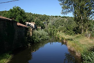
Aliste
| Aliste | ||
| Data | ||
| location | Zamora Province , Spain | |
| River system | Duero | |
| Drain over | Esla → Duero → Atlantic | |
| source | at San Pedro de las Herrerías | |
| Source height | 1100 m | |
| muzzle | at Villanueva de los Corchos in the Esla coordinates: 41 ° 35 ′ 51 ″ N , 5 ° 58 ′ 56 ″ W 41 ° 35 ′ 51 ″ N , 5 ° 58 ′ 56 ″ W.
|
|
| length | 60 km | |
The Aliste is a right tributary of the Esla and about 60 km long. It rises in the southern part of the Spanish mountain range Sierra de la Culebra near the town of San Pedro de las Herrerías at about 1100 meters. After that, it always runs in a south-easterly direction through several small villages. Five kilometers east of Videmala it finally flows into the Esla, which at this point already crosses the Ricobayo-Dam is dammed. The amount of water in the river varies greatly between summer and winter. In winter it receives a lot of water from its small tributaries, but in hot summers it develops into a small trickle in the upper reaches.
