
Amberd
| Amberd | ||
|---|---|---|
 Amberd Fortress and Church |
||
| Data | ||
| place | Aragazotn ( Armenia ) | |
| Coordinates | 40 ° 23 '18.3 " N , 44 ° 13' 35" E | |
|
||

Amberd ( Armenian : Անբերդ) is a medieval fortress , partially destroyed since 1236 , about 6 km from the village of Byurakan at an altitude of 2300 m on the southern slope of Mount Aragaz in Armenia . Amberd was also one of the medieval capitals of Armenia.
history
It is believed that the fortress was founded by Kamsarakan princes. Later it was bought by the Armenian rulers of the Bagratid dynasty, who turned it into one of the main fortresses of the empire.
The church was built from tuff stone in 1026 by Prince Vahram Vatchoutian .
The fortress was first attacked by the Seljuks in the 11th century . In 1236, Amberd was destroyed by fire from attacking Mongols and was never rebuilt.
Fortress complex
Amberd is one of the rare witnesses of Armenian military architecture of the Middle Ages. The fortress, which was built on a mountain spur, was part of a defensive system that controlled the Ararat plain .
In addition to the remains of the ramparts and the little Mother of God Church ( Surb Astvatsatsin ) parts of a three-story palace , one of two domes covered bathhouse, a central heating system, water supply system, including tanks , and a secret passage from Palas get to the other buildings.
photos

Church of Our Lady ( Surb Astvatsatsin )

Fortress and Church of Our Lady

Church of Our Lady located below the fortress

Khachkare at the Amberd Fortress
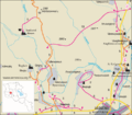
Environment map


See also
Web links
- Amberd. Armenian Heritage
- Armeniapedia.org Amberd in the Armeniapedia (Eng.)
- Amberd on Armenica.org (Engl.)
- Presentation d'Amberd sur le site de l'association culturelle arménienne de Marne-la-Vallée (French)