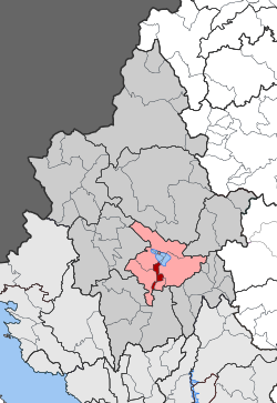
Anatoli (Ioannina)
|
Parish of Anatoli Δημοτική Ενότητα Ανατολής (Ανατολή) |
||
|---|---|---|
|
|
||
| Basic data | ||
| State : |
|
|
| Region : |
Epirus
|
|
| Regional District : | Ioannina | |
| Municipality : | Ioannina | |
| Geographic coordinates : | 39 ° 38 ′ N , 20 ° 52 ′ E | |
| Height above d. M .: | 490 m (Anatoli) |
|
| Area : | 15.845 km² | |
| Residents : | 11,555 (2011) | |
| Population density : | 729.3 inhabitants / km² | |
| Code No .: | 180102 | |
| Structure: |
1 city district 2 local communities |
|
| Located in the municipality of Ioannina and in the regional unit of Ioannina | ||
Anatoli ( Greek Ανατολή ( f. Sg. )) Is a southern suburb and municipality of the Epirotian capital Ioannina . Anatoli is located on the south bank of Lake Pamvotida , around seven kilometers from the center of Ioannina. The neighboring districts are Bizani to the west and Pamvotida to the east. The population has more than doubled since 1991 with an increase from 5,578 to 11,555 inhabitants. The proportion of descendants of refugees from Asia Minor or Pontic Greeks as well as newcomers from the rural areas of the prefecture, namely from the area of Tzoumerka , is relatively high. They maintain the cultural heritage of the Greeks of Asia Minor in associations; the establishment of the archive of Asia Minor-Pontic culture is one of these efforts.
Anatoli was spun off from Ioannina in 1931, initially as a rural community (kinotita), from 1997 after the incorporation of two neighboring settlements as an urban community (dimos). With the administrative reform in 2010 , Anatoly reverted to Ioannina.
The Greek motorway 2 runs through the center of the municipality and connects the municipality to the Greek motorway network, but also divides it into two parts.
structure
| District local community |
Greek name | code | Area (km²) | 2001 residents | Residents 2011 | Villages and settlements |
|---|---|---|---|---|---|---|
| Anatoly | Δημοτική Κοινότητα Ανατολής | 18010201 | 7.698 | 5815 | 9798 | Anatoly |
| Bafra | Τοπική Κοινότητα Μπάφρας | 18010202 | 3,798 | 671 | 838 | Bafra |
| Neokesaria | Τοπική Κοινότητα Νεοκαισαρείας | 18010203 | 4,349 | 712 | 919 | Neokesaria |
| total | 180102 | 15.845 | 7198 | 11,555 | ||
Sightseeing
The church of Agios Ioannis-Bonilas was built as a basilica in 1453 , later expanded with additions.
Individual evidence
- ↑ Results of the 2011 census at the National Statistical Service of Greece (ΕΛ.ΣΤΑΤ) ( Memento from June 27, 2015 in the Internet Archive ) (Excel document, 2.6 MB)

