Anderson Scarp
| Anderson Scarp | ||
|---|---|---|
|
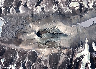
The Dais (center) with the narrow band of Anderson Scarp that appears dark here |
||
| location | Victoria Land , East Antarctica | |
| part of | Transantarctic Mountains | |
|
|
||
| Coordinates | 77 ° 33 ′ S , 161 ° 21 ′ E | |
The Anderson Scarp is a 935 m high cliff in East Antarctica Victoria Land . It rises 1.3 km west of Hall Bluff on the Dais in the western section of the Wright Valley .
The Advisory Committee on Antarctic Names named the cliff in 2004 after Kent Anderson of the seismological laboratory of the United States Geological Survey in Albuquerque , who played a key role in the installation of a so-called VNDA seismograph at Bull Pass near Lake Vanda in the early 1990s .
Web links
- Anderson Scarp in the Geographic Names Information System of the United States Geological Survey (English)
- Anderson Scarp on geographic.org (English)

