Apocalypse peaks
| Apocalypse peaks | ||
|---|---|---|
|
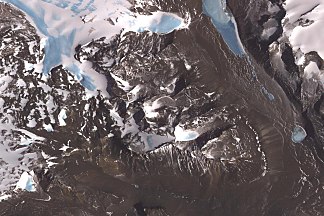
ASTER satellite image of the Apocalypse Peaks: left the Huka-Kapo , above the Haselton Glacier , right the Barwick Valley and below the Balham Valley |
||
| Highest peak | Mount Dragovan ( 2360 m ) | |
| location | Victoria Land , East Antarctica | |
| part of | Transantarctic Mountains | |
|
|
||
| Coordinates | 77 ° 23 ′ S , 160 ° 51 ′ E | |
The Apocalypse Peaks are a group of mountain peaks that loom east of the Willett Range between the Barwick Valley and Balham Valley in Antarctic Victoria Land. The highest peak in the group is Mount Dragovan at 2360 m .
Participants of a campaign carried out from 1958 to 1959 as part of New Zealand's Victoria University's Antarctic Expeditions named them so because the scree slopes between the individual peaks make them appear like the Apocalyptic Horsemen .
Web links
- Apocalypse Peaks in the Geographic Names Information System of the United States Geological Survey (English)
- Apocalypse Peaks on geographic.org (English)

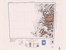
Map of the western part of the Antarctic Dry Valleys from 1962 (new edition 1988), Apocalypse Peaks in the northwest of the ice-free area

