Island Range
| Island Range | ||
|---|---|---|
|
ASTER satellite image of the Isle of Range: from left to right the square Green Mesa , the smaller Canfield Mesa and the large Halzen Mesa , which runs out into Mount Insel on the far right ; above Balham Valley , below McKelvey Valley and part of the Olympus Range . The Bullseye Lake is barely visible in the shadow of Halzen Mesa. |
||
| location | Victoria Land , East Antarctica | |
| part of | Transantarctic Mountains | |
|
|
||
| Coordinates | 77 ° 24 ′ S , 161 ° 20 ′ E | |
The Island Range is a mountain range ice-free, flattened mountaintop in East Antarctic Victoria Land . It separates the McKelvey Valley from the Balham Valley .
Participants in a campaign run by Victoria University's Antarctic Expeditions from 1958 to 1959 named them after their island-like appearance.
Web links
- Insel Range in the Geographic Names Information System of the United States Geological Survey (English)
- Island Range on geographic.org (English)

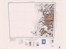
Taylor Glacier topographic map with the Island Range in the northeastern quarter

