Araçatuba
| Araçatuba | |
|---|---|
|
Coordinates: 21 ° 13 ′ S , 50 ° 26 ′ W
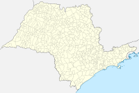
Araçatuba on the map of Sao Paulo
|
|
|
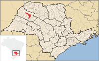
Location of the municipality of Araçatuba in the state of São Paulo
|
|
| Basic data | |
| Country | Brazil |
| State | São Paulo |
| City foundation | December 8, 1921 |
| Residents | 182,526 (Ber. 2011) |
| City insignia | |
| Detailed data | |
| surface | 1,167 km² |
| height | 390 m |
| Waters | Rio Tietê |
| Time zone | UTC −3 |
| City Presidency | Dilador Borges (PSDB) |
| Website | |
Araçatuba is a municipality in the interior of the Brazilian state of São Paulo with 182,526 inhabitants (2011). The parish is at 50 ° 25 'West and 21 ° 12' South. It is the capital of the region of the same name and is 519 kilometers from the city of São Paulo . The municipal area covers an area of 1,167 km². The community is located on the Rio Tietê .
The city takes its name from araçá . The Tupi used this word to describe a fruit that grows in the area.
history
The community goes back to a warehouse and a train station that were built in 1908 on the occasion of the construction of a railway line. On December 8, 1921, Araçatuba was recognized as an independent municipality.
climate
In a tropical climate, the city has an average temperature of 23 ° C. The hottest month is February with an average temperature of 26 ° C, with the average maximum being 31 ° C.
economy
Livestock farming, mainly cattle, as well as the cultivation and processing of sugar cane are important industries in the city.


