Archer Peak
| Archer Peak | ||
|---|---|---|
|
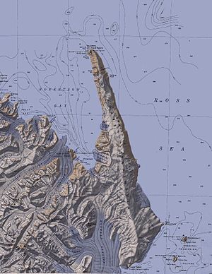
Topographic map of the Adare Peninsula and Possession Island (bottom right) with Archer Peak |
||
| height | 110 m | |
| location | Possession Island , Victoria Land , East Antarctica | |
| Coordinates | 71 ° 52 '0 " S , 171 ° 10' 0" O | |
|
|
||
The Archer Peak is a 110 m high mountain in the East Antarctic Victoria Land . It rises as the southwestern branch of Possession Island in the Ross Sea southeast of the Adare Peninsula .
Participants of the British Southern Cross Expedition (1898-1900) under the direction of the Norwegian polar explorer Carsten Egeberg Borchgrevink named him after the Norwegian ship designer Colin Archer (1832-1921), builder of the whaler Pollux from 1886, the Borchgrevink in Southern Cross renamed and used as a transport ship on this research trip.
Web links
- Archer Peak in the Geographic Names Information System of the United States Geological Survey (English)
- Archer Peak on geographic.org (English)

